 Nagano(長野)
 Mt. Kisokoma-ga-take
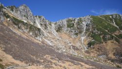
Mt. Kisokoma-ga-take (木曽駒ヶ岳) is a 2,956m peak rising in Nagano Prefecture — the highest peak of the Central Alps.The Sen...
100 Famous Japanese Mountains — we cover 101 of them, all reachable by public transport. Popular choices include Hachimantai, Kirigamine, Mt. Adatara and Mt. Aino. Each guide shows the route from the nearest station to the trailhead, with up-to-date bus timetables.
100 Famous Japanese Mountains
Nagano(長野)  Gifu(岐阜)
  Oita(大分)
  Shizuoka(静岡)
  Fukushima(福島)
  Shizuoka(静岡)
  Fukushima(福島)
 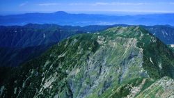 Gifu(岐阜)
 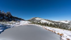 Fukushima(福島)
  Hokkaido
  Gifu(岐阜)
  Gunma(群馬)
 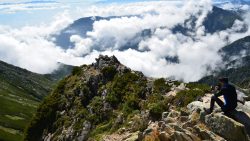 Nagano(長野)
  Nagano(長野)
  Shizuoka(静岡)
  Shizuoka(静岡)
 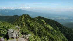 Gunma(群馬)
  Mie
Mie  Gunma(群馬)
  Toyama(富山)
  Nagano(長野)
  Nagano(長野)
  Gunma(群馬)
  Shizuoka(静岡)
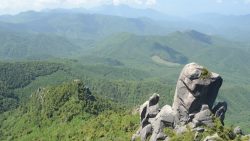
 Ainodake (3,189.5m) is a mountain in the northern part of the Southern Alps (Akaishi Mountains), straddling Shizuoka and Yamanashi Prefectures. It is the fourth highest peak in Japan. This page introduces bus access to Hirogawara, the gateway to the Southern Alps. For access from the same trailhead, see also Kitadake. *Timetable last checked: [sc name=”updated_date”][/sc] Access to the Trailhead Going: Kofu Sta. → Hirogawara Return: Hirogawara → Kofu Sta. 1. Going: Kofu Sta. → Hirogawara From JR Kofu Station South Exit bus stop, take the Yamanashi Kotsu Southern Alps Mountaineering Bus (Hirogawara Line) to Hirogawara.Travel time: Approx. 1 hour 55 minFare: 2,400 yen + 300 yen (user cooperation fee) Season: […]
 Shizuoka(静岡)
  Nagano(長野)
  Shizuoka(静岡)
 Amagisan is a collective name for the mountain range running east-west through the center of the Izu Peninsula in Shizuoka Prefecture. The highest peak is Banzaburodake at 1,405m. *Timetable last checked: [sc name=”updated_date”][/sc] Access to the Trailhead Going: Ito Sta. → Amagi Traverse Trailhead Return: Amagi Traverse Trailhead → Ito Sta. Map & Recommended Route 1. Going: Ito Sta. → Amagi Traverse Trailhead From JR Ito Station (Platform 2), take the Tokai Bus “Amagi Tokyu Resort Shuttle Bus” to Amagi Traverse Trailhead.Travel time: Approx. 55 min Bus Timetable: Ito Sta. → Amagi Traverse Trailhead Daily service (extra buses on select dates only) Ito Sta. (Dep.) Amagi Traverse Trailhead (Arr.) Notes […]
 Yamanashi(山梨)
 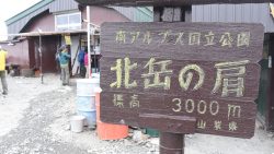 Yamanashi(山梨)
  Toyama(富山)
  Toyama(富山)
  Toyama(富山)
  Toyama(富山)
  Nagano(長野)
  Toyama(富山)
 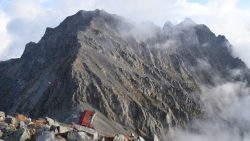 Nagano(長野)
  Hokkaido