Mt. Aka
More figures and data sources
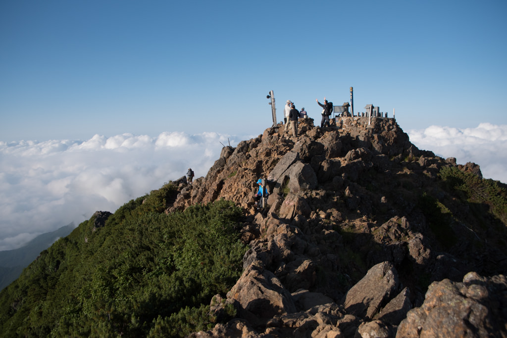
Mt. Aka (赤岳) is the main peak of the Yatsugatake Range (elevation 2,899m) straddling Nagano and Yamanashi Prefectures. With its undulating rocky ridge, 360-degree panorama, and extensive mountain-hut network, it is a popular high mountain. The main approach is from Minotoguchi on the Nagano side, where the loop combining the Kitazawa and Minamizawa valleys is the standard. There are also varied options such as an advanced route from the Shinkyoji Ridge on the Kiyosato side, and a ridge traverse via Iou-dake and Yoko-dake.
Chains and steep slopes continue across the rocky-ridge zones (Jizo Ridge, Bunzaburo Ridge, Kenkai Ridge, etc.). Helmet, rockfall countermeasures, and weather judgement are essential. In the residual-snow period (until early June) and early winter, crampons and ice axe may be required. Mountain huts operate centered on Akadake Kosen and Gyojagoya (in the valley) and Akadake Tenbo-so / Akadake Chojo Sanso (on the ridge). Prepare your plan and equipment, and confirm the latest operating status before entering. (Refer to 2025 operating/reservation guidance for Gyojagoya / Akadake Kosen, and operating information for Akadake Tenbo-so.) Reference: Operating information and reservation periods for Gyojagoya / Akadake Kosen. Akadake Kosen / Gyojagoya Official, 2025 reservation guidance, Akadake Tenbo-so.
Timetable last checked: July 3, 2026
- [Outbound] Chino Station → Minotoguchi
- [Outbound] (Tokyo) Takebashi Station / Shinjuku Station → Minotoguchi (highway bus)
- [Outbound] Kiyosato Station → Sun Meadows Kiyosato
- [Return] Minotoguchi → Chino Station
- [Return] Minotoguchi → Shinjuku Station (highway bus)
- [Return] Sun Meadows Kiyosato → Kiyosato Station
Hiking Course Details — Mt. Aka
Click to show current location.
Click for full-screen view.
*If the map does not appear, please click here.*
Map & Recommended Route — Mt. Aka
Mt. Aka — Reference Hiking Times
| Segment | Distance | Ascent/Descent | Out | Back |
|---|---|---|---|---|
| Minoto-guchi → Akadake Sanso | 2.7 km | +211 m / −19 m | 1:05 | 0:55 |
| Akadake Sanso → Minoto Sanso | 0.2 km | +26 m / −0 m | 0:05 | 0:05 |
| Minoto Sanso → Gyoja Hut | 3.9 km | +638 m / −0 m | 2:15 | 1:45 |
| Gyoja Hut → Mt. Akadake | 1.3 km | +543 m / −0 m | 1:35 | 1:40 |
| Mt. Akadake → Mt. Ogi | 2.2 km | +57 m / −621 m | 2:20 | 1:55 |
| Mt. Ogi → Mt. Ushikubi | 0.4 km | +8 m / −58 m | 0:10 | 0:15 |
| Mt. Ushikubi → Sai-no-Kawara | 1.4 km | +0 m / −395 m | 1:10 | 1:10 |
| Round trip | 16.3 km | +1437 m / −1437 m | 9:35 | |
From Minotoguchi to Minoto (the trailhead)
The bus terminus “Minotoguchi” is not the trailhead. To reach Minoto (Akadake Sanso / Yamanoko-mura), where the Kitazawa and Minamizawa trails begin, you walk about 3 km / 1 hour along an unpaved gravel forest road. Private cars can drive in to Minoto, but by bus this walk is required. Add it to your round-trip course time; because the day is long, an overnight stay (two days) is common (a day hike suits strong walkers only).
1. [Outbound] Chino Station → Minotoguchi
From JR Chuo Main Line Chino Station West Exit Platform 4, take the Alpico Kotsu Minotoguchi Line and get off at the terminus, Minotoguchi.
Fare: ¥1,900 (adult one way, revised 2025/8, continued into 2026 season)
Travel time: about 38 minutes
Operating days: Sat/Sun/holidays + daily from 8/1 – 8/30 (no weekday service)
Operating period: 2026/5/2 – 10/25
Bus TimetableMinotoguchi Line (toward Minotoguchi) Timetable
| Chino Station | Minotoguchi |
|---|---|
| 9:35 | 10:13 |
| 14:20 | 14:58 |
| 15:00 | 15:38 |
Reference: [Alpico Kotsu Minotoguchi Line]
2. [Outbound] Takebashi Station → Minotoguchi
※ Mainichi Alpen-go 2026 Season Information: Please confirm the 2026 operating schedule for Kanto-departure services (Takebashi / Shinjuku) on the official site. Check the latest operating calendar on the official site. The information below is from 2025.
From Tokyo’s Takebashi / Shinjuku and elsewhere, the Mainichi Alpen-go by Maitabi (Mainichi Newspapers Travel) runs directly to Minotoguchi (in front of Yatsugatake Sanso) (seasonal, reservation required).
Travel time: about 6 hours Fare: about ¥8,000–10,000 (varies by plan)
Main times (reference): Takebashi 22:30 dep / Shinjuku 23:00 dep → Minotoguchi arrival around 4:30–5:10
Some services include a late-night nap plan or vary in stopover by date. Check the latest information on each official course page for details.
Reference: [Alpen-go (morning arrival / outbound)] / [Yatsugatake-departure return].
3. [Outbound] Kiyosato Station → Sun Meadows Kiyosato
From JR Koumi Line Kiyosato Station, take the sightseeing-loop Kiyosato Picnic Bus “Southern Loop Route” to Sun Meadows Kiyosato. Convenient access to the foot of the Shinkyoji Ridge / Sai-no-Kawara direction (for advanced climbers).
Fare: ¥600
Travel time: about 25 minutes<
Fare: ¥600
Travel time: about 25 minutes
Operating period: 2026/4/25 – 11/16
Reference: Kiyosato Picnic Bus
Bus TimetableKiyosato Bus Center to Sun Meadows Kiyosato
| Kiyosato Station | Sun Meadows Kiyosato |
|---|---|
| 10:10 | 10:24 |
| 10:50 | 11:04 |
| 13:00 | 13:14 |
| 14:40 | 14:54 |
| 16:30 | 16:43 |
| Kiyosato Station | Sun Meadows Kiyosato |
|---|---|
| 9:00 | 9:13 |
| 9:50 | 10:10 |
| 10:50 | 11:04 |
| 12:50 | 13:10 |
| 13:40 | 13:54 |
| 14:25 | 14:39 |
| 15:45 | 15:58 |
| 16:20 | 16:40 |
4. [Return] Minotoguchi → Chino Station
From Minotoguchi, take the Minotoguchi Line toward Chino Station.
Fare: ¥1,900
Travel time: about 38 minutes
Operating days: Sat/Sun/holidays + daily 8/1 – 8/30 (no weekday service)
Operating period: 2026/5/2 – 10/25
Bus TimetableMinotoguchi bus stop to Chino Station
| Minotoguchi | Chino Station |
|---|---|
| 10:30 | 11:08 |
| 15:15 | 15:53 |
| 16:00 | 16:38 |
Reference: [Alpico Kotsu Minotoguchi Line]
5. [Return] Minotoguchi → Shinjuku Station
Direct service to Shinjuku via Maitabi’s Mainichi Alpen-go (reservation required).
Travel time: about 3 hours Fare: about ¥5,500
Main times:
15:40 Minotoguchi 15:40 dep → 18:45 Shinjuku Station → 19:15 Tokyo Station (Mainichi Alpen-go Yatsugatake direction (return))
15:40 Minotoguchi 15:40 dep → 18:45 Shinjuku Station → 19:15 Tokyo Station (Alpen-go Yatsugatake (return) W seat)
15:45 Minotoguchi 15:40 dep → 18:45 Shinjuku Station → 19:15 Tokyo Station (Alpen-go Yatsugatake (return) W seat)
6. [Return] Sun Meadows Kiyosato → Kiyosato Station
From Sun Meadows Kiyosato bus stop, take the “Kiyosato Picnic Bus Northern Loop Route” and get off at Kiyosato Station.
Fare: ¥600
Travel time: about 25 minutes
Operating period: 2026/4/25 – 11/16
Reference: Kiyosato Picnic Bus
Bus TimetableSun Meadows Kiyosato to Kiyosato Station
| Sun Meadows Kiyosato | Kiyosato Station |
|---|---|
| 10:24 | 10:40 |
| 11:04 | 11:20 |
| 13:14 | 13:30 |
| 14:54 | 15:10 |
| 16:43 | 17:00 |
| Sun Meadows Kiyosato | Kiyosato Station |
|---|---|
| 9:13 | 9:30 |
| 10:10 | 10:30 |
| 11:04 | 11:25 |
| 13:10 | 13:31 |
| 13:54 | 14:15 |
| 14:39 | 15:00 |
| 15:58 | 16:15 |
| 16:40 | 17:00 |
Reference: [Kiyosato Kogen Reconstruction Association]
Your next mountain
A route up Japan's highest peak via the Gotenba and須走口trailheads, celebrated for the exhilarating sand-run descent.
A pivotal summit on the Omote-Ginza traverse, concentrating the full sweep from Yarigatake and Hotaka to the Tateyama range into one view.
A Togakushi sacred ridge climbed via the Mune-tsuki-Hacchō pitch, with a final rocky crest opening to a grand panorama.
A Shugendo sacred peak featuring the harrowing knife-edge Ari-no-towatari and relentless chains, a genuine test of nerve and skill.
Climbed it? Stamp your logbook