
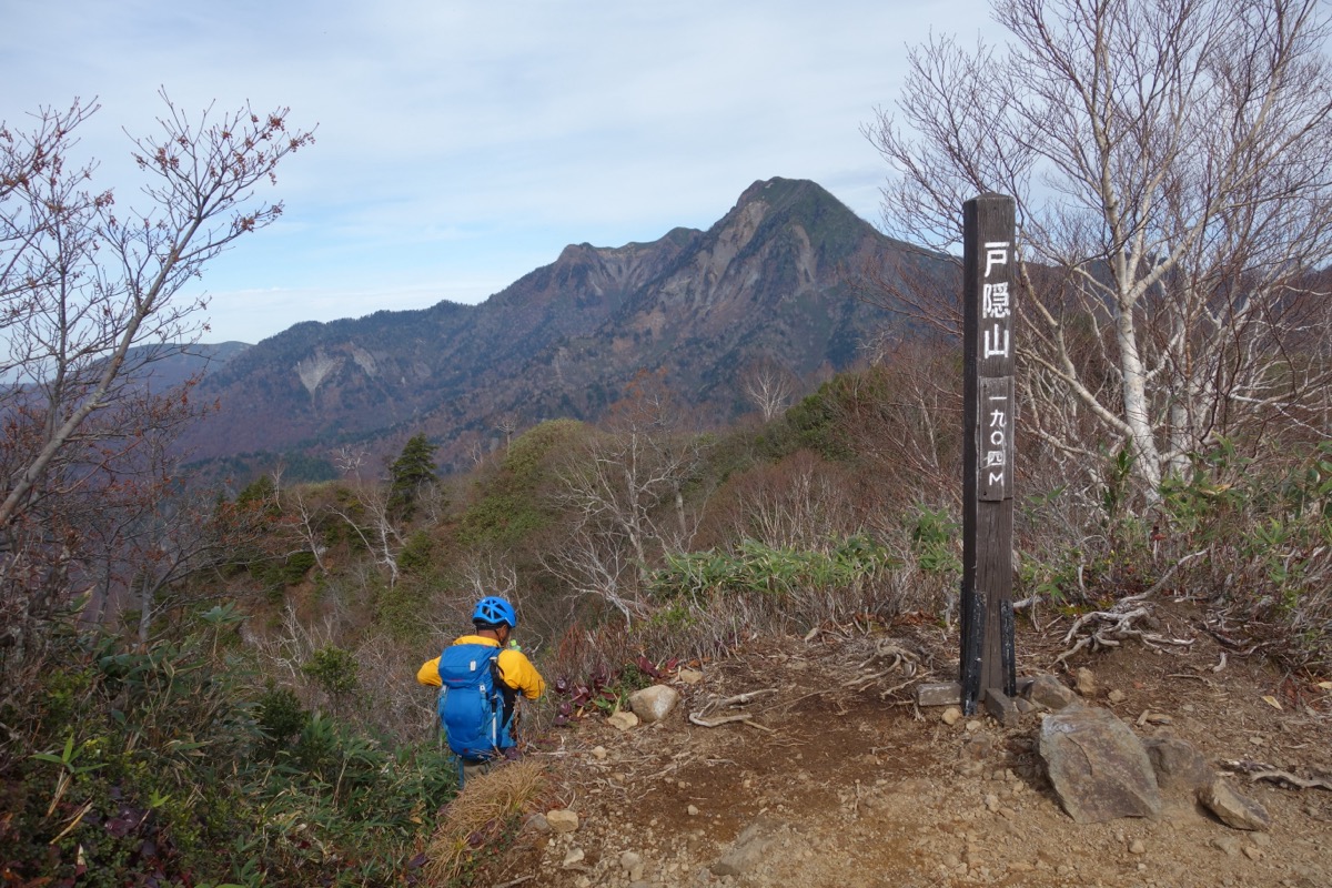
Mt. Takatsuma (高妻山, 2,353 m), straddling Myoko in Niigata and Nagano City in Nagano Prefecture, is the highest peak in the Togakushi range within Myoko-Togakushi Renzan National Park — a 100 Famous Mountain of Japan (Kyūya Fukada’s selection).
The trail from Togakushi Campground passes a chain of 10 Buddha shrines (Ichi-Fudō at the 1st station to Jū-Amida just below the summit) from the Togakushi Shugendō tradition. The standard course from the campground is a 5-hour ascent to the summit, ~10-hour round trip, advanced ★★★★; the steep “Munetsuki-hatchō” climb and the rocky ridge just below the summit are the technical crux. In recent years a gentler Miroku ridge new trail has been opened (recommended for descent).
How to access the trailheads
- [Round trip] Nagano Station ⇔ Togakushi Campground (Alpico Kotsu Togakushi-kogen Line, 10 runs/day)
- 10-Buddha pilgrimage course, lodging, suggested plans
Standard times (Togakushi Campground → Ichi-Fudō → Mt. Takatsuma loop, advanced, ~10 hours)
Togakushi Campground (1,200 m) → (0:20) → Ohashi trailhead → (1:30) → Ichi-Fudō (1,700 m, former hut / water) → (1:00) → Go-Jizō-yama (1,998 m) → (1:30) → Hachi-Kannon → (1:00) → Jū-Amida → (0:10) → Mt. Takatsuma summit (2,353 m) → descend via Miroku ridge new trail (3:30) → Togakushi Campground
1. [Round trip] Nagano Station ⇔ Togakushi Campground (Alpico Kotsu Togakushi-kogen Line, 10 runs/day)
To the trailhead at Togakushi Campground, take Alpico Kotsu Togakushi-kogen Line (Nagano Station Zenkoji exit platform 7 → Zenko-ji → Togakushi Chusha → Togakushi Campground) for about 1 h 17 min, ¥1,500 one way, 10 runs per day. From Togakushi Campground bus stop to the Ohashi trailhead is 20 min on foot (through the campground). Self-drive: ~1 h from Nagano IC; climbing parking at the campground entrance (~50 spaces, free; overflow parking in peak season).
Operating period : Year round (climbing season Jun–Oct recommended)
Travel time : Nagano Station Zenkoji exit → Togakushi Campground about 1 h 17 min
Fare : ~¥1,500 (one way)
Frequency : 10 runs per day
Nagano Station Zenkoji exit → Togakushi Campground (Alpico Kotsu Togakushi-kogen Line, hiker excerpt)
| Nagano Station Zenkoji exit dep. | Togakushi Chusha via | Togakushi Campground arr. |
|---|---|---|
| around 6:30 (early) | around 7:30 | around 7:47 |
| around 9:00 | around 10:00 | around 10:17 |
| around 12:00 | around 13:00 | around 13:17 |
| around 15:00 | around 16:00 | around 16:17 |
Togakushi Campground → Nagano Station Zenkoji exit (Alpico Kotsu, return)
| Togakushi Campground dep. | Togakushi Chusha via | Nagano Station Zenkoji exit arr. |
|---|---|---|
| around 7:50 | around 8:07 | around 9:07 |
| around 10:30 | around 10:47 | around 11:47 |
| around 14:30 | around 14:47 | around 15:47 |
| around 17:50 (last) | around 18:07 | around 19:07 |
Note : Times vary by year — confirm with Alpico Kotsu or Go Nagano. Missing the last bus (Togakushi Campground ~17:50) means an overnight or a taxi (~¥15,000) to Nagano Station. Even with the 6:30 early bus reaching the campground at 7:47, the 10-hour course is tight, so overnight at Togakushi Campground (tent ¥1,500/person, lodge ¥6,500+) or a Togakushi Chusha shukubō is realistic. After descending, try Togakushi soba (~¥1,200 around Chusha).
Reference : Alpico Kotsu Togakushi-kogen Line | Togakushi Tourism Association
Inquiries : Alpico Kotsu Nagano ☎026-254-6000 / Togakushi Campground ☎026-254-3581
2. 10-Buddha pilgrimage course, lodging, suggested plans
About Mt. Takatsuma
The highest peak of the Togakushi range (2,353 m) on the Niigata-Nagano border, within Myoko-Togakushi Renzan National Park. Fukada classifies it on the Niigata side, but the main access is via Togakushi on the Nagano side. A historic centre of Togakushi Shugendō, the trail is marked with 10 Buddha shrines from Ichi-Fudō to Jū-Amida (the Amida Nyorai of the 13-Buddha tradition) just below the summit. Fukada calls it “Takatsuma of Togakushi“; it pairs with Mt. Togakushi (1,904 m) as the twin peaks of the range.
Trail summary (2 main courses)
- Togakushi Campground → Ichi-Fudō → Go-Jizō-yama → summit (advanced, ~5 h ascent, descent via different route): standard loop
- Miroku ridge new trail (advanced, recently opened): recommended for descent — gentler but longer
Lodging and hot springs
– Togakushi Campground (☎026-254-3581): tent ¥1,500/person, lodge ¥6,500+, best climbing base
– Togakushi Chusha shukubō (20+ houses around Togakushi Chusha, with Togakushi soba ¥10,000+): traditional temple lodging
– Togakushi Kamitsuge Onsen “Yuyu-kan” (Chusha, bath ¥650): great for after the descent
– No huts or emergency shelters on the mountain: day-hike basis; for an overnight, use the campground or shukubō
Climbing season / flowers: June – October. Late June – early July: Kibana-no-atsumori-sō (endemic, endangered), Hakusan-chidori. Late September – early October: autumn colours. Residual snow lingers near Ichi-Fudō until early June.
Cautions
– Advanced 10 hours, no huts: day-hike only, for fit hikers
– Steep “Munetsuki-hatchō” climb (Kyū-Seishi to Jū-Amida): just below the summit, beware of falls
– Limited water: only at Ichi-Fudō former hut and Obi-iwa — carry at least 2 L
– Strictly no picking Kibana-no-atsumori-sō: MOE Red List EN
– Bear sightings: carry bells and pepper spray
Emergency contacts and inquiries
- Nagano City Hall Togakushi Branch: ☎026-254-2811 / Togakushi Tourism Association: ☎026-254-2888
- Myoko City Hall (Niigata side): ☎0255-72-5111
- Nagano Chuo Police (climbing plan, mountain rescue): ☎026-244-0110
- Togakushi Campground (lodging, inquiries): ☎026-254-3581 / Alpico Kotsu: ☎026-254-6000
Suggested plans
- One night, Togakushi Campground pre-night + summit attempt (recommended, standard): Day 1 Nagano Station → Togakushi Campground (visit Chusha, Togakushi soba lunch; overnight at campground or shukubō). Day 2 early 5:00 start → Ichi-Fudō 7:00 → summit 11:00 → Miroku ridge descent → Togakushi Campground 15:00 → bus 15:30 → Nagano Station 16:47
- Two nights, Togakushi + Kurohime pair (fit hikers): Day 1 Togakushi Campground overnight. Day 2 Mt. Takatsuma day hike. Day 3 Mt. Kurohime day hike (adjacent, same campground base). Pair with Togakushi soba and the Togakushi five-shrine pilgrimage
Reference : Togakushi Tourism Association | Mt. Takatsuma trailhead access guide
Photo by Wikimedia Commons
Comments