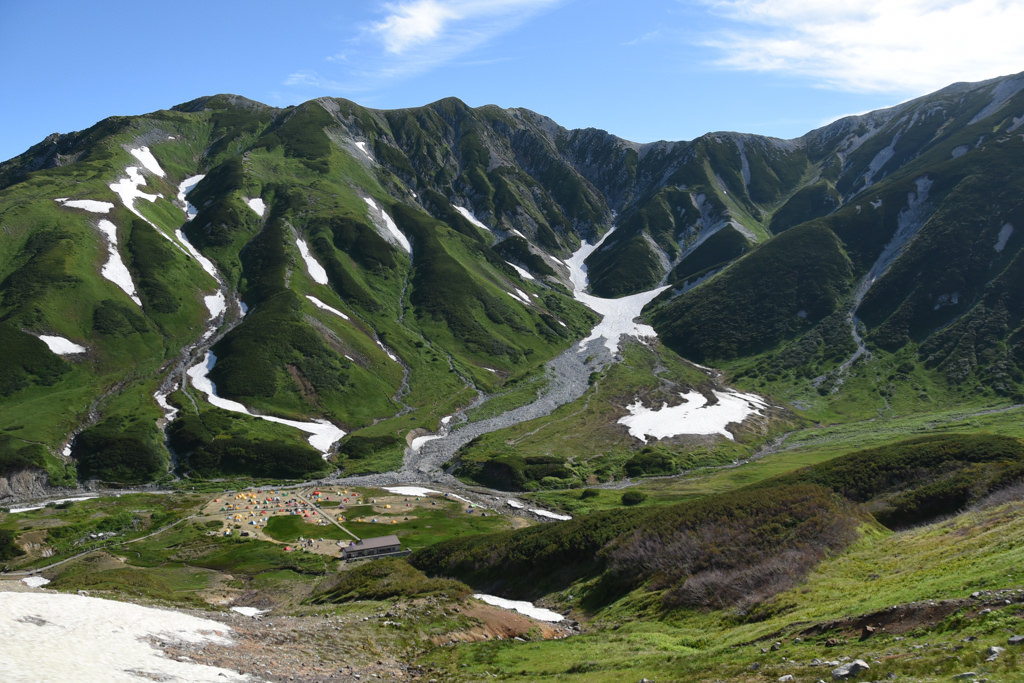
Mt. Tate (立山) is the main peak of the Tateyama Range in the northern Northern Alps, and is the collective name for three peaks: Mt. Oyama (3,003m), Mt. Onanji (3,015m), and Mt. Fuji-no-Oritate (2,999m).
Mt. Onanji is the highest peak of Toyama Prefecture, and is selected as one of the 100 Famous Japanese Mountains and the 100 Flowering Mountains.
A sacred mountain of long-standing mountain worship, many ptarmigan inhabit the Murodo area, and as the snow melts, alpine-plant flower fields spread out. Using the Tateyama Kurobe Alpine Route, you can access Murodo at 2,450m elevation by public transport alone.
This page introduces train and bus access to Murodo, the Mt. Tate trailhead.
*Timetable last checked: May 22, 2026
Map
How to access the trailheads
1. [Going] Tateyama Station → Bijodaira → Murodo
From Toyama Chiho Railway Tateyama Station, take the Tateyama Cable Car (about 7 minutes) up to Bijodaira, then transfer to the Tateyama Kogen Bus (about 50 minutes) and head to the Murodo Terminal. The cable car and Kogen bus operate on a connecting schedule.
Operating period: April 15 – November 3, 2026 (※ 11/4 – 11/30 separate schedule)
Travel time: Tateyama Station – Bijodaira (7 minutes) | Bijodaira – Murodo (50 minutes)
Fare: one-way ¥4,090 (cable car ¥1,090 + Kogen bus ¥3,000)
Bus TimetableTateyama Station → Bijodaira → Murodo Bus Timetable
| Tateyama Station | Bijodaira Arr. | Bijodaira Dep. | Murodo |
|---|---|---|---|
| ▼6:40 | 6:47 | ▼7:00 | 7:50 |
| 7:00 | 7:07 | ↓ | ↓ |
| 7:20 | 7:27 | 7:40 | 8:30 |
| 7:40 | 7:47 | ↓ | ↓ |
| 8:00 | 8:07 | 8:20 | 9:10 |
| 8:20 | 8:27 | ↓ | ↓ |
| 8:40 | 8:47 | 9:00 | 9:50 |
| 9:00 | 9:07 | ↓ | ↓ |
| 9:20 | 9:27 | 9:40 | 10:30 |
| 9:40 | 9:47 | ↓ | ↓ |
| 10:00 | 10:07 | 10:20 | 11:10 |
| 10:20 | 10:27 | ↓ | ↓ |
| 10:40 | 10:47 | 11:00 | 11:50 |
| 11:00 | 11:07 | ↓ | ↓ |
| 11:20 | 11:27 | ↓ | ↓ |
| 11:40 | 11:47 | 12:00 | 12:50 |
| 12:20 | 12:27 | 12:40 | 13:30 |
| 12:40 | 12:47 | ↓ | ↓ |
| 13:00 | 13:07 | 13:20 | 14:10 |
| 13:20 | 13:27 | ↓ | ↓ |
| 13:40 | 13:47 | 14:00 | 14:50 |
| 14:00 | 14:07 | ↓ | ↓ |
| 14:20 | 14:27 | 14:40 | 15:30 |
| 14:40 | 14:47 | ↓ | ↓ |
| 15:00 | 15:07 | 15:20 | 16:10 |
| 15:20 | 15:27 | ↓ | ↓ |
| 15:40 | 15:47 | 16:00 | 16:50 |
| 16:00 | 16:07 | ↓ | ↓ |
▼ mark = specific operating days only (4/15 – 5/15, 7/18 – 19, 8/11 – 15, 9/19 – 22, 10/10 – 11). ↓ = cable car only (no Kogen bus connection)
Reference: [Tateyama Kurobe Alpine Route]
2. [Return] Murodo → Bijodaira → Tateyama Station
From Murodo Terminal, take the Tateyama Kogen Bus (about 50 minutes) down to Bijodaira, then transfer to the Tateyama Cable Car (about 7 minutes) back to Tateyama Station.
Operating period: April 15 – November 3, 2026 (※ 11/4 – 11/30 separate schedule)
Travel time: Bijodaira – Murodo (50 minutes) | Tateyama Station – Bijodaira (7 minutes)
Fare: one-way ¥4,090 (Kogen bus ¥3,000 + cable car ¥1,090)
Bus TimetableMurodo → Bijodaira → Tateyama Station Bus Timetable
| Murodo | Bijodaira Arr. | Bijodaira Dep. | Tateyama Station |
|---|---|---|---|
| 8:10 | 9:00 | 9:10 | 9:17 |
| 8:40 | 9:30 | 9:40 | 9:47 |
| 9:20 | 10:10 | 10:20 | 10:27 |
| 10:00 | 10:50 | 11:00 | 11:07 |
| 10:40 | 11:30 | 11:40 | 11:47 |
| 11:20 | 12:10 | 12:20 | 12:27 |
| 12:00 | 12:50 | 13:00 | 13:07 |
| 13:00 | 13:50 | 14:00 | 14:07 |
| 13:40 | 14:30 | 14:40 | 14:47 |
| 14:20 | 15:10 | 15:20 | 15:27 |
| 15:00 | 15:50 | 16:00 | 16:07 |
| 15:40 | 16:30 | 16:40 | 16:47 |
| 16:20 | 17:10 | 17:20 | 17:27 |
| ◆17:00 | ◆17:50 | ◆18:00 | 18:07 |
◆ mark = specific operating days only (4/15 – 5/15, 7/18 – 19, 8/11 – 15, 9/19 – 22, 10/10 – 11)
Reference: [Tateyama Kurobe Alpine Route]