

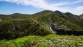
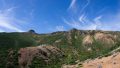
Mt. Nikko-Shirane (日光白根山) is a 2,578m peak on the border of Nikko City in Tochigi Prefecture and Tone District in Gunma Prefecture. The highest peak in the Kanto region, and one of the 100 Famous Japanese Mountains. From the summit, Mt. Nantai, Lake Chuzenji, and the Oze mountains can be seen at a glance; in early summer, colonies of Shirane-aoi can be observed.
Using the Marunuma Kogen Ski Resort Ropeway (summit station elevation 2,000m), you can reach the summit in about 2.5 hours and make a day-hike possible.
*Timetable last checked: May 16, 2026
There are three trailheads: Yumoto Onsen, Sugenuma Trailhead, and Nikko-Shirane Ropeway.
In particular, using the Nikko-Shirane Ropeway makes climbing relatively easy.
To reach these three trailheads, you can take a bus from Tobu Nikko Station, or from the Jomokogen Station / Numata Station direction.
How to access the trailheads
- [Outbound] Tobu Nikko Station → Yumoto Onsen → Sugenuma Trailhead → Nikko-Shirane Ropeway
- [Outbound] Jomokogen / Numata Station → Nikko-Shirane Ropeway → Sugenuma Trailhead → Yumoto Onsen
- [Return] Nikko-Shirane Ropeway → Sugenuma Trailhead → Yumoto Onsen → Tobu Nikko Station
- [Return] Yumoto Onsen → Sugenuma Trailhead → Nikko-Shirane Ropeway → Numata Station / Jomokogen Station
Hiking Course Details — Mt. Nikko-Shirane
Click to show current location.
Click for full-screen view.
*If the map does not appear, please click here.*
Map & Recommended Route — Mt. Nikko-Shirane
1. [Outbound] Nikko Station → Yumoto Onsen → Sugenuma Trailhead → Nikko-Shirane Ropeway
From JR Nikko Station / Tobu Nikko Station, take the Tobu Bus Nikko “Yumoto Onsen” service to Yumoto Onsen.
At Yumoto Onsen, transfer to the Kan-etsu Kotsu “Yumoto Onsen Line (Kamata direction)”
to Sugenuma Trailhead / Nikko-Shirane Ropeway.
Travel time: Nikko Station → Yumoto Onsen about 80 minutes / Yumoto Onsen → Ropeway about 37 minutes
Fare: Nikko Station → Yumoto Onsen ¥1,950 (Tobu Bus Nikko) / Yumoto Onsen → Ropeway about ¥1,500 (Kan-etsu Kotsu)
Operating information:
Tobu Bus Nikko summer schedule (2026/4/1 – 11/30) /
Kan-etsu Kotsu Yumoto Onsen Line (Sat/Sun/holidays only from 2026/6/1 – 10/25)
Bus TimetableTobu Nikko Station to Nikko-Shirane Ropeway
| JR Nikko Station | Tobu Nikko Station | Yumoto Onsen Arr. | Yumoto Onsen Dep. | Sugenuma (Trailhead) | Nikko-Shirane |
|---|---|---|---|---|---|
| 6:52 | 6:55 | 8:12 | 8:30 | 8:43 | 9:07 |
| 8:42 | 8:45 | 10:10 | 10:20 | 10:33 | 10:57 |
| 11:37 | 11:40 | 13:05 | 13:15 | 13:28 | 13:52 |
| 15:10 | 15:13 | 16:38 | 16:48 | 17:01 | 17:25 |
Reference (official / NAVITIME):
Tobu Bus Nikko summer schedule PDF
Kan-etsu Kotsu “Yumoto Onsen Line” PDF
Tobu Nikko → Yumoto Onsen (NAVITIME)
2. [Outbound] Jomokogen / Numata Station → Nikko-Shirane Ropeway → Sugenuma Trailhead → Yumoto Onsen
From Jomokogen Station or Numata Station, take the Kan-etsu Kotsu “Kamata Line (down)” to Kamata.
At Kamata, transfer to the “Yumoto Onsen Line (Yumoto Onsen direction)” to Nikko-Shirane Ropeway / Sugenuma Trailhead / Yumoto Onsen.
Travel time: Jomokogen Station → Kamata about 1 hour 30 minutes / Numata Station → Kamata about 50 minutes / Kamata → Ropeway about 25 minutes
Fare: Jomokogen Station → Kamata ¥2,800 / Numata Station → Kamata ¥2,400 (Kan-etsu Kotsu Kamata Line)
Operating information:
Kamata Line (summer schedule: 2026/4/1 –) /
Yumoto Onsen Line (Sat/Sun/holidays only from 2026/6/1 – 10/25)
Bus TimetableJomokogen to Nikko-Shirane Ropeway / Sugenuma / Yumoto Onsen
| Jomokogen Station | Numata Station | Kamata Arr. (transfer) | Kamata Dep. | Nikko-Shirane Ropeway | Sugenuma Trailhead | Yumoto Onsen |
|---|---|---|---|---|---|---|
| – | 6:20 | 7:17 | 7:20 | 7:38 | 8:03 | 8:16 |
| 10:15 | 10:40 | 11:34 | 12:02 | 12:20 | 12:48 | 13:01 |
| – | 14:02 | 15:02 | 15:28 | 15:46 | 16:14 | 16:27 |
Reference (official / NAVITIME):
Kan-etsu Kotsu “Kamata Line” guide (each PDF available)
Kan-etsu Kotsu “Kamata Line” down PDF
Kan-etsu Kotsu “Yumoto Onsen Line” PDF
3. [Return] Nikko-Shirane Ropeway → Sugenuma Trailhead → Yumoto Onsen → Nikko Station
From the Nikko-Shirane Ropeway / Sugenuma Trailhead, board the bus toward Yumoto Onsen,
and at Yumoto Onsen, transfer to the Tobu Bus Nikko bound for Tobu Nikko Station.
Travel time: Ropeway → Yumoto Onsen about 37 minutes / Yumoto Onsen → Nikko Station about 80 minutes
Fare: Ropeway → Yumoto Onsen about ¥1,500 (Kan-etsu Kotsu) / Yumoto Onsen → Nikko Station ¥1,950
Operating period: Sat/Sun/holidays only from June 1 to October 25, 2026
Bus TimetableNikko-Shirane Ropeway to Tobu Nikko Station
| Nikko-Shirane Ropeway | Sugenuma Trailhead | Yumoto Onsen Arr. (transfer) | Yumoto Onsen Dep. | Tobu Nikko Station | JR Nikko Station |
|---|---|---|---|---|---|
| 7:39 | 8:03 | 8:16 | 8:25 | 9:41 | 9:45 |
| 9:20 | 9:44 | 9:57 | 10:20 | 11:36 | 11:40 |
| 12:24 | 12:48 | 13:01 | 13:30 | 14:46 | 14:50 |
| 15:50 | 16:14 | 16:27 | 16:48 | 17:56 | 18:00 |
Reference (official / NAVITIME):
Kan-etsu Kotsu “Yumoto Onsen Line” PDF
Tobu Bus Nikko Timetable (summer schedule) PDF
Yumoto Onsen → Tobu Nikko (NAVITIME)
4. [Return] Yumoto Onsen → Sugenuma Trailhead → Nikko-Shirane Ropeway → Numata Station / Jomokogen Station
From each Yumoto Onsen, Sugenuma Trailhead, or Nikko-Shirane Ropeway trailhead, board the bus bound for Kamata, then at Kamata transfer to the Kan-etsu Kotsu bus bound for Numata Station / Jomokogen Station direction.
Travel time: Ropeway → Kamata about 25 minutes / Kamata → Numata Station about 50 minutes / Kamata → Jomokogen Station about 1 hour 30 minutes
Fare: Kamata → Numata Station ¥2,400 / Kamata → Jomokogen Station ¥2,800
Operating period:
Yumoto Onsen Line (Sat/Sun/holidays only from 2026/6/1 – 10/25) /
Kamata Line (summer schedule: 2026/4/1 –)
Bus TimetableNikko-Shirane Ropeway to Tobu Nikko Station
| Yumoto Onsen | Sugenuma Trailhead | Nikko-Shirane Ropeway | Kamata Arr. (transfer) | Kamata Dep. | Numata Station Arr. (transfer) | Numata Station Dep. | Jomokogen Station |
|---|---|---|---|---|---|---|---|
| 10:20 | 10:33 | 10:57 | 11:22 | 11:47 | 12:44 | 14:19 | 14:44 |
| 13:15 | 13:28 | 13:52 | 14:17 | 14:42 | 15:27 | 16:38 | 17:03 |
| 16:48 | 17:01 | 17:25 | 17:50 | 18:00 | 18:57 | – | – |
※ Direct services to Jomokogen Station are few, so depending on the time of day, waiting times occur at Numata Station
(e.g., 12:44 arr → 14:19 dep). Always verify the latest service against the timetables below.
Reference (official / NAVITIME):
Kan-etsu Kotsu “Yumoto Onsen Line” PDF /
Kan-etsu Kotsu “Kamata Line” (up PDF available) /
Kan-etsu Kotsu “Kamata Line” up PDF /
Numata Station → Jomokogen Station (NAVITIME)
Photo by Gmoz
Comments