
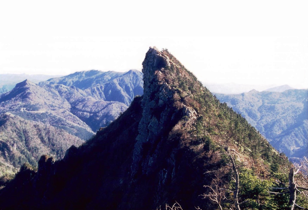
Mt. Ishizuchi (石鎚山, 1,982 m at Mt. Tenguzaka) rises across Saijo City and Kumakōgen Town in Ehime Prefecture and is counted among the 100 Famous Mountains of Japan — the highest peak in western Japan. Long revered as a Shugendō sacred mountain, its highlights include Chōjōsha (Ishizuchi Shrine summit hall) just below the top, the dramatic cliff peaks of Tengu-dake and Misen (1,974 m), and the four famous chain-climbing sections (Tameshi-no-kusari, Ichi-no-kusari, Ni-no-kusari, San-no-kusari). The chain sections all have bypass trails so even beginners can summit. On clear days the panorama spans the Seto Inland Sea, all of Shikoku, and as far as Kyushu.
From JR Yosan Line Iyo-Saijo Station, Setouchi Bus’s “Nishi-no-kawa Line” reaches Ropeway-mae, where the Ishizuchi Climbing Ropeway lifts hikers to Jōju Station at 1,300 m — the start of the Omote-Sandō (front trail) via Jōju Shrine.
How to access the trailhead
- [Outbound] Iyo-Saijo Station → Jōju Station (Setouchi Bus + Ishizuchi Tozan Ropeway connection)
- [Return] Jōju Station → Iyo-Saijo Station (Ishizuchi Tozan Ropeway + Setouchi Bus connection)
Estimated Trail Times (Omote-Sandō round-trip, approx. 7 hours)
Ropeway Summit Jōju Station → (50 min) → Ishizuchi Shrine Chūgū Jōjusha → (1 hr) → Hatchōzaka → (1 hr 20 min) → Tameshi-no-kusari → (1 hr) → Ni-no-kusari-moto → (30 min) → Misen (1,974 m) → (10 min) → Tengu-dake (1,982 m) → return on the same trail (descent approx. 3 hours)
1. [Outbound] Iyo-Saijo Station → Jōju Station (Setouchi Bus + Ishizuchi Tozan Ropeway, connection)
From JR Yosan Line Iyo-Saijo Station, board Setouchi Bus’s “Nishi-no-kawa Line” (bound for Nishi-no-kawa) and alight at Ropeway-mae. Travel time approx. 1 h 21 min. From the bus stop it’s a 5-minute walk to the Ishizuchi Climbing Ropeway’s Sanroku Shimotani Station.
Operating period: Year-round
Travel time: approx. 1 h 21 min (Iyo-Saijo Stn → Ropeway-mae)
Fare: Iyo-Saijo Stn → Ropeway-mae adult one-way ¥1,030
Note: Only 4 trips per day — confirm the schedule in advance, especially the last bus.
Reference: Setouchi Bus (official)
Connection TimetableIyo-Saijo Station → Ropeway-mae → Jōju Station (Bus + 5 min walk + Ropeway)
| Iyo-Saijo Stn dep. | Ropeway-mae arr. | Ropeway dep. | Jōju Stn arr. |
|---|---|---|---|
| 7:10 | 8:31 | 8:40 (first) | 8:48 |
| 10:00 | 11:21 | 11:40 | 11:48 |
| 13:10 | 14:31 | 14:40 | 14:48 |
| 15:50 | 17:11 | 17:20 | 17:28 |
Reference: [NAVITIME Setouchi Bus Nishi-no-kawa Line]
2. [Return] Jōju Station → Iyo-Saijo Station (Ishizuchi Tozan Ropeway + Setouchi Bus, connection)
After descending, take the ropeway back to Sanroku Shimotani Station, then walk 5 minutes to the Ropeway-mae bus stop and board the Setouchi Bus back to Iyo-Saijo Station. The 4 return trips take only 54 minutes (faster downhill).
Operating period: Year-round
Travel time: approx. 54 min (Ropeway-mae → Iyo-Saijo Stn)
Fare: Ropeway-mae → Iyo-Saijo Stn adult one-way ¥1,030
Connection TimetableJōju Station → Ropeway-mae → Iyo-Saijo Station (Ropeway + 5 min walk + Bus)
| Jōju Stn dep. | Sanroku Shimotani arr. | Ropeway-mae bus dep. | Iyo-Saijo Stn arr. |
|---|---|---|---|
| 9:20 | 9:28 | 9:33 | 10:27 |
| 12:00 | 12:08 | 12:23 | 13:17 |
| 15:00 | 15:08 | 15:26 | 16:20 |
| 17:00 | 17:08 | 17:20 | 18:14 |
Reference: [NAVITIME Setouchi Bus Nishi-no-kawa Line (return)]
Photo by HendrixEesti
Comments