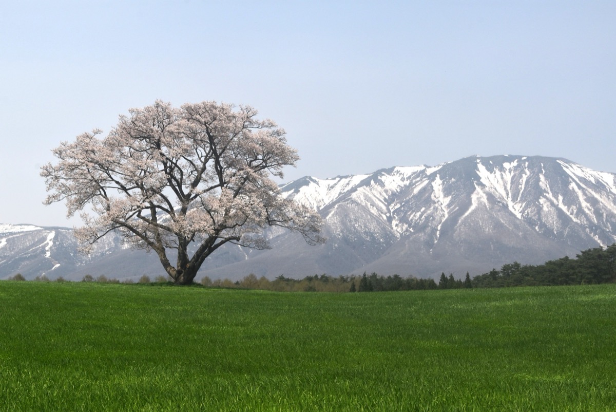
Mt. Iwate (岩手山, 2,038 m) is an active volcano straddling Takizawa, Hachimantai and Shizukuishi in Iwate Prefecture. Its elegant cone earns it the names “Nanbu Fuji” and “Ganju-san“, and it is the iconic mountain of Iwate Prefecture, counted among the 100 Famous Mountains of Japan (Kyūya Fukada’s selection).
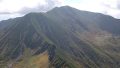
Its 7 trails include the Yanagisawa course (Umagaeshi, old / new routes), the Yakehashiri course (1719 lava-flow with great Komakusa flower fields), and the Amihari course from Amihari Onsen. The 8th-station emergency hut (free, capacity 50, blankets provided) is one of the best in Tōhoku, and the great Komakusa flower fields (mid-July to early August) plus the wide summit crater rim are the main attractions.
How to access the trailheads
- [Round trip] Morioka Station ⇔ Umagaeshi trailhead (Yanagisawa course, Iwate Kenpoku Bus summer / taxi)
- Yakehashiri / Amihari courses, trail overview (under restriction), suggested plans
Standard times (Yanagisawa course from Umagaeshi, out-and-back, advanced ★★★★★, ~9:30, after 1 Jul 2026 reopening)
Umagaeshi trailhead (630 m) → (1 hr) → 2.5th station (old / new route junction) → old route (steep) → (3 hr) → 7th station → (40 min) → 8th-station emergency hut (1,750 m, water) → (50 min) → Fudō-daira → (30 min) → Mt. Iwate summit (2,038 m, crater rim) → (3 hr 30 min) → Umagaeshi trailhead
1. [Round trip] Morioka Station ⇔ Umagaeshi trailhead (Yanagisawa course, Iwate Kenpoku Bus summer / taxi)
The standard course after reopening (from 1 Jul 2026), the Yanagisawa course, starts at Umagaeshi (630 m). Iwate Kenpoku Bus runs in summer (typically Jul–Oct, schedule varies by year) from Morioka Station. Runs are limited, so taxi is more practical: Morioka Station to Umagaeshi about 35 min, ~¥6,000, or about 20 min / ~¥3,500 from IGR Iwate Ginga Line’s Takizawa Station. By car, about 15 min / ~10 km from Takizawa IC, parking ~100 spaces.
Access guide :
Morioka Station → Umagaeshi : Iwate Kenpoku Bus about 45 min, ~¥700 (summer only, limited runs)
Morioka Station → Umagaeshi : taxi about 35 min, ~¥6,000
Takizawa Station (IGR) → Umagaeshi : taxi about 20 min, ~¥3,500
Self-drive : about 15 min from Takizawa IC (~10 km), parking ~100 spaces
Morioka Station → Umagaeshi (Iwate Kenpoku Bus summer-only, hiker excerpt, dates vary by year)
| Morioka Station dep. | Umagaeshi arr. |
|---|---|
| around 6:30 (early) | around 7:15 |
| around 13:30 | around 14:15 |
Umagaeshi → Morioka Station (Iwate Kenpoku Bus, return, summer only)
| Umagaeshi dep. | Morioka Station arr. |
|---|---|
| around 14:00 | around 14:45 |
| around 17:00 (last) | around 17:45 |
Note : Umagaeshi is open from the 1 Jul 2026 mountain opening (closed before that). Summer bus periods and times vary by year — always confirm at Iwate Kenpoku Bus. When taking a taxi, ask for “Umagaeshi Campsite”.
Reference : Iwate Kenpoku Bus Morioka area | Takizawa City Mt. Iwate
Inquiries : Iwate Kenpoku Bus ☎019-641-1212 / Takizawa City Hall ☎019-684-2111
2. Yakehashiri / Amihari courses, trail overview (under restriction), suggested plans
Yakehashiri course (intermediate, eastern, reopening 1 Jul 2026): Yakehashiri trailhead (561 m) → second crater → 7th station → Hirakasa Fudō hut → summit. Goes through the 1719 lava-flow field and is famous for great Komakusa flower fields (mid-Jul to early Aug). Taxi from Morioka about 45 min, ~¥8,000; parking at Iwate-san Yakehashiri International Village. Round trip ~9 hours.
Amihari course (intermediate, western, restriction continues as of May 2026): Amihari Onsen → Inukura junction → Okama-ko junction → Fudō-daira → summit. Iwate Kenpoku Bus from Amihari Onsen about 1 h 30 min, ¥1,200. As a western trail, the restriction is expected to continue beyond July 2026; no reopening date.
Trail summary (7 courses, eastern 4 will reopen)
- Yanagisawa (Umagaeshi, E) ⭕reopens: most popular, old (steep) / new (easy), 9:30
- Yakehashiri (E) ⭕reopens: lava flow, Komakusa fields, 9:00
- Mikamizaka (E) ⭕reopens: intermediate
- Kanboto (E) ⭕reopens: intermediate
- Amihari (W) ⛔restricted: western
- Matsukawa (W) ⛔restricted: western
- Nanataki (W) ⛔restricted: western
Huts and hot springs (after reopening)
– 8th-station emergency hut (1,750 m, Yanagisawa course): free, capacity 50, blankets, Onari-shimizu water spring, toilet. Season typically late Jun – mid-Oct (closed during restriction). Inquiries: Takizawa City ☎019-684-2111
– Fudō-daira emergency hut (just below summit): free, emergency use
– Amihari Onsen: bath ¥500 (western, restricted area)
– Matsukawa Onsen “Shofuso”: bath ¥500
Cautions
– All trails closed until 1 Jul 2026; the 3 western trails remain closed thereafter
– After reopening (eastern 4), climbing / descent forms will be required: Iwate Police ☎019-653-0110
– The assumed crater area (Daijigoku-dani, Okama-ko) remains closed
– Komakusa preservation: do not leave the trail
– Bear sightings: carry bear bells
Emergency contacts and inquiries
- Iwate Pref. Environment & Lifestyle Dept. Disaster Section (eruption / restriction): ☎019-629-5151
- Takizawa City Hall (Umagaeshi / Yanagisawa): ☎019-684-2111 / Hachimantai City Hall (Yakehashiri): ☎0195-74-2111
- Morioka West Police (climbing plan, mountain rescue): ☎019-643-0110
- Iwate Kenpoku Bus: ☎019-641-1212 / Iwate Pref. Police Mountain Rescue HQ: ☎019-653-0110
Suggested plans (after 1 Jul 2026 reopening)
- Day hike, Yanagisawa course (advanced / fit): Morioka Station 5:30 (taxi) → Umagaeshi 6:00 → 8th-station 10:00 → summit 11:30 → descend → Umagaeshi 16:00 → Morioka Station. ~10 hours total
- One night at 8th-station hut + summit (recommended): Day 1 Morioka → Umagaeshi → 8th-station emergency hut overnight (bring bedding and food). Day 2 early summit and crater rim → descend → bathe at Yakehashiri Onsen → return to Morioka
- Day hike, Yakehashiri course (intermediate): Morioka → Yakehashiri trailhead → Komakusa fields → summit out-and-back → bathe at Yakehashiri Onsen → Morioka (best mid- to late July at peak bloom)
Reference : Iwate Pref. Mt. Iwate climber info | Takizawa City Mt. Iwate
Photo by Yoshi Canopus
Comments