
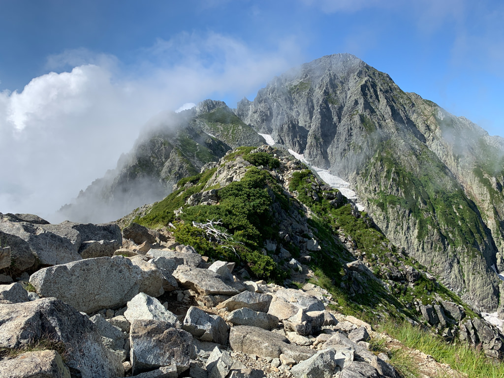
Mt. Tsurugidake is a 2,999m peak in the Tateyama Mountain Range in the northern part of the Northern Alps, Toyama Prefecture. It is one of Japan’s 100 Famous Mountains and the 22nd highest mountain in Japan. It is considered the most dangerous mountain among those climbed by general hikers in Japan, featuring notorious chain-assisted rock sections known as “Kani no Yokobai” (Crab’s Sideways Traverse) and “Kani no Tatebai” (Crab’s Vertical Climb).
This page provides train and bus access information to Murodo, the starting point for climbing Mt. Tsurugidake.
Access to the Trailhead
1. Going: Tateyama Sta. → Bijodaira → Murodo
Step 1: From Toyama Chiho Railway Tateyama Station, take the Tateyama Cable Car to Bijodaira. Travel time: Approx. 7 min / Fare: 1,090 yen
Step 2: From Bijodaira, take the Tateyama Highland Bus to Murodo. Travel time: Approx. 50 min / Fare: 3,000 yen
Operating period: Regular schedule April 15 to November 3, 2026
Timetable: Tateyama Sta. → Murodo
| Dep. Tateyama Sta. (Cable Car) | Arr. Bijodaira | Dep. Bijodaira (Highland Bus) | Arr. Murodo (approx.) |
|---|---|---|---|
| ▼06:40 | 06:47 | ▼07:00 | 07:50 |
| 07:20 | 07:27 | 07:40 | 08:30 |
| 08:00 | 08:07 | 08:20 | 09:10 |
| 08:40 | 08:47 | 09:00 | 09:50 |
| 09:20 | 09:27 | 09:40 | 10:30 |
| 10:00 | 10:07 | 10:20 | 11:10 |
| 10:40 | 10:47 | 11:00 | 11:50 |
| 11:40 | 11:47 | 12:00 | 12:50 |
| 12:20 | 12:27 | 12:40 | 13:30 |
| 13:00 | 13:07 | 13:20 | 14:10 |
| 13:40 | 13:47 | 14:00 | 14:50 |
| 14:20 | 14:27 | 14:40 | 15:30 |
| 15:00 | 15:07 | 15:20 | 16:10 |
| 15:40 | 15:47 | 16:00 | 16:50 |
▼ = Special operation days only (4/15–5/15, 7/18–19, 8/11–15, 9/19–22, 10/10–11)
Reference: Tateyama Kurobe Alpine Route (Timetable)
2. Return: Murodo → Bijodaira → Tateyama Sta.
Step 1: From Murodo, take the Tateyama Highland Bus to Bijodaira (approx. 50-70 min). Fare: 3,000 yen
Step 2: From Bijodaira, take the Tateyama Cable Car to Tateyama Station (approx. 7 min). Fare: 1,090 yen
Operating period: Regular schedule April 15 to November 3, 2026
Timetable: Murodo → Tateyama Sta.
| Dep. Murodo (Bus) | Arr. Bijodaira | Dep. Bijodaira (Cable Car) | Arr. Tateyama Sta. |
|---|---|---|---|
| 08:10 | 09:00 | 09:10 | 09:17 |
| 08:40 | 09:30 | 09:40 | 09:47 |
| 09:20 | 10:10 | 10:20 | 10:27 |
| 10:00 | 10:50 | 11:00 | 11:07 |
| 10:40 | 11:30 | 11:40 | 11:47 |
| 11:20 | 12:10 | 12:20 | 12:27 |
| 12:00 | 12:50 | 13:00 | 13:07 |
| 13:00 | 13:50 | 14:00 | 14:07 |
| 13:40 | 14:30 | 14:40 | 14:47 |
| 14:20 | 15:10 | 15:20 | 15:27 |
| 15:00 | 15:50 | 16:00 | 16:07 |
| 15:40 | 16:30 | 16:40 | 16:47 |
| 16:20 | 17:10 | 17:20 | 17:27 |
| ◆17:00 | ◆17:50 | ◆18:00 | 18:07 |
◆ = Special operation days only (4/15–5/15, 7/18–19, 8/11–15, 9/19–22, 10/10–11)
Reference: Tateyama Kurobe Alpine Route (Timetable)
Hiking Course Details — Mt. Tsurugi (剱岳)
Click to show current location.
Click for full-screen view.
*If the map does not appear, please click here.*
Map & Recommended Route — Mt. Tsurugi (剱岳)

