

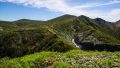
Mt. Tanigawa (谷川岳) is a 1,977m peak on the border of Gunma and Niigata Prefectures. One of the 100 Famous Japanese Mountains, from the twin peaks “Toma-no-Mimi” and “Oki-no-Mimi” you can enjoy a 360-degree grand panorama. Since you can gain elevation at once by ropeway, it is a popular mountain for day-trip climbing. The autumn foliage and the impact of the rock walls are spectacular.
From Minakami Station on the JR Joetsu Line, you can access Tanigawadake Yoh (formerly Tanigawadake Ropeway) by bus (about 25 minutes).
For Mt. Tanigawa, it is common to use the ropeway (current: Tanigawadake Yoh by Hoshino Resorts) to go up to mid-mountain.
For Tanigawadake Yoh, when using the Shinkansen access from Jomokogen Station, when using conventional line access from Minakami Station by bus.
Tanigawadake Yoh operating hours
April ~ November
Weekday: 8:00–17:00
Sat/Sun/holidays: 7:00–17:00
December ~ March
All days: 8:30–16:30
Ropeway fare
Adult: one-way ¥1,800 / round trip ¥3,000
Elementary school: one-way ¥900 / round trip ¥1,500
Note: From Doai Station, the closest to the ropeway, it is about 20 minutes on foot, but there is a very long staircase between the platform and the ticket gate.
*Timetable last checked: May 30, 2026
How to access the trailheads
- [Outbound] Jomokogen Station → Tanigawadake Yoh (formerly Tanigawadake Ropeway)
- [Outbound] Minakami Station → Tanigawadake Yoh (formerly Tanigawadake Ropeway)
- [Outbound] Doai Station → Tanigawadake Yoh (formerly Tanigawadake Ropeway)
- [Return] Tanigawadake Yoh (formerly Tanigawadake Ropeway) → Jomokogen Station
- [Return] Tanigawadake Yoh (formerly Tanigawadake Ropeway) → Minakami Station
- [Return] Tanigawadake Yoh (formerly Tanigawadake Ropeway) → Doai Station
Hiking Course Details — Mt. Tanigawa
Click to show current location.
Click for full-screen view.
*If the map does not appear, please click here.*
Map & Recommended Route — Mt. Tanigawa
1. [Outbound] Jomokogen Station → Tanigawadake Yoh (formerly Tanigawadake Ropeway)
From Jomokogen Station bus stop Platform 1, board the Kan-etsu Kotsu bus “bound for Minakami Station / Tanigawadake Yoh” and get off at the terminus, Tanigawadake Yoh. Only direct services starting from Jomokogen Station are listed (services terminating at Minakami Station are excluded).
Travel time: about 45 minutes
Fare: ¥1,400
Bus TimetableJomokogen Station → Tanigawadake Yoh
| Jomokogen Station Dep. | Tanigawadake Yoh Arr. |
|---|---|
| 8:00 | 8:45 |
| 8:35 | 9:20 |
| 9:30 | 10:15 |
| 10:20 | 11:05 |
| 11:27 | 12:12 |
| 12:30 | 13:15 |
| 12:55 | 13:40 |
| 13:57 | 14:42 |
| 14:50 | 15:35 |
| 16:12 | 16:59 |
Reference: [NAVITIME]
2. [Outbound] Minakami Station → Tanigawadake Yoh (formerly Tanigawadake Ropeway)
From Minakami Station Platform 3, board the Kan-etsu Kotsu bus “bound for Tanigawadake Yoh” and get off at the terminus. In addition to the direct services from Jomokogen Station, services originating from Minakami Station are also available.
Travel time: about 20 minutes
Fare: ¥850
Bus TimetableMinakami Station → Tanigawadake Yoh
| Minakami Station Dep. | Tanigawadake Yoh Arr. |
|---|---|
| 8:25 | 8:45 |
| 9:00 | 9:20 |
| 9:55 | 10:15 |
| 10:45 | 11:05 |
| 11:35 | 11:55 |
| 11:52 | 12:12 |
| 12:55 | 13:15 |
| 13:20 | 13:40 |
| 14:22 | 14:42 |
| 14:45 | 15:05 |
| 15:15 | 15:35 |
| 15:47 | 16:07 |
| 16:39 | 16:59 |
Reference: [NAVITIME]
3. [Outbound] Doai Station → Tanigawadake Yoh (formerly Tanigawadake Ropeway)
From Doai Station, it is about 20 minutes on foot to Tanigawadake Yoh. All buses from Jomokogen / Minakami Station stop here, but as there are 462 stairs between the platform and the ticket gate, unless there is a special reason, taking the bus from Minakami Station is recommended.
Fare guide: Ueno Station → Doai Station IC ¥3,880 (JR Joetsu Line, conventional)
Bus fare: Doai Station-mae → Tanigawadake Yoh ¥770
Reference: Like an underground fortress, “Japan’s number one mole station” Joetsu Line / Doai Station
Bus TimetableDoai Station → Tanigawadake Yoh
| Doai Station-mae Dep. | Tanigawadake Yoh Arr. |
|---|---|
| 09:13 | 09:20 |
| 10:58 | 11:05 |
| 11:48 | 11:55 |
| 13:33 | 13:40 |
| 14:35 | 14:42 |
| 15:28 | 15:35 |
| 16:00 | 16:07 |
| 16:50 | 16:57 |
Reference: [NAVITIME]
4. [Return] Tanigawadake Yoh (formerly Tanigawadake Ropeway) → Jomokogen Station
From the Tanigawadake Yoh bus stop, board the Kan-etsu Kotsu bus “bound for Jomokogen Station”. All services go via Minakami Station.
Travel time: about 50 minutes
Fare: ¥1,400
Bus TimetableTanigawadake Yoh → Jomokogen Station
| Tanigawadake Yoh Dep. | Jomokogen Station Arr. |
|---|---|
| 9:00 | 9:50 |
| 10:25 | 11:15 |
| 11:20 | 12:10 |
| 12:00 | 12:50 |
| 12:22 | 13:13 |
| 13:20 | 14:10 |
| 14:50 | 15:40 |
| 15:45 | 16:35 |
| 16:12 | 17:02 |
| 17:05 | 17:55 |
Reference: [NAVITIME]
5. [Return] Tanigawadake Yoh (formerly Tanigawadake Ropeway) → Minakami Station
From the Tanigawadake Yoh bus stop, board the Kan-etsu Kotsu bus “bound for Minakami Station” or “bound for Jomokogen Station”.
Travel time: about 23 minutes
Fare: ¥850
Bus TimetableTanigawadake Yoh → Minakami Station
| Tanigawadake Yoh Dep. | Minakami Station Arr. |
|---|---|
| 09:30 | 09:53 |
| 11:20 | 11:43 |
| 12:00 | 12:23 |
| 13:52 | 14:15 |
| 14:50 | 15:13 |
| 15:45 | 16:08 |
| 16:12 | 16:35 |
| 17:05 | 17:28 |
Reference: [NAVITIME]
6. [Return] Tanigawadake Yoh (formerly Tanigawadake Ropeway) → Doai Station
About 20 minutes on foot. By bus, about 3 minutes.
Bus fare: Tanigawadake Yoh → Doai Station-mae ¥770
Fare guide: Doai Station → Ueno Station IC ¥3,880 (JR Joetsu Line, conventional)
Bus TimetableTanigawadake Yoh → Doai Station
| Tanigawadake Yoh Dep. | Doai Station-mae Arr. |
|---|---|
| 09:30 | 09:33 |
| 11:20 | 11:23 |
| 12:00 | 12:03 |
| 13:52 | 13:55 |
| 14:50 | 14:53 |
| 15:45 | 15:48 |
| 16:12 | 16:15 |
| 17:05 | 17:08 |
Reference: [NAVITIME]

Comments