 Shizuoka(静岡)
 Mt. Jumai
Mt. Jumai (十枚山, 1,726 m), straddling Aoi-ku in Shizuoka City and Nanbu in Yamanashi on the Abe-Higashi Ridge, is one of ...
Shizuoka(静岡) has 7 mountains you can reach using only public transport — trains and buses. 2 of them are among Japan's 100 Famous Mountains. Popular choices include Mt. Amagi, Mt. Tekaridake, Mt. Ashitaka and Mt. Daimugen. Each guide shows the route from the nearest station to the trailhead, with up-to-date bus timetables.
See all mountains in Chubu(中部) →
Bordering prefectures include Yamanashi(山梨), Nagano(長野), Kanagawa(神奈川) and Aichi.
Mountains in Shizuoka(静岡) — Map
Shizuoka(静岡) 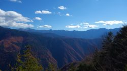 Shizuoka(静岡)
  Shizuoka(静岡)
  Shizuoka(静岡)
 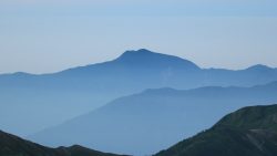 Shizuoka(静岡)
 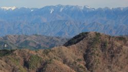 Shizuoka(静岡)
  Yamanashi(山梨)
  Shizuoka(静岡)
  Shizuoka(静岡)
  Shizuoka(静岡)
  Shizuoka(静岡)
  Shizuoka(静岡)
 Ainodake (3,189.5m) is a mountain in the northern part of the Southern Alps (Akaishi Mountains), straddling Shizuoka and Yamanashi Prefectures. It is the fourth highest peak in Japan. This page introduces bus access to Hirogawara, the gateway to the Southern Alps. For access from the same trailhead, see also Kitadake. *Timetable last checked: [sc name=”updated_date”][/sc] Access to the Trailhead Going: Kofu Sta. → Hirogawara Return: Hirogawara → Kofu Sta. 1. Going: Kofu Sta. → Hirogawara From JR Kofu Station South Exit bus stop, take the Yamanashi Kotsu Southern Alps Mountaineering Bus (Hirogawara Line) to Hirogawara.Travel time: Approx. 1 hour 55 minFare: 2,400 yen + 300 yen (user cooperation fee) Season: […]
 Shizuoka(静岡)
  Shizuoka(静岡)
 Amagisan is a collective name for the mountain range running east-west through the center of the Izu Peninsula in Shizuoka Prefecture. The highest peak is Banzaburodake at 1,405m. *Timetable last checked: [sc name=”updated_date”][/sc] Access to the Trailhead Going: Ito Sta. → Amagi Traverse Trailhead Return: Amagi Traverse Trailhead → Ito Sta. Map & Recommended Route 1. Going: Ito Sta. → Amagi Traverse Trailhead From JR Ito Station (Platform 2), take the Tokai Bus “Amagi Tokyu Resort Shuttle Bus” to Amagi Traverse Trailhead.Travel time: Approx. 55 min Bus Timetable: Ito Sta. → Amagi Traverse Trailhead Daily service (extra buses on select dates only) Ito Sta. (Dep.) Amagi Traverse Trailhead (Arr.) Notes […]
 Shizuoka(静岡)
  Kanagawa(神奈川)
  Shizuoka(静岡)