

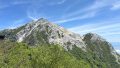
Mt. Senjogatake (3,033m) is a mountain straddling Minami-Alps City, Yamanashi Prefecture and Ina City, Nagano Prefecture. Located in the northern part of the Southern Alps (Akaishi Mountains), it is one of the 100 Famous Japanese Mountains. Its gentle, sweeping ridgeline has earned it the nickname “Queen of the Southern Alps.” The summit area features three cirques (kar): Kosenjogatake Cirque, Yabusawa Cirque, and Daisenjogatake Cirque, with abundant alpine flora.
Access is via the South Alps Forest Road Bus from Todai Park (formerly Senryuso) on the Nagano side to Kitazawa Pass (approx. 50 min, seasonal). From the same trailhead, you can also climb Mt. Kaikomagatake.
Access to the Trailhead
The main trailhead for Mt. Senjogatake is Kitazawa Pass. A popular circuit combines the Kosenjogatake ridge route (ascent approx. 4 hrs) with the Yabusawa route (descent approx. 3 hrs), taking about 7 hours total.
Note: The road between Hirogawara and Kitazawa Pass on the Yamanashi side has been closed to vehicles and buses since Typhoon Hagibis (2019). Vehicle and bus access to Kitazawa Pass is only available from the Ina City side (Todai Park), Nagano Prefecture.
To reach Todai Park, take the South Alps Geoliner (seasonal) from JR Chino Station and transfer to the forest road bus, or take the Morning Geoliner (Saturdays only) from Ina Bus Terminal. By car, it is approx. 40 minutes from Ina IC on the Chuo Expressway.
1. Going: Chino Sta. → Todai Park → Kitazawa Pass
Take JR Bus Kanto “South Alps Geoliner” from JR Chuo Main Line Chino Station and transfer at Todai Park (formerly Senryuso) to the South Alps Forest Road Bus (Queen Line). Get off at Kitazawa Pass.
Bus Timetable Chino Sta. to Todai Park (South Alps Geoliner)
Ride time: Approx. 65 min
Fare: ¥1,800
Operating period: Mid-Jul to mid-Oct, Fri/Sat/Sun/holidays (2025: Jul 18 – Oct 13)
*Daily service in early to mid-August
| Chino Sta. dep. | Todai Park arr. |
|---|---|
| 10:40 | 11:45 |
Reference:
Bus Timetable Todai Park to Kitazawa Pass (Forest Road Bus)
Ride time: Approx. 50 min
Fare: ¥1,150 + ¥220 baggage fee (backpacks 18L+)
*Tickets sold at the ticket machine inside Todai Park (sales start approx. 30 min before the first bus). No IC cards accepted, cash only.
Operating period: Early Jun to early Nov (2026: Jun 1 – Nov 3)
*Late Apr to May: service runs only to Utajuku
| Todai Park dep. | Kitazawa Pass arr. | Notes |
|---|---|---|
| 5:45 | 6:35 | Daily |
| 6:30 | 7:20 | Weekends/holidays |
| 8:05 | 8:55 | |
| 10:05 | 10:55 | |
| 12:10 | 13:00 | |
| 14:20 | 15:10 |
*On days the 5:45 service runs, the 6:30 service does not operate.
*Geoliner arrives 11:45 → connects to the 12:10 forest road bus.
Reference: Ina City South Alps Forest Road Bus
2. Going: Ina Bus Terminal (Inashi Sta.) → Todai Park → Kitazawa Pass
From Ina Bus Terminal (approx. 3 min walk from JR Iida Line Inashi Station), take JR Bus Kanto “Morning Geoliner” to Todai Park, then transfer to the South Alps Forest Road Bus (Queen Line) first departure to Kitazawa Pass.
Bus Timetable Ina Bus Terminal to Todai Park (Morning Geoliner)
Ride time: Approx. 40 min
Fare: ¥950
Operating period: Mid-Jul to early Oct, Saturdays only (2025: Jul 19 – Oct 11)
| Ina BT dep. | Todai Park arr. |
|---|---|
| 4:30 | 5:10 |
*Arrives Todai Park 5:10 → connects to the 5:45 first forest road bus. See Section 1 for the forest road bus timetable and fares.
Reference:
3. Return: Kitazawa Pass → Todai Park → Chino Sta.
Take the South Alps Forest Road Bus (Queen Line) from Kitazawa Pass to Todai Park, then transfer to JR Bus Kanto “South Alps Geoliner” to JR Chino Station.
Bus Timetable Kitazawa Pass to Todai Park (Forest Road Bus)
Ride time: Approx. 45 min
Fare: ¥1,150 + ¥220 baggage fee (backpacks 18L+)
| Kitazawa Pass dep. | Todai Park arr. |
|---|---|
| 7:30 | 8:15 |
| 10:00 | 10:45 |
| 13:10 | 13:55 |
| 15:00 | 15:45 |
| 16:00 | 16:45 |
*Forest road bus dep. 16:00 (arr. 16:45) → connects to Geoliner dep. 17:00.
Reference: Ina City South Alps Forest Road Bus
Bus Timetable Todai Park to Chino Sta. (South Alps Geoliner)
Ride time: Approx. 85 min
Fare: ¥1,800
Operating period: Mid-Jul to mid-Oct, Fri/Sat/Sun/holidays (same as outbound)
| Todai Park dep. | Chino Sta. arr. |
|---|---|
| 17:00 | 18:24 |
Reference:
4. Return: Kitazawa Pass → Todai Park → Ina Bus Terminal (Inashi Sta.)
Take the South Alps Forest Road Bus (Queen Line) from Kitazawa Pass to Todai Park. Then take the South Alps Geoliner to Takato Station and transfer to a JR bus to Ina Bus Terminal.
Bus Timetable Kitazawa Pass to Todai Park (Forest Road Bus)
Ride time: Approx. 45 min
Fare: ¥1,150 + ¥220 baggage fee (backpacks 18L+)
*See Section 3 for the timetable.
Bus Timetable Todai Park to Ina Bus Terminal (Geoliner → JR Bus transfer)
Transfer to a JR bus at Takato Station.
Fare: Todai Park → Takato Sta. ¥310 + Takato Sta. → Ina BT ¥590
Operating period: Mid-Jul to mid-Oct, Fri/Sat/Sun/holidays (same as outbound Geoliner)
| Todai Park dep. | Takato Sta. arr. | Takato Sta. dep. | Ina BT arr. |
|---|---|---|---|
| 17:00 | 17:20 | 17:55 | 18:19 |
*Forest road bus dep. 16:00 (arr. 16:45) → connects to Geoliner dep. 17:00.
Reference:

Comments