Mt. Sobosan (そぼさん, 1,756m) straddles the borders of Bungo-Ono City / Taketa City (Oita), Takachiho Town (Miyazaki, Nishi-Usuki District), and Takamori Town (Kumamoto, Aso District), within Sobo-Katamuki Quasi-National Park, selected in Kyuya Fukada’s One Hundred Mountains of Japan. As the lord of mainland Kyushu, it is one of the Three Famous Mountains of Bungo (Mt. Sobo, Mt. Yufu, Mt. Kuju).
The Kitatani course (Kumamoto side, most popular) or Koura course (Oita side, Kamoshika-go bus available) is the standard. Intermediate ★★★・distance ~8 km・elevation gain 800 m・action time ~7 hours (day hike). Highlights include virgin forest and akebono-tsutsuji rhododendron (mid-April to mid-May), plus a 360° summit panorama of mainland Kyushu.
Access to the trailhead
- [Outbound / Return] Bungo-Taketa Station ⇔ Koura trailhead (Kamoshika-go Mon-Sat, reservation required)
- Three trailheads, 9th-Station Hut, suggested plans
Course time (Koura course, day hike, Intermediate, ~7 hours)
Koura trailhead (740 m) → (0:30) → Senkendaira → (2:00) → Kunimitouge Pass (1,320 m) → (1:30) → Mt. Sobo 9th-Station Hut (1,640 m) → (0:30) → Mt. Sobo summit (1,756 m) → descent (2:30) → Koura trailhead
1. [Outbound / Return] Bungo-Taketa Station ⇔ Koura trailhead (Kamoshika-go Mon-Sat, reservation required)
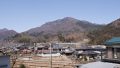
For the Koura trailhead (740 m), take “Kamoshika-go” (Taketa City-operated shared taxi) approx. 30 min・one-way ¥2,000・Mon-Sat operation (no service Sun and Dec 30 – Jan 3); 2 services per day (outbound 7:00 / 9:15, return 15:30 / 17:30). Reservation required by 15:00 the day before (Taketa City Citizens’ Affairs ☎0974-63-2638); no same-day cancellation. Private car: Kyushu Expressway Kumamoto IC → R57 → R325 → Pref. Rd or Oita Expressway Oita IC → R10 → R57 → Pref. Rd; Koura trailhead parking 25 free spaces. From bus stop to trailhead parking is a 25 min walk uphill (1.5 km, paved road).
Operating period : Mon-Sat (no service Sun, Dec 30 – Jan 3), year-round
Travel time : Bungo-Taketa Stn → Koura ~30 min
Fare : One-way ¥2,000 (cash only, preschool children free)
Frequency : 2 services per day (outbound 7:00 / 9:15, return 15:30 / 17:30)
Bungo-Taketa Stn → Koura (Kamoshika-go, Mon-Sat, hikers, advance reservation required)
| Bungo-Taketa Stn dep | Koura arr |
|---|---|
| 7:00 (early) | 7:30 |
| 9:15 (morning) | 9:45 |
Koura → Bungo-Taketa Stn (Kamoshika-go, return, Mon-Sat, advance reservation required)
| Koura dep | Bungo-Taketa Stn arr |
|---|---|
| 15:30 (afternoon) | 16:00 |
| 17:30 (evening, last) | 18:00 |
Note : Kamoshika-go requires reservation by 15:00 the day before (Taketa City Citizens’ Affairs ☎0974-63-2638); no same-day cancellation or time change. The bus stop is 1.5 km before the trailhead parking (25 min walk uphill). No service Sun or year-end; on those days taxi (Bungo-Taketa Station front) or pre-overnight + private car is realistic. After descent, Nagayu Onsen “Gani-yu” or Shichirida Onsen is recommended.
Reference : Taketa Tourism — Kamoshika-go official | Yamasugu — Mt. Sobosan trailheads
Contact : Taketa City Citizens’ Affairs (Kamoshika-go reservation) ☎0974-63-2638 / Takachiho Tourism Association ☎0982-73-1213 / Mt. Sobo 9th-Station Hut, Mr. Kato ☎090-5936-5337
2. Three trailheads, 9th-Station Hut, suggested plans
About Mt. Sobosan
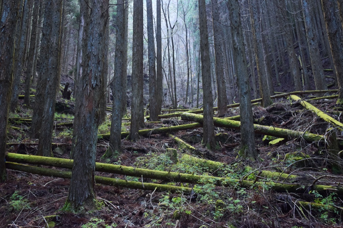
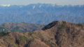
Mt. Sobosan forms the heart of Sobo-Katamuki Quasi-National Park and is regarded as the lord of mainland Kyushu. Old-growth forest of beech and other trees spreads across the ridges, and from mid-April to mid-May great colonies of akebono azalea turn the slopes pink, making it one of Kyushu’s foremost spots for mountain flowers. Using the Sobosan Kyugome hut (an unstaffed, free emergency shelter) just below the summit as a base makes the climb comfortably achievable, and from the top a 360° panorama opens out over Mt. Asosan, the Kuju Mountains, and the distant Kirishima range.
Trail overview (3 main courses)
- Kitatani course (Kumamoto side, standard, most popular, Intermediate, ~6 hr): Kitatani trailhead → Senkendaira → Kunimitouge → Mt. Sobo summit; shortest, easiest walking; parking 20 spaces
- Koura course (Oita side, Intermediate, ~7 hr): Koura trailhead → Kunimitouge → 9th-Station Hut → summit; Kamoshika-go bus available; parking 25 spaces
- Ohira course (Oita side, Intermediate – Expert, ~8 hr): Ohira trailhead → Kurogane Ridge → summit; many akebono-tsutsuji; parking available
Mountain huts / hot springs (2026 information)
– Mt. Sobo 9th-Station Hut (just below summit, 1,640 m, ☎090-5936-5337 Mr. Kato): Unstaffed emergency shelter since March 2018, lodging free, toilet free, bring own bedding, capacity ~30
– Nagayu Onsen “Gani-yu” (Taketa City, bath ¥500)・Shichirida Onsen “Shimoyu” (post-descent)
– Kitatani trailhead parking: 20 spaces free・toilet・boot-wash water / Koura trailhead: 25 spaces free / Ohira trailhead: parking available
Climbing season / flora: May to November. Mid-April to mid-May: akebono-tsutsuji mass colonies (Ohira-goe – Old Mt. Sobo, Kazaana course, Kurogane Ridge, Miyahara, around Tengu-iwa). October-November: autumn colors. Winter (December-March) has snow / ice; Intermediate-plus only.
Cautions
– Kamoshika-go requires day-before reservation, no Sun service: No same-day cancellation; weekdays recommended
– Akebono-tsutsuji peak weekend parking fills up: Weekdays recommended, or pre-overnight
– 9th-Station Hut unstaffed shelter, free lodging: Bedding / food must be brought
– Water at huts, Kunimitouge: Carrying water essential, at least 1.5 L
– Yamabiru (mountain leeches), hornet sightings: May-October, appropriate gear
Emergency contacts / inquiries
- Taketa City Citizens’ Affairs (Kamoshika-go): ☎0974-63-2638 / Takachiho Tourism Association: ☎0982-73-1213
- Bungo-Ono Police Station (climbing notification / mountain rescue): ☎0974-22-0110
- Mt. Sobo 9th-Station Hut, Mr. Kato: ☎090-5936-5337
- Bungo-Ono City Office: ☎0974-22-1001 / Takamori Town Office: ☎0967-62-1111
Suggested plans (Koura course, Kamoshika-go day hike, recommended, standard)
- Day hike (Koura course, Kamoshika-go, recommended, standard): Day 1 Tokyo → Fukuoka Airport → Shinkansen → Kumamoto → Hohi Line → Bungo-Taketa Station pre-overnight (advance Kamoshika-go reservation required). Day 2 Bungo-Taketa Stn 7:00 → Kamoshika-go → Koura 7:30 → Kunimitouge 10:00 → 9th-Station Hut 11:30 → summit 12:00 → descent → Koura 15:00 → Kamoshika-go 15:30 → Bungo-Taketa Stn 16:00 → return
- 1 night 2 days, 9th-Station Hut shelter overnight (strong hikers, akebono-tsutsuji season): Day 1 Koura → 9th-Station Hut shelter overnight (bedding / food, free). Day 2 early summit (sunrise) → descend toward Ohira (circuit) → return
Reference : Taketa Tourism — Kamoshika-go | Mt. Sobo 9th-Station Hut official
Photo by Raita
Comments