
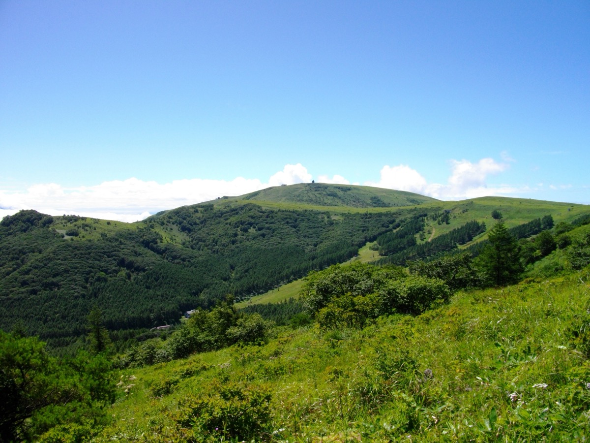
Kirigamine (霧ヶ峰, 1,925 m) is a shield-volcano plateau in the northeast of Suwa City, Nagano Prefecture, and is counted among the 100 Famous Mountains of Japan. Centred on the main peak Mt. Kuruma (1,925 m), vast highland and wetland scenery extends across the area, famous for its nikkō-kisuge (day-lily) blooms in July, azaleas in June, and grass-autumn colours in October. The Yashima Marsh (a National Natural Monument) is a rare high-altitude raised wetland of sphagnum moss. With only 100–300 m of elevation gain, Kirigamine is one of the most beginner- and family-friendly hyakumeizan.
Alpico Kotsu operates the seasonal “Kirigamine / Yashima Marsh Line” from JR Kami-Suwa Station, directly connecting Kurumayama Highland, Kurumayama-kata (shoulder), Kirigamine Interchange, and Yashima Marsh.
How to access the trailheads
- [Outbound] Kami-Suwa Station → Kirigamine / Yashima Marsh / Kurumayama-kata / Kurumayama Highland (Alpico Kotsu)
- [Return] Kurumayama Highland / Kurumayama-kata / Yashima Marsh → Kami-Suwa Station (Alpico Kotsu)
Course Times (Kurumayama-kata loop, approx. 3 hours)
Kurumayama-kata bus stop → (0:40) → Mt. Kuruma summit (1,925 m) → (0:30) → Chōchō-miyama → (0:30) → Monomi-ishi → (0:30) → Yashima Marsh → (0:30) → Sawatari → (0:20) → Kurumayama-kata bus stop
1. [Outbound] Kami-Suwa Station → Kirigamine / Yashima Marsh / Kurumayama-kata / Kurumayama Highland (Alpico Kotsu)
From JR Kami-Suwa Station West Exit (Lake Suwa side), board the Alpico Kotsu “Kirigamine / Yashima Marsh Line” and alight at your chosen trailhead. The four main trailheads are Kurumayama-kata (shortest to the summit of Mt. Kuruma), Kirigamine Interchange (near the Nature Conservation Center), Yashima Marsh (wetland circuit start), and Kurumayama Highland (chairlift access and Shirakaba-ko descent).
Operating period: May 2 – October 25, 2026 | Saturdays, Sundays, holidays, and daily during August 1–30 (no service on most other weekdays)
Travel time: Kami-Suwa Stn → Kirigamine approx. 34 min | → Yashima Marsh approx. 45 min | → Kurumayama-kata approx. 60 min | → Kurumayama Highland approx. 68 min
Fare: Kami-Suwa → Kirigamine adult ¥1,700 | → Yashima Marsh adult ¥1,700 | → Kurumayama Highland adult ¥2,300
Note: Service is curtailed on August 15 due to the Lake Suwa Fireworks Festival. Heavy summer road congestion may cause significant delays — allow extra travel time.
Reference: Alpico Kotsu Kirigamine / Yashima Marsh Line | Kirigamine Nature Conservation Center
Bus TimetableKami-Suwa Station → Kurumayama Highland (Alpico Kotsu Kirigamine Line)
| Kami-Suwa Stn | Kirigamine | Yashima Marsh | Kurumayama-kata | Kurumayama Hl. |
|---|---|---|---|---|
| 9:35 | 10:09 | 10:20 | 10:35 | 10:43 |
| 10:35 | 11:09 | 11:20 | 11:35 | 11:43 |
| 14:30 | 15:04 | 15:15 | 15:30 | 15:38 |
Note: Two additional trips at 11:30 and 14:21 start from Kyōshimizu (Kirigamine) and do not originate from Kami-Suwa. Confirm details on the operator’s PDF.
Reference: [Alpico Kotsu (official PDF)]
2. [Return] Kurumayama Highland / Kurumayama-kata / Yashima Marsh → Kami-Suwa Station (Alpico Kotsu)
After hiking, board the Alpico Kotsu Kirigamine Line back to Kami-Suwa Station from the nearest bus stop (Kurumayama Highland, Kurumayama-kata, or Yashima Marsh). With only 3 return trips per day, descend with time to spare.
Operating period: Same as outbound — May 2 – October 25, 2026
Travel time: Kurumayama Hl. → Kami-Suwa Stn approx. 65 min | Yashima Marsh → Kami-Suwa Stn approx. 42 min
Fare: Same as outbound
Bus TimetableKurumayama Highland → Kami-Suwa Station (Alpico Kotsu Kirigamine Line)
| Kurumayama Hl. | Kurumayama-kata | Yashima Marsh | Kirigamine | Kami-Suwa Stn |
|---|---|---|---|---|
| 11:50 | 11:58 | 12:13 | 12:22 | 12:55 |
| 13:45 | 13:53 | 14:08 | — | 14:50 |
| 14:55 | 15:03 | 15:18 | — | 16:00 |
Note: The 10:40 trip from Kurumayama Highland terminates at Tatenoumi-iriguchi and does not continue to Kami-Suwa Station.
Reference: [Alpico Kotsu (official PDF)]
Photo by Mass Ave 975
Comments