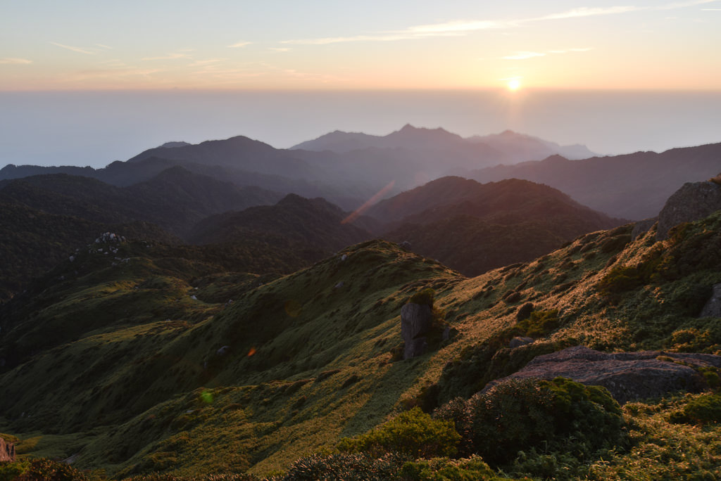
Mt. Miyanoura is a 1,936m peak located in the central part of Yakushima Island, Kagoshima Prefecture. The entire island is registered as a UNESCO World Heritage Site, and Mt. Miyanoura is listed among Japan’s 100 Famous Mountains.
There are two main trailheads: Shiratani Unsuikyo and Kigensugi, both accessible by Yakushima Kotsu bus from the island’s ports and airport.
How to access the trailheads
- Going: Miyanoura Port → Shiratani Unsuikyo
- Going: Anbo Port / Airport → Shiratani Unsuikyo
- Going: Miyanoura Port / Airport → Kigensugi
- Going: Anbo Port → Kigensugi
- Return: Shiratani Unsuikyo → Miyanoura Port
- Return: Shiratani Unsuikyo → Airport / Anbo Port
- Return: Kigensugi → Airport / Miyanoura Port
- Return: Kigensugi → Anbo Port
Hiking Course Details — Mt. Miyanoura
Click to show current location.
Click for full-screen view.
*If the map does not appear, please click here.*
Map & Recommended Route — Mt. Miyanoura
October 1, 2025: Yakushima Kotsu Bus schedule revision
Yakushima Kotsu buses (Shiratani-Unsuikyo / Kigensugi / Ohko-no-Taki routes) had a schedule revision on October 1, 2025. Please verify current times on the official PDF (English).
Kagoshima ⇔ Yakushima Main Routes (2026):
- Orita Kisen “Ferry Yakushima 2”: Kagoshima 8:30 → Miyanoura 12:30 / Miyanoura 13:30 → Kagoshima 17:40 (4 hours, ¥6,500 adult 2nd class). Official — Fare revised 2026/4/1.
- Tane-Yaku Jetfoil “Toppy & Rocket”: 7 trips daily (6 in winter), approx 1h50min. Official
- Kassho Kaiun “Hibiscus”: Kagoshima Taniyama 18:00 → Tanegashima → Miyanoura 07:00 next morning (overnight). Official
1. Going: Miyanoura Port → Shiratani Unsuikyo
From Miyanoura Port or Miyanoura, take the Yakushima Kotsu bus bound for Shiratani Unsuikyo and get off at the last stop.
Travel time: approx. 35 min
Fare: 560 yen
Bus Timetable: Miyanoura Port to Shiratani Unsuikyo
| Miyanoura Port | Miyanoura | Shiratani Unsuikyo |
|---|---|---|
| 8:10 | 8:13 | 8:45 |
| 10:15 | 10:18 | 10:50 |
| 13:05 | 13:08 | 13:40 |
| 15:30 | 15:33 | 16:05 |
Reference:
2. Going: Anbo Port / Airport → Shiratani Unsuikyo
From Anbo Port or Yakushima Airport, take the bus bound for Miyanoura Port and get off at Obaramachi. Transfer to the Shiratani Unsuikyo bus and get off at the last stop.
Fare: approx. 1,410 yen total (1 transfer)
Bus Timetable: Anbo Port to Shiratani Unsuikyo
| Anbo | Anbo Port | Airport | Obaramachi | Obaramachi | Shiratani Unsuikyo |
|---|---|---|---|---|---|
| 7:34 | – | 7:50 | 8:08 | 8:15 | 8:45 |
| 9:34 | 9:38 | 9:54 | 10:12 | 10:20 | 10:50 |
| 11:59 | 12:03 | 12:19 | 12:37 | 13:10 | 13:40 |
| 14:39 | 14:43 | 14:59 | 15:17 | 15:35 | 16:05 |
Reference:
3. Going: Miyanoura Port / Airport → Kigensugi
From Miyanoura Port or the Airport, take the bus bound for Anbo Port and get off at Gocho-mae. Transfer to the Kigensugi bus and get off at the last stop, Kigensugi.
Fare: approx. 2,170 yen total (1 transfer)
Bus Timetable: Miyanoura / Airport to Kigensugi
| Miyanoura Port | Miyanoura | Airport | Gocho-mae | Gocho-mae | Kigensugi |
|---|---|---|---|---|---|
| 8:40 | 8:43 | 9:03 | 9:15 | 9:20 | 10:27 |
| 12:50 | 12:53 | 13:13 | 13:25 | 13:30 | 14:37 |
Reference:
4. Going: Anbo Port → Kigensugi
From Anbo Port or Anbo, take the bus bound for Kigensugi and get off at the last stop.
Travel time: approx. 1 hr
Fare: 1,260 yen
Bus Timetable: Anbo Port to Kigensugi
| Anbo Port | Anbo | Kigensugi |
|---|---|---|
| 9:26 | 9:28 | 10:27 |
| 13:36 | 13:38 | 14:37 |
Reference:
5. Return: Shiratani Unsuikyo → Miyanoura Port
From Shiratani Unsuikyo bus stop, take the bus bound for Miyanoura Port and get off at Miyanoura or the last stop, Miyanoura Port.
Travel time: approx. 35 min
Fare: 560 yen
Bus Timetable: Shiratani Unsuikyo to Miyanoura Port
| Shiratani Unsuikyo | Miyanoura | Miyanoura Port |
|---|---|---|
| 9:00 | 9:27 | 9:35 |
| 10:50 | 11:17 | 11:25 |
| 13:45 | 14:12 | 14:20 |
| 16:10 | 16:37 | 16:45 |
Reference:
6. Return: Shiratani Unsuikyo → Airport / Anbo Port
From Shiratani Unsuikyo, take the bus to Miyanoura Port and get off at Obaramachi. Transfer to the bus bound for Anbo Port and get off at the Airport or Anbo Port.
Fare: approx. 1,410 yen total (1 transfer)
Bus Timetable: Shiratani Unsuikyo to Airport / Anbo Port
| Shiratani Unsuikyo | Obaramachi | Obaramachi | Airport | Anbo Port | Anbo |
|---|---|---|---|---|---|
| 9:00 | 9:25 | 10:05 | 10:23 | 10:44 | 10:46 |
| 10:50 | 11:15 | 11:20 | 11:38 | 11:56 | 11:58 |
| 13:45 | 14:10 | 14:15 | 14:33 | 14:51 | 14:53 |
| 16:10 | 16:35 | 16:55 | 17:13 | 17:33 | 17:35 |
Reference:
7. Return: Kigensugi → Airport / Miyanoura Port
From Kigensugi, take the bus to Gocho-mae and get off at Anbo. Transfer to the bus bound for Miyanoura Port and get off at the Airport or Miyanoura Port.
Fare: approx. 2,170 yen total (1 transfer)
Bus Timetable: Kigensugi to Airport / Miyanoura Port
| Kigensugi | Anbo | Anbo | Airport | Miyanoura | Miyanoura Port |
|---|---|---|---|---|---|
| 10:45 | 11:44 | 11:59 | 12:19 | 12:39 | 12:44 |
| 14:55 | 15:54 | 16:24 | 16:44 | 17:04 | 17:09 |
Reference:
8. Return: Kigensugi → Anbo Port
From Kigensugi, take the bus to Gocho-mae and get off at Anbo. Walk from Anbo to Anbo Port.
Travel time: approx. 1 hr
Fare: 1,260 yen
*The bus does not stop at Anbo Port.
Bus Timetable: Kigensugi to Anbo
| Kigensugi | Anbo |
|---|---|
| 10:45 | 11:44 |
| 14:55 | 15:54 |
Reference: