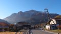
Amagisan is a collective name for the mountain range running east-west through the center of the Izu Peninsula in Shizuoka Prefecture. The highest peak is Banzaburodake at 1,406m.
Access to the Trailhead
Map
1. Going: Ito Sta. → Amagi Traverse Trailhead
From JR Ito Station (Platform 2), take the Tokai Bus “Amagi Tokyu Resort Shuttle Bus” to Amagi Traverse Trailhead.
Travel time: Approx. 55 min
Bus Timetable: Ito Sta. → Amagi Traverse Trailhead
| Ito Sta. (Dep.) | Amagi Traverse Trailhead (Arr.) | Notes |
|---|---|---|
| 07:55 | 08:50 | 通常便 |
| 10:15 | 11:10 | 通常便 |
| 14:15 | 15:10 | 増発便 |
| 15:40 | 16:35 | 通常便 |
Reference: Tokai Bus Timetable (revised Apr 2025)
2. Return: Amagi Traverse Trailhead → Ito Sta.
From Amagi Traverse Trailhead, take the same shuttle bus to Ito Station.
Travel time: Approx. 55 min
Bus Timetable: Amagi Traverse Trailhead → Ito Sta.
| Amagi Traverse Trailhead (Dep.) | Ito Sta. (Arr.) | Notes |
|---|---|---|
| 09:00 | 09:55 | 通常便 |
| 11:20 | 12:15 | 通常便 |
| 15:20 | 16:15 | 増発便 |
| 16:45 | 17:40 | 通常便 |
Reference: Tokai Bus Timetable (revised Apr 2025)