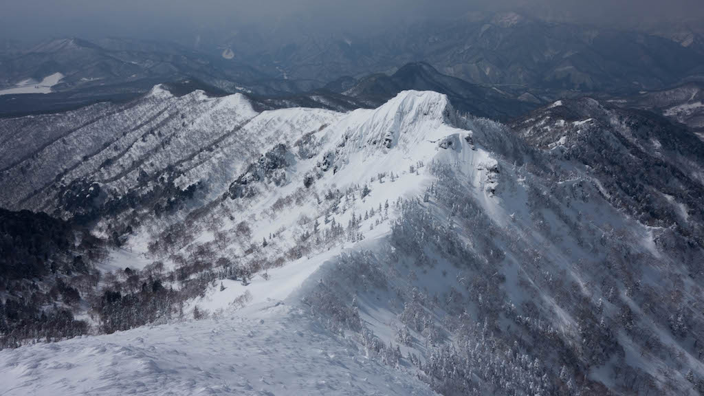
Mt. Hotaka (武尊山) is a 2,158m peak in the northern Gunma Prefecture. One of the 100 Famous Japanese Mountains, also called “Joshu Hotaka”. Deep mountain nature covered with beech and Dakekanba virgin forest is the attraction; also selected as one of the 100 Flowering Mountains. Autumn foliage is also magnificent, enjoyable through all four seasons.
From Minakami Station on the JR Joetsu Line, access Hotakabashi by bus, or from Numata Station to Kenkomura by bus.
*Timetable last checked: May 22, 2026
How to access the trailheads
- [Going] Minakami Station → Hotakabashi
- [Going] Numata Station → Kenkomura
- [Going] Numata Station → Kawaba Onsen-guchi
- [Return] Hotakabashi → Minakami Station
- [Return] Kenkomura → Numata Station
- [Return] Kawaba Onsen-guchi → Numata Station
1. [Going] Minakami Station → Hotakabashi
From Bus Stop Platform 4 in front of Minakami Station, take the Kan-etsu Kotsu bus bound for Takaragawa Onsen / Yu-no-Koya and get off at Hotakabashi.
Travel time: 24 minutes
Fare: ¥1,000
From Hotakabashi to the summit is about 5.5 hours.
Bus TimetableMinakami Station → Hotakabashi Bus Timetable
| Minakami Station Dep. | Hotakabashi |
|---|---|
| 8:32 | 8:56 |
| 10:49 | 11:13 |
| 12:00 | 10:24 |
| 13:35 | 13:59 |
| 15:55 | 16:19 |
| 17:43 | 18:07 |
Reference: [Kan-etsu Kotsu Co., Ltd.]
2. [Going] Numata Station → Kenkomura
From Numata Station Bus Stop Platform 4, take the Kan-etsu Kotsu Numata Station – Kawaba Loop Line and get off at Kenkomura.
*Since it is a loop line, there are clockwise and counterclockwise lines; both are listed here.
Travel time: about 30 minutes
Fare: ¥880
Bus TimetableNumata Station → Kenkomura Bus Timetable
| Numata Station | Kenkomura |
|---|---|
| 10:30 | 11:02 |
| 13:10 | 13:47 |
| 16:25 | 16:57 |
| 17:25 | 17:56 |
Reference: [Kan-etsu Kotsu Co., Ltd.]
3. [Going] Numata Station → Kawaba Onsen-guchi
From Numata Station Bus Stop Platform 4, take the Kan-etsu Kotsu Numata Station – Kawaba Loop Line and get off at Kawaba Onsen-guchi.
*Since it is a loop line, there are clockwise and counterclockwise lines; both are listed here.
Travel time: about 30 minutes
Fare: ¥790
Bus TimetableNumata Station → Kawaba Onsen-guchi Bus Timetable
| Numata Station | Kawaba Onsen-guchi |
|---|---|
| 07:05 | 07:32 |
| 08:43 | 09:19 |
| 09:35 | 10:11 |
| 10:30 | 10:57 |
| 13:10 | 13:51 |
| 14:45 | 15:12 |
| 15:35 | 16:05 |
| 16:25 | 16:52 |
| 17:25 | 18:00 |
| 18:37 | 19:04 |
| *19:13 | *19:43 |
Reference: [Kan-etsu Kotsu Co., Ltd.]
4. [Return] Hotakabashi → Minakami Station
From Hotakabashi bus stop, take the bus bound for Minakami Station.
Travel time: 31 minutes
Fare: ¥1,000
Bus TimetableHotakabashi → Minakami Station Bus Timetable
| Hotakabashi | Minakami Station |
|---|---|
| 6:54 | 7:25 |
| 7:39 | 8:10 |
| 7:41 | 8:12 |
| 9:49 | 10:20 |
| 12:08 | 12:39 |
| 13:11 | 13:42 |
| 14:51 | 15:22 |
| 17:03 | 17:34 |
Reference: [Kan-etsu Kotsu Co., Ltd.]
5. [Return] Kenkomura → Numata Station
From Kenkomura bus stop, take the “Numata Station – Kawaba Loop Line” and get off at Numata Station.
*Since it is a loop line, there are clockwise and counterclockwise lines; both are listed here.
Travel time: about 30 minutes
Fare: ¥880
Bus TimetableKenkomura → Numata Station Bus Timetable
| Kenkomura | Numata Station |
|---|---|
| 07:00 | 07:40 |
| 11:02 | 11:46 |
| 13:47 | 14:26 |
| 16:57 | 17:41 |
| 17:56 | 18:35 |
Reference: [Kan-etsu Kotsu Co., Ltd.]
6. [Return] Kawaba Onsen-guchi → Numata Station
From Kawaba Onsen-guchi bus stop, take the “Numata Station – Kawaba Loop Line” and get off at Numata Station.
*Since it is a loop line, there are clockwise and counterclockwise lines; both are listed here.
Travel time: about 30 minutes
Fare: ¥790
Bus TimetableKawaba Onsen-guchi → Numata Station Bus Timetable
| Kawaba Onsen-guchi | Numata Station |
|---|---|
| *06:16 | *06:50 |
| 07:05 | 07:40 |
| 07:32 | 08:10 |
| 09:19 | 09:54 |
| 10:11 | 10:46 |
| 10:57 | 11:46 |
| 13:51 | 14:26 |
| 15:12 | 15:56 |
| 16:05 | 16:40 |
| 16:52 | 17:41 |
| 18:00 | 18:35 |
| 19:04 | 19:42 |
| *19:43 | *20:18 |
Reference: [Kan-etsu Kotsu Co., Ltd.]
Photo by Seth FJT