 Nagano(長野)
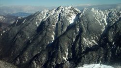
 Mt. Nokogiri
Mt. Nokogiri (鋸岳, 2,685 m), straddling Ina in Nagano and Hokuto in Yamanashi, is one of the 200 Famous Japanese Mountain...
100 Highest Mountains — we cover 40 of them, all reachable by public transport. Popular choices include Mt. Aino, Mt. Aka, Mt. Akaishi and Mt. Arakawa. Each guide shows the route from the nearest station to the trailhead, with up-to-date bus timetables.
100 Highest Mountains
Nagano(長野)  Nagano(長野)
  Yamanashi(山梨)
  Toyama(富山)
 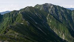 Nagano(長野)
  Nagano(長野)
  Gifu(岐阜)
  Shizuoka(静岡)
 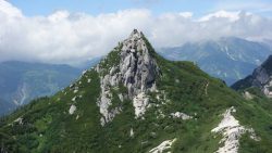 Nagano(長野)
  Shizuoka(静岡)
 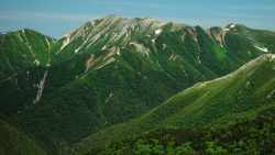 Nagano(長野)
  Gifu(岐阜)
  Nagano(長野)
  Shizuoka(静岡)
  Shizuoka(静岡)
  Toyama(富山)
  Nagano(長野)
 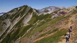 Toyama(富山)
  Nagano(長野)
  Nagano(長野)
 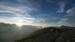 Nagano(長野)
  Shizuoka(静岡)
 Ainodake (3,189.5m) is a mountain in the northern part of the Southern Alps (Akaishi Mountains), straddling Shizuoka and Yamanashi Prefectures. It is the fourth highest peak in Japan. This page introduces bus access to Hirogawara, the gateway to the Southern Alps. For access from the same trailhead, see also Kitadake. *Timetable last checked: [sc name=”updated_date”][/sc] Access to the Trailhead Going: Kofu Sta. → Hirogawara Return: Hirogawara → Kofu Sta. 1. Going: Kofu Sta. → Hirogawara From JR Kofu Station South Exit bus stop, take the Yamanashi Kotsu Southern Alps Mountaineering Bus (Hirogawara Line) to Hirogawara.Travel time: Approx. 1 hour 55 minFare: 2,400 yen + 300 yen (user cooperation fee) Season: […]
 Nagano(長野)
  Yamanashi(山梨)
  Nagano(長野)
 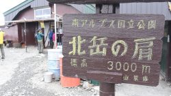 Yamanashi(山梨)
  Toyama(富山)
 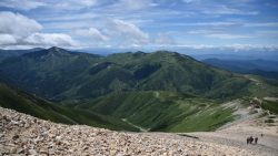 Toyama(富山)
  Toyama(富山)
  Toyama(富山)
  Nagano(長野)
 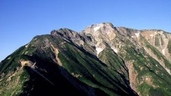 Toyama(富山)
  Nagano(長野)
  Nagano(長野)
  Nagano(長野)
  Nagano(長野)
 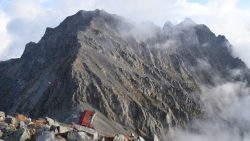 Nagano(長野)
  Shizuoka(静岡)