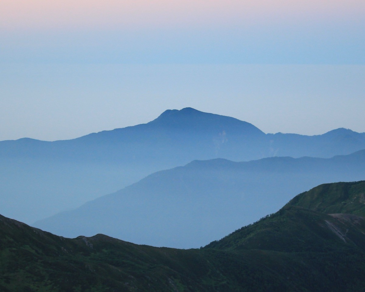
Mt. Daimugen (大無間山, 2,330 m), straddling Aoi Ward of Shizuoka City and Kawanehon in Shizuoka, is one of the 200 Famous Japanese Mountains.
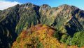
A primeval-forest peak lying quietly in the depths of the far-southern Southern Alps, it is prized for a tranquil walk that follows deep forest and a long ridge step by step, valuing solitude over sweeping views. The usual Tashiro route is a round trip of about 17.7 km, takes more than seven hours to the summit at standard pace, and is an advanced route normally done over two days with a night at the Konukan Hut. The collapsing ground called the “Kyoshi” (saw-teeth) just before Mt. Konukan is the route’s hardest section, with much loose rock and very unstable footing, demanding solid experience and sound judgment.
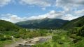
The trailhead is Tashiro (Suwa Shrine). You can reach the trailhead from Shizuoka Station via Yokosawa on the Ikawa district community bus, but services are very few, so an overnight stay or a rental car is realistic.
The trailhead is Tashiro (Suwa Shrine; parking for hikers available). The usual approach gains the ridge from Tashiro, passes the Konukan Hut and Mt. Konukan, and crosses the collapsing Kyoshi to reach Mt. Daimugen. It is an advanced route of about 17.7 km round trip, over seven hours to the summit at standard pace, normally done over two days with a night at the Konukan Hut, and a day trip is only for strong-legged experts. The collapse of the Kyoshi (P1–P4) is still ongoing and is marked only as a thin non-trail line even on the Yama-to-Kogen map, so great care is needed against loose rock and slips.
The Konukan Hut on the way (unstaffed, capacity about 10, no water source, no toilet) is the only base, so carry all your water yourself. This is bear country, so carry a bear bell and submit a climbing plan. The season is May to early November, outside the snow period.
How to access the trailhead
1. [Round trip] Shizuoka Station → Yokosawa → Tashiro (Mt. Daimugen trailhead)
The nearest base is Shizuoka Station (JR Tokaido Main Line / Tokaido Shinkansen). From Shizuoka Station, take the Shizutetsu Just Line (toward Yokosawa / Ikawa) to the Yokosawa bus stop in about 1 hour 20 minutes, then change to the Ikawa district community bus to the Tashiro bus stop in about 1 hour 30 minutes. However, each line runs very infrequently (about two services a day), so staying overnight near Tashiro or coming by rental car is realistic. By car, head for Tashiro from the Shin-Shizuoka IC on the Shin-Tomei via Route 362 and prefectural roads.
– Shizuoka City Ikawa Branch Office (Ikawa district community bus) 054-260-2211 / Shizutetsu Just Line 054-252-0505
Source: [Mt. Daimugen Tashiro trailhead info (Yamakei Online)]
Route and safety notes
Route: Tashiro → Konukan Hut → Mt. Konukan → Kyoshi → Mt. Daimugen. It is an advanced route of about 17.7 km round trip, over seven hours to the summit, normally done over two days with a night at the Konukan Hut. The Hinatazawa route from Sumatakyo is even longer.
The collapsing Kyoshi: the Kyoshi (P1–P4) just before Mt. Konukan is still collapsing and is the route’s hardest section. Loose rock is abundant and footing unstable, so take great care against slips. A topographic map and GPS are essential.
Hut and water: the Konukan Hut on the way (unstaffed, capacity about 10, no water source, no toilet) is the only base. Carry all your water yourself and bring a portable toilet.
Season: the season is May to early November, outside the snow period. This is bear country, so carry a bear bell and do not go with beginners only. Submit a climbing plan and carry warm and rain gear and a map and compass (GPS).
In an emergency: in a mishap or accident, call 110 (police) or 119 (fire/rescue).
・Shizuoka City Office 054-254-2111
Photo by Alpsdake / Wikimedia Commons, CC BY-SA 4.0
Comments