Mt. Jumai (十枚山, 1,726 m), straddling Aoi-ku in Shizuoka City and Nanbu in Yamanashi on the Abe-Higashi Ridge, is one of the 300 Famous Japanese Mountains.
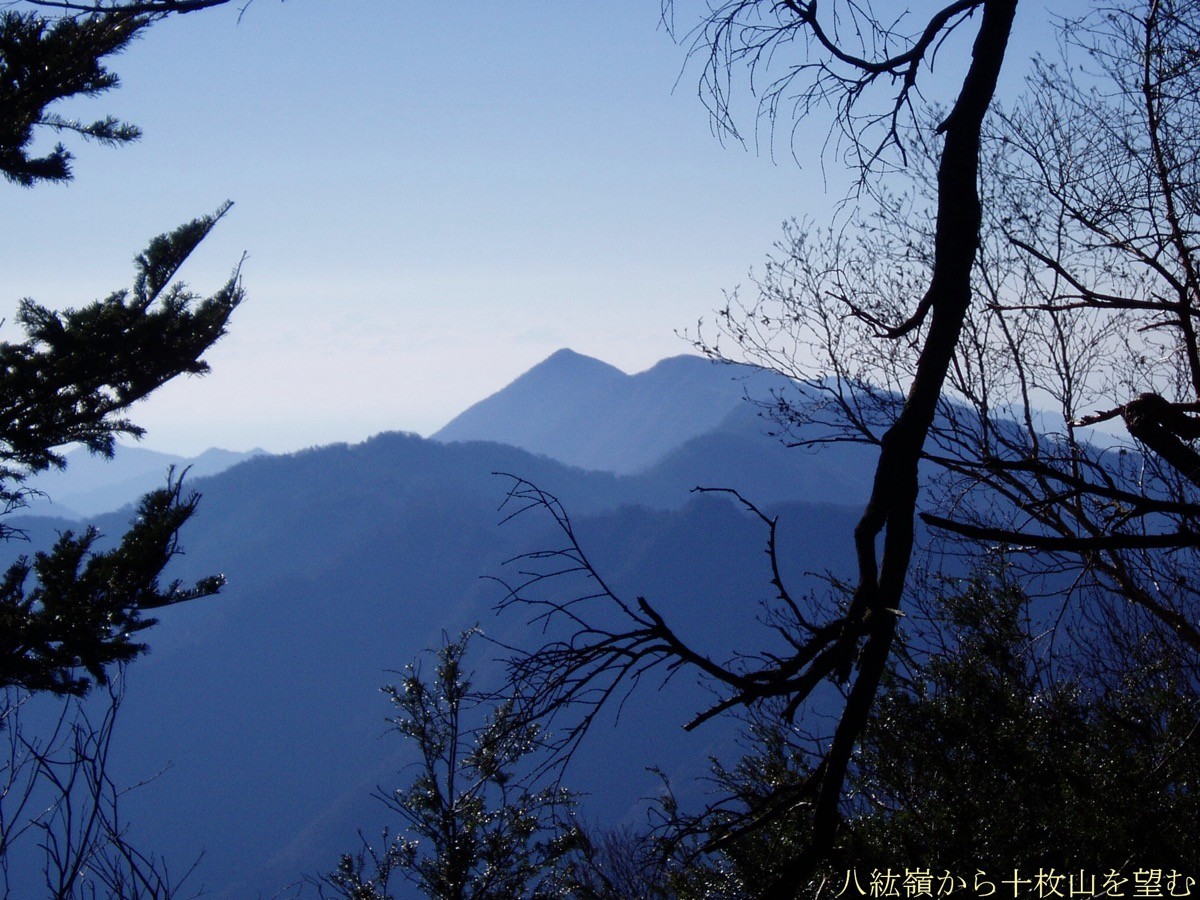
On the Abe-Higashi Ridge east of the Abe River, it consists of the main Mt. Jumai (1,726 m) and Mt. Shimo-Jumai (1,732 m), which holds the triangulation point, and from the grassy area around Jumai Pass at the top there is a grand view of Mt. Fuji and the southern Southern Alps. The usual route is the direct climb from Nakanodan on the Shizuoka side; from the Jumai trailhead it is about 2 hours to the summit, an intermediate-or-harder mountain of continuous chest-high steep climbing. Public-transport access is the key to this mountain: from Shizuoka Station you take the Shizutetsu Just Line Abe Line bus toward Rokurogi.
The trailhead is the Jumai trailhead at Nakanodan (Aoi-ku, Shizuoka City; about 1,100 m elevation), reached on foot in about 1 hour 15 minutes from the Rokurogi bus stop, near the end of the Abe Line, via Sekinosawa Bridge and the hamlet of Nakanodan. From the trailhead it is a steep climb of about 600 m of gain, around 2 hours, to the summit; as the total gain from Rokurogi exceeds 1,400 m, the basic plan is to come on the first bus and start early.
Water sources are scarce, so carry plenty, and as the climbing is steep carry a map and compass (GPS). The season is April to November, with the autumn colours especially fine. The summit area also connects to the Abe-Higashi Ridge traverse toward Mt. Aozasa and Mt. Mafuji.
How to access the trailhead
- [Outbound] Shizuoka Station → Rokurogi → Jumai trailhead
- [Return] Jumai trailhead → Rokurogi → Shizuoka Station
1. [Outbound] Shizuoka Station → Rokurogi → Jumai trailhead
The base is JR Shizuoka Station (Shin-Shizuoka Bus Terminal); take the Shizutetsu Just Line Abe Line bus bound for Umegashima Onsen and get off at the Rokurogi bus stop. As there is no bus straight to the trailhead (Nakanodan), walk about 1 hour 15 minutes from Rokurogi via Sekinosawa Bridge and the hamlet of Nakanodan to the trailhead. Services are few, so be sure to take the first morning bus.
Bus timetable ①: Shizuoka Station → Rokurogi (Shizutetsu Just Line Abe Line, bound for Umegashima Onsen)
| Shizuoka Station dep. | Rokurogi arr. |
|---|---|
| 08:15 (weekdays) | 09:35 |
Taxi: a taxi from the Shizuoka City side to the Rokurogi area or Nakanodan is possible but long and costly, so sharing among hikers is realistic (Shizutetsu Taxi 054-203-1111). By car: there is parking for a few cars at the Jumai trailhead in Nakanodan; about 1 hour from Shin-Shizuoka IC on the Shin-Tomei Expressway.
Source: [Shizutetsu Just Line timetable]
2. [Return] Jumai trailhead → Rokurogi → Shizuoka Station
On the way down, return on foot about 1 hour from the Jumai trailhead to the Rokurogi bus stop, then take the Abe Line bus bound for Shizuoka Station / Shin-Shizuoka from Rokurogi back to Shizuoka Station (Rokurogi to Shizuoka Station takes about 1 hour 20 minutes). On Saturdays the afternoon downhill buses are sparse, so a day trip suits weekdays and Sundays/holidays; always confirm the last bus to match your descent time.
Bus timetable ②: Rokurogi → Shizuoka Station (Shizutetsu Just Line Abe Line, bound for Shizuoka Station / Shin-Shizuoka)
| Rokurogi dep. | Shizuoka Station arr. |
|---|---|
| 15:52 (weekdays, Sun/hol) | about 17:13 |
| 16:01 (weekdays) | about 17:22 |
Source: [Shizutetsu Just Line timetable]
Route and safety notes
Route: Jumai trailhead (Nakanodan) → direct route → Jumai Pass → Mt. Jumai. About 2 hours from the trailhead to the summit, a steep climb of about 600 m of gain, intermediate or harder. From the summit you look out over Mt. Fuji and the Southern Alps.
Access and bus: take the Shizutetsu Just Line Abe Line from Shizuoka Station to Rokurogi (outbound Shizuoka Station 08:15 → Rokurogi 09:35), and on the way down from Rokurogi back to Shizuoka Station. Services are few and there is no afternoon bus on Saturdays, so check the times in advance.
Steep climb and water: as the chest-high steep climbing is continuous, make an early start. Water sources are scarce, so carry plenty.
Season and gear: the season is April to November, with the autumn colours at their best. Carry a map and compass (GPS) and rain gear, and submit a climbing plan.
In an emergency: in a mishap or accident, call 110 (police) or 119 (fire/rescue).
・Shizuoka City Office 054-254-2111 / Shizuoka-Chuo Police Station 054-252-0110
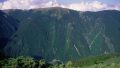
Photo by Oyama no taisho / Wikimedia Commons, CC0
Comments