Mt. Hakone (箱根山; its highest peak is Mt. Kamiyama, 1,438 m) is an active volcano in Hakone, Kanagawa, and one of the 300 Famous Japanese Mountains.
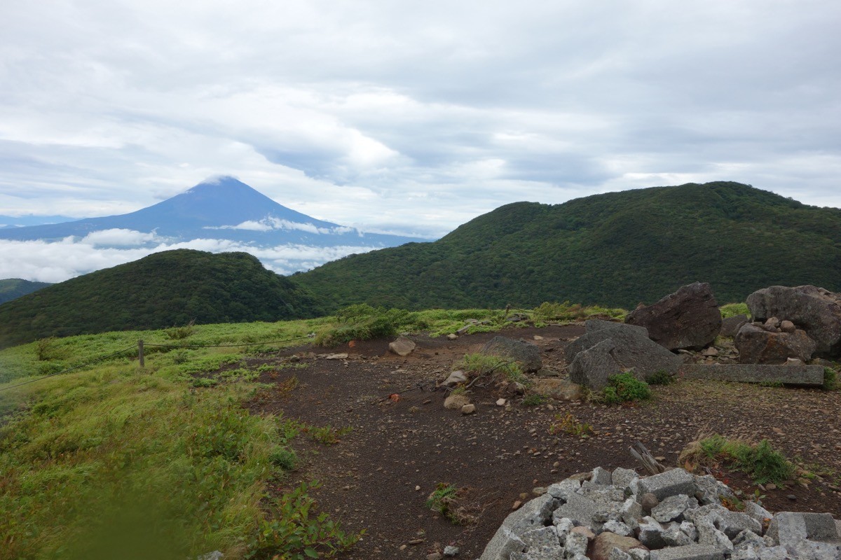
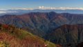
It is the central cone of the Hakone caldera that cradles Lake Ashi, and from the summit of Mt. Kamiyama you look out over Mt. Fuji across Lake Ashi, as well as Sagami Bay and the Boso Peninsula, with fine autumn colours. The usual way is to ride the Komagatake Ropeway up to Mt. Komagatake and make a round trip to Mt. Kamiyama; the Komagatake–Kamiyama trail, long closed after the 2015 volcanic activity, reopened in March 2025 for the first time in about 10 years. However, the Kamiyama–Owakudani section remains closed due to volcanic gas, and you must descend at once if you smell gas.
The gateway is Hakone-en. The route rides the Komagatake Ropeway up from Hakone-en, and its easy public-transport access is a real attraction.
The climb starts at the summit of Mt. Komagatake (1,356 m), reached by the Komagatake Ropeway from Hakone-en on the shore of Lake Ashi in about 7 minutes (first car up 9:00, last 16:30, every 20 minutes, adult round trip 2,200 yen), then about 3 minutes on foot from Komagatake summit station. The section from Komagatake summit via the junction to Mt. Kamiyama is what reopened in March 2025; the Komagatake–Kamiyama round trip takes roughly 1 hour 30 minutes to 2 hours, an intermediate route with some steep spots (the wider course is about 3.5 km). Beyond Kamiyama (toward Owakudani and Mt. Kanmurigatake) is off-limits, so turn back. As Mt. Hakone is regulated when the volcanic alert level rises, always check the Japan Meteorological Agency and Hakone Town volcano information before climbing.
If you smell volcanic gas, descend at once and do not push on. It can be climbed year-round, but beware of snow and ice in winter. Mt. Kamiyama can be walked together with Mt. Komagatake in half a day.
How to access the trailhead
1. [Round trip] Odawara / Hakone-Yumoto Station → Hakone-en → Mt. Komagatake (Mt. Kamiyama trailhead)
To the gateway Hakone-en, take the Izuhakone Bus (toward Owakudani, Kojiri and Hakone-en) from the east exit of Odawara Station in about 80 minutes, or from Hakone-Yumoto Station on the Izuhakone Bus in about 1 hour 5 minutes. At Hakone-en transfer to the Komagatake Ropeway and ride up to Komagatake summit station in about 7 minutes (first car up 9:00, last 16:30, every 20 minutes, adult round trip 2,200 yen). Allow plenty of time for the last ropeway car, and check in advance whether there are suspensions or volcanic restrictions on the day with the Hakone Komagatake Ropeway and Hakone Town official information.
– Hakone Tourist Association 0460-85-5700 / Hakone Komagatake Ropeway (Prince Hotels) 0460-83-1151
Source: [Reopening of the Komagatake–Kamiyama hiking course (Hakone Town)]
Route and safety notes
Route: Mt. Komagatake summit → junction → Mt. Kamiyama summit → return the way you came. The Komagatake–Kamiyama round trip takes roughly 1 hour 30 minutes to 2 hours, an intermediate route with some steep spots. Beyond Kamiyama (Owakudani, Mt. Kanmurigatake) is off-limits.
Ropeway: the Komagatake Ropeway links Hakone-en and Komagatake summit in about 7 minutes (first car up 9:00, last 16:30, every 20 minutes, adult round trip 2,200 yen). Mind the last car and descend early.
Volcanic gas and restrictions: Mt. Hakone is an active volcano, and the Kamiyama–Owakudani section is closed. Descend at once if you smell gas. When the volcanic alert level rises the area is restricted, so always check the Japan Meteorological Agency and Hakone Town volcano information before climbing.
Season and gear: it can be climbed year-round, but beware of snow and ice in winter. Carry a map and compass (GPS) and water, and submit a climbing plan.
In an emergency: in a mishap or accident, call 110 (police) or 119 (fire/rescue).
・Hakone Town Office 0460-85-7111 / Odawara Police Station 0465-32-0110
Photo by Koda6029 / Wikimedia Commons, CC0
Comments