Contents

Mt. Hinokiboramaru

1,601m · Kanagawa

Timetable checked 2026/05/17
Mt. Hinokiboramaru1,601 mKanagawa
🚃 Reachable by public transport · Day trip · Intermediate · for reasonably fit hikers
Access ease Moderate
Gateway station Shin-Matsuda Station  →  Trailhead Nishi-Tanzawa Visitor Center
1 public-transport routes ・ Station→trailhead approx. 43 min
Intermediate
Stamina3/10
TechnicalC rocky sections / chains
Trail time 6h 50mbk
More figures and data sources
Distance 13.0 kmbkTotal ascent ↑1,250 mbk
🌸 Best season: May, Nov bk🏠 Water source, Toilets
“bk” = data from books (being replaced with our own measurements). Distance, ascent and trail time are measured/estimated from the map route.

Mt. Hinokiboramaru (檜洞丸) is a 1,601m peak located in the western Tanzawa Mountains of Kanagawa Prefecture.
The fourth-highest in the Tanzawa Mountains, known for the beautiful Shiroyashio and azalea colonies in early summer, it is a hidden famous peak of Tanzawa beloved by many hikers. The quiet mountain area with spreading beech virgin forest is also an attraction.
From Shin-Matsuda Station, head to the Nishi-Tanzawa Visitor Center by bus, and from there it is common to climb.

How to access the trailheads

  1. [Outbound] Shin-Matsuda Station → Yaga Station → Nishi-Tanzawa Visitor Center
  2. [Return] Nishi-Tanzawa Visitor Center → Yaga Station → Shin-Matsuda Station

*Timetable last checked: May 17, 2026

1. [Outbound] Shin-Matsuda Station → Nishi-Tanzawa Visitor Center

From the bus stop in front of Odakyu Shin-Matsuda Station or JR Yaga Station, board the Fujikyu Mobility bus bound for Nishi-Tanzawa Visitor Center.

Operating period: year-round (schedule changes by season)

Fare: ¥1,360 (from Shin-Matsuda Station) | ¥780 from Yaga Station
Travel time: 43 minutes (from Yaga Station) | 1 hour 11 minutes (from Shin-Matsuda Station)

Bus TimetableShin-Matsuda Station → Yaga Station → Nishi-Tanzawa Visitor Center

Weekdays
Shin-Matsuda StationYaga StationNishi-Tanzawa Visitor Center
07:1507:4108:26
08:2508:5109:36
13:0513:3114:16
14:2014:4615:31
15:4516:1116:56
17:4518:1118:56
Weekends & Holidays
Shin-Matsuda StationYaga StationNishi-Tanzawa Visitor Center
7:157:418:26
7:458:118:56
8:258:519:36
9:3510:0110:16
13:0513:3114:16
14:2014:4615:31
15:4516:1116:56
17:4518:1118:56

Reference: [Fujikyu Mobility]

2. [Return] Nishi-Tanzawa Visitor Center → Yaga Station → Shin-Matsuda Station

From Nishi-Tanzawa Visitor Center, board the Fujikyu Mobility bus bound for Shin-Matsuda Station.

Operating period: year-round (schedule changes by season)

Fare: ¥1,360 (to Shin-Matsuda Station) | ¥780 to Yaga Station
Travel time: 43 minutes (to Yaga Station) | 1 hour 11 minutes (to Shin-Matsuda Station)

Bus TimetableNishi-Tanzawa Visitor Center → Shin-Matsuda Station Bus Timetable

Weekdays
Nishi-Tanzawa Visitor CenterYaga StationShin-Matsuda Station
07:0507:4808:19
08:4509:2809:54
09:5010:3310:59
14:4015:2315:49
15:4016:2316:49
17:0517:4818:14
19:0019:4320:09
Weekends & Holidays
Nishi-Tanzawa Visitor CenterYaga StationShin-Matsuda Station
8:459:289:54
9:159:5810:24
9:5010:3310:59
10:5511:3812:04
14:4015:2315:49
15:4016:2316:49
17:0517:4818:14
19:0019:4320:09

Reference: [Fujikyu Mobility]

Hinokiboramaru Hiking Routes, Difficulty & Best Season

Mt. Hinokiboramaru is a 1,601 m peak that stands as a symbol of the Nishitanzawa (western Tanzawa) area. The most popular route is an out-and-back on the Tsutsuji Shindo trail starting from the Nishitanzawa Visitor Center. It is known for its virgin beech forest and its early-summer azaleas.

Main routes

  • Classic (Nishitanzawa Visitor Center → Tsutsuji Shindo → Hinokiboramaru, round trip): about 11 km / elevation gain about 1,050 m (cumulative climb about 1,350 m) / time about 3 hr 45 min to ascend, about 6–6.5 hours round trip / difficulty: intermediate.
  • Other routes: a loop via the Inugoeji pass and a route along the Ishidanayama ridge are also possible.

Difficulty & fitness

The physical demand is moderate to slightly high. It is a well-maintained regular trail, but it includes sustained steep climbs on wooden steps, a stream crossing at Gora-zawa, and a chained section just below the summit. As the round trip takes about 6–6.5 hours, a reasonable level of hiking experience and stamina is needed.

Best season

Late May to early June is especially famous for the Shiroyashio and Togoku-mitsuba azaleas. The fresh greenery of spring and the autumn foliage (October–November) are also beautiful. In summer, watch out for leeches (yamabiru) in the lower forest.

Highlights

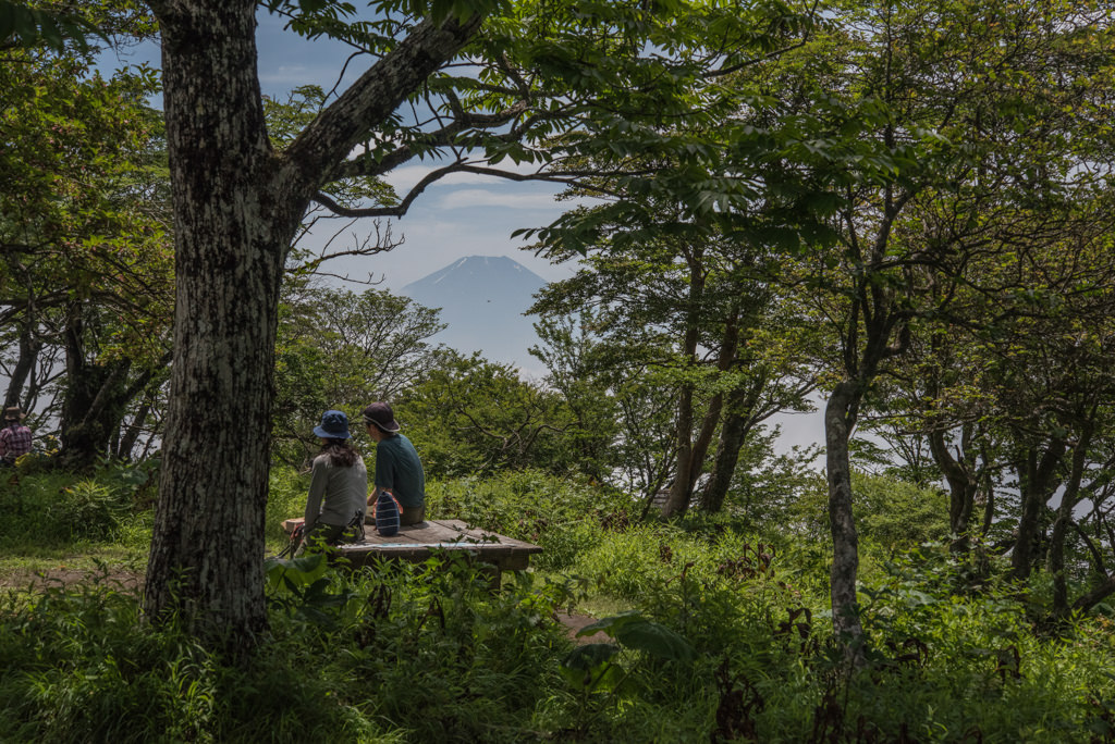
The attractions are the virgin beech forest, the views of Mt. Fuji and the main Tanzawa ridge from around the summit, and the azalea colonies that color the ridgeline. Aogatake Sanso hut stands near the summit, while water and toilets are available at the Nishitanzawa Visitor Center.

Your next mountain

Mt. To-no-dake 100 Mountains of Kanto
IntermediateEasy🚃Tokyo 1h 53Day tripTrail time 8h 2614.1 km

The Tanzawa flagship with sweeping views of Fuji and Sagami Bay, showing the range's varied character on the Ōkura Ridge and the Omote Ridge traverse.

Mt. Tanzawa 100 Famous Mountains
IntermediateEasy🚃Tokyo 1h 38OvernightTrail time 8h 0018 km

The interior heart of the Tanzawa range with residual old-growth Buna forest, a key staging point for the Tōnodake–Hirudake traverse.

IntermediateModerate🚃Tokyo 1h 24Day tripTrail time 6h 1015.6 km

A Tanzawa ridge peak where the mountain hut's legendary Nabewari udon noodles draw as many pilgrims as the summit view.

Mt. Sennokura 200 Famous Mountains
IntermediateEasy🚃Tokyo 3h 48Day tripTrail time 8h 2613.96 km

The highest peak of the Tanigawa range, where a flower-filled ridge from Taira-hyōtan leads to a sweeping border-ridge panorama.

Climbed it? Stamp your logbook