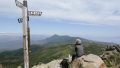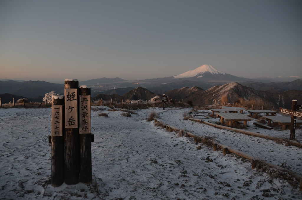
Mt. Hirugatake is a 1,673 m peak in the central Tanzawa Range — the highest mountain in the Tanzawa Range and in Kanagawa Prefecture. The unobstructed summit offers panoramic views of Mt. Fuji, the South Alps, Yatsugatake, Okuchichibu, and even Tokyo Tower on clear days.
Located at the center of the Tanzawa Range, day hikes are tight on time; most hikers do an overnight stay at a mountain hut or use long traverse routes from adjacent trailheads. This page covers the three main currently-usable routes and the status of the formerly-popular northeastern (Higashino) route.
Important: March 30, 2026 Kanachu bus revision effectively eliminates Higashino route access
The “Higashino bus stop” route formerly covered in this article became effectively unusable due to the Kanagawa Chuo Kotsu Tsukui Depot schedule revision on March 30, 2026:
- San-55 route (Sankagi – Higashino weekend service): Discontinued March 29, 2026
- San-56 route (Sankagi – Higashino – Tsukiyono): Reduced to 1 weekday round trip only (Sankagi dep. 12:10 / Tsukiyono dep. 12:55), weekend service discontinued
- Hashi-01 (Hashimoto Sta. – Sankagi): Significantly reduced through 2025/10/06 + 2026/3/30 successive revisions
Sagamihara City is piloting a reservation-based shared taxi in the Aonohara/Aone areas (full operation planned April 2027; Kanachu will fully withdraw west of Sankagi by March 2027). Until then, we strongly recommend the Okura / Yabitsu / Nishi-Tanzawa routes below. Details: Kanachu revision announcement
*Timetable last checked: May 22, 2026
Access Methods
- Route 1: Shibusawa Sta. – Okura (Okura Ridge – Tonotake – Tanzawa-san – Hirugatake / most popular)
- Route 2: Hadano Sta. – Yabitsu Toge (Omote Ridge traverse / for traverse hikers)
- Route 3: Shin-Matsuda Sta. – Nishi-Tanzawa VC (Hinokiboramaru – Hirugatake / Nishi-Tanzawa main ridge)
- Return: Reverse of each route + traverse return patterns
- Recommended plans & mountain hut info
1. Route 1: Shibusawa Sta. – Okura (most popular, standard route)
From the north exit of Shibusawa Station (Odakyu Line), board Kanagawa Chuo Kotsu “Shibu-02 route bound for Okura” and ride to the terminus at Okura. This route has the highest service frequency and is the standard starting point for Tanzawa hikes.
Operating period: Year-round (increased service on weekends/holidays, early morning departures available)
Travel time: approx. 15 minutes
Fare: 220 yen
From Okura, climb the Okura Ridge (nicknamed “Baka-one”). Itinerary: Tonotake (~3 hr) – Tanzawa-san (~1 hr) – Hirugatake (~2 hr 30 min). Day hike is for fit hikers only; overnight at Miyama-sanso or Hirugatake-sanso recommended.
Reference: Kanagawa Chuo Kotsu Official
2. Route 2: Hadano Sta. – Yabitsu Toge (Omote Ridge traverse)
From the north exit of Hadano Station (Odakyu Line), board Kanagawa Chuo Kotsu “Hada-21 route bound for Yabitsu Toge” and ride to the terminus at Yabitsu Toge. Continues via Omote Ridge (Ni-no-Toh, San-no-Toh) to Tonotake – Tanzawa-san – Hirugatake.
Operating period: Year-round (seasonal frequency variation; weekend early-morning extra service for hikers)
Travel time: approx. 50 minutes
Fare: 510 yen
From Yabitsu Toge to Tonotake is ~3 hr 30 min. Omote Ridge has rocky sections and chains, plus collapsed terrain near Karasuo and Gyoja-ga-Take — intermediate level. After Tonotake the route merges with Route 1; Hirugatake is ~3 hr 30 min further.
Reference: Kanagawa Chuo Kotsu Official
3. Route 3: Shin-Matsuda Sta. – Nishi-Tanzawa VC (Nishi-Tanzawa main ridge)
From the north exit of Shin-Matsuda Station (Odakyu Line), board Fujikyu Mobility bus bound for Nishi-Tanzawa Visitor Center and ride to the terminus. (Note: Fujikyu Shonan Bus was rebranded to Fujikyu Mobility on February 1, 2024.)
Operating period: Year-round (separate weekday/holiday schedules, extra service in peak seasons)
Travel time: approx. 1 hr 11 min from Shin-Matsuda Station
Fare: 1,210 yen
From Nishi-Tanzawa Visitor Center: Gora-zawa Junction – Hinokiboramaru (~3 hr 30 min) – Hirugatake (~3 hr). The Nishi-Tanzawa main ridge traverse is a tough route with continuous steep climbs. Overnight at Hinokiboramaru or Hirugatake hut recommended.
Reference: Fujikyu Mobility Matsuda Office / Nishi-Tanzawa Visitor Center
4. Return: Reverse of each route + traverse return patterns
Descent options from Hirugatake depend on trailhead and route choice:
- Okura direction (most common): Hirugatake – Tanzawa-san – Tonotake – Okura (Kanachu Shibu-02 to Shibusawa Sta.). Descent ~5 hours.
- Yabitsu Toge direction: Hirugatake – Tanzawa-san – Tonotake – Shin-Otai – Yabitsu Toge (Kanachu Hada-21 to Hadano Sta.). Descent ~6 hours.
- Nishi-Tanzawa direction: Hirugatake – Hinokiboramaru – Nishi-Tanzawa Visitor Center (Fujikyu Mobility to Shin-Matsuda Sta.). Descent ~5 hr 30 min.
- Traverse: Entering one trailhead and exiting another is convenient (e.g. enter from Okura, exit at Nishi-Tanzawa).
All bus routes have limited service (especially Nishi-Tanzawa direction, last buses are early evening). Plan with ample buffer time for descent. Verify last departure times on each operator’s official site.
5. Recommended plans & mountain hut info
Standard 2-day plan (beginner to intermediate):
- Day 1: Okura (Shibu-02 from Shibusawa) – Okura Ridge – Tonotake – Tanzawa-san Miyama-sanso overnight (or continue to Hirugatake hut)
- Day 2: Tanzawa-san – Hirugatake – back to Tanzawa-san – Tonotake – Okura (round trip), or traverse out to Nishi-Tanzawa
2-day traverse plan (advanced):
- Day 1: Nishi-Tanzawa Visitor Center – Hinokiboramaru – Hirugatake Hirugatake-sanso overnight
- Day 2: Hirugatake – Tanzawa-san – Tonotake – Okura
Main mountain huts:
- Hirugatake-sanso: At Hirugatake summit, year-round, reservation required. Official
- Miyama-sanso: At Tanzawa-san summit, year-round, reservation required. Official
- Sonbutsu-sanso: At Tonotake summit, year-round, reservation required.
- Aogadake-sanso: At Hinokiboramaru summit, year-round, reservation required.
Important notes:
- Water & supplies: Water sources on the ridge are limited. Each hut sells supplies, but prepare in advance.
- Weather: Ridge elevation ~1,600 m — be prepared for strong winds and sudden weather changes. Rain gear, insulation, and headlamp required.
- Bears & leeches: As the name “Hiru” (meaning “leech”) suggests, yamabiru (mountain leeches) are common in summer (especially lower Okura Ridge and Nishi-Tanzawa main ridge). Carry salt or repellent. Bear sightings have also increased.
- Trail conditions: Always check Tanzawa Visitor Center closure info before departing.
Photo by Wikipedia