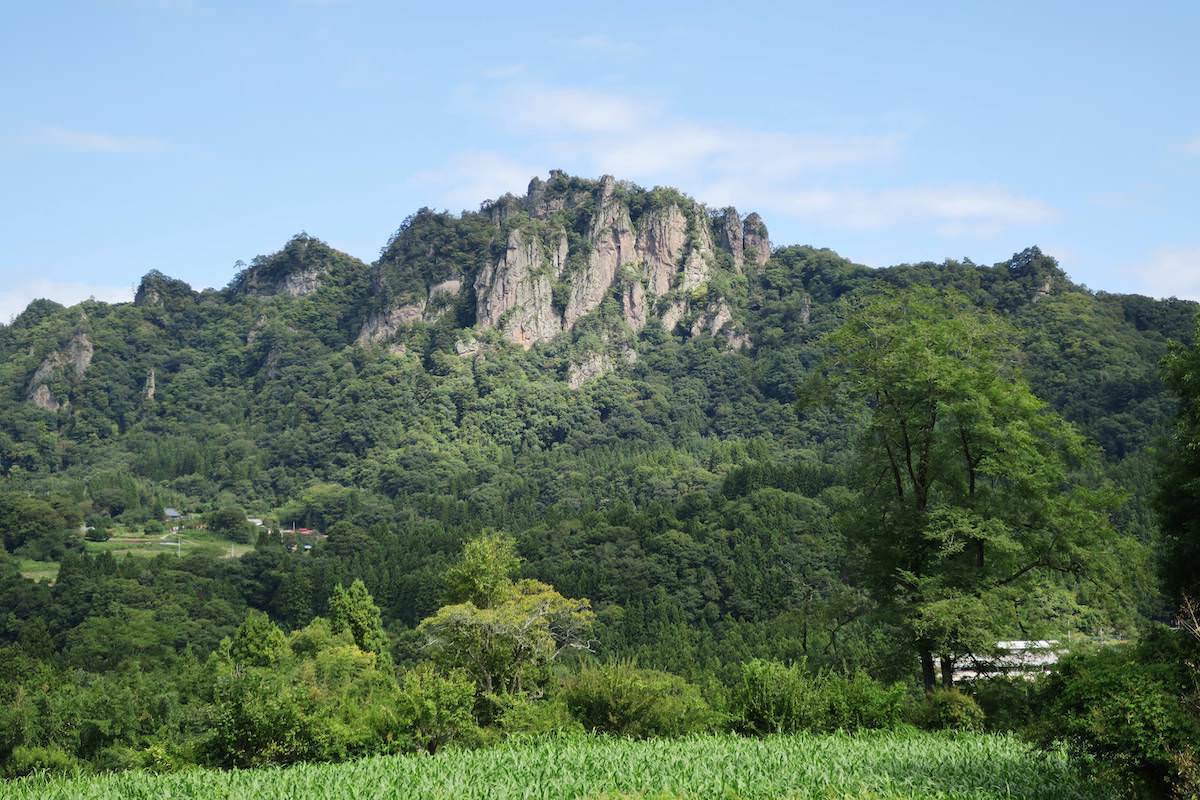
Mt. Iwabitsu (岩櫃山) is an 802.6m rocky peak in Higashi-Agatsuma Town, Gunma Prefecture. Although a low mountain, it has rocky and chain sections, and depending on course selection, can be enjoyed widely from beginner hiking to intermediate-level rocky ridge walking. In the area, trails such as “Onemichi” / “Sawamichi” (on the Hirasawa Trailhead side) and “Mitsuiwamichi” / “Akaiwamichi” (on the Gohara / Furuya side) are maintained, and on-site information signs and official maps are well-developed. In particular, Mitsuiwamichi has consecutive chain sections and ladders, so it is for intermediate hikers. For safety, carry a helmet and gloves, and exercise utmost caution when passing wet rocks. Depending on the situation, “Tengu-no-Kakehashi” may be recommended to detour.
*Timetable last checked: May 17, 2026
Some routes differ from those on the GSI map.
For details, the Mt. Iwabitsu area guide posted by Higashi-Agatsuma Town is a good reference.
Hirasawa Trailhead Tourist Information Center operating period
The Mt. Iwabitsu Hirasawa Trailhead Tourist Information Center is seasonally open April ~ end of November (9:00–16:00). It is closed December ~ March, and toilets and information pamphlets cannot be obtained. For winter entry, please prepare other toilets and equipment in advance.
Reference: Higashi-Agatsuma Town Mt. Iwabitsu area guide map
How to access the trailheads
- [Outbound] Gohara Station → Mitsuiwa Trailhead
- [Return] Hirasawa Trailhead → Gunma-Haramachi Station
Hiking Course Details — Mt. Iwabitsu
Click to show current location.
Click for full-screen view.
*If the map does not appear, please click here.*
Map & Recommended Route — Mt. Iwabitsu
1. [Outbound] Gohara Station → Mitsuiwa Trailhead
From JR Agatsuma Line Gohara Station, 25 minutes on foot to Mitsuiwa Trailhead. (1.6km)
From JR Agatsuma Line Gohara Station, about 25 minutes on foot (about 1.6km) to Mitsuiwa Trailhead.
From in front of the station, following the prefectural road / information signs takes you to the trailhead. As Mitsuiwamichi is a rocky ridge route with consecutive chain sections and ladders, switching to the Hirasawa Trailhead side route (Onemichi / Sawamichi) is safer in wet rock, freezing, or strong wind conditions.
Fare guide: Takasaki Station → Gohara Station ¥860 (JR Agatsuma Line)
Travel time: about 1 hour
Reference: google map
2. [Return] Hirasawa Trailhead → Gunma-Haramachi Station
From the summit, take “Sawamichi” to Hirasawa Trailhead (about 40 minutes). From Hirasawa Trailhead to JR Agatsuma Line Gunma-Haramachi Station is about 40 minutes on foot (about 2km) as a guide. Starting from the Hirasawa Trailhead Tourist Information Center (toilets / pamphlets available during operating period), descend the paved road.
Fare guide: Gunma-Haramachi Station → Takasaki Station ¥860 (JR Agatsuma Line)
Travel time: about 57 minutes
Reference: google map

