Mt. Arafune (荒船山, 1,423 m), straddling Shimonita Town in Gunma Prefecture and Saku City in Nagano Prefecture, is one of the 200 Famous Japanese Mountains.
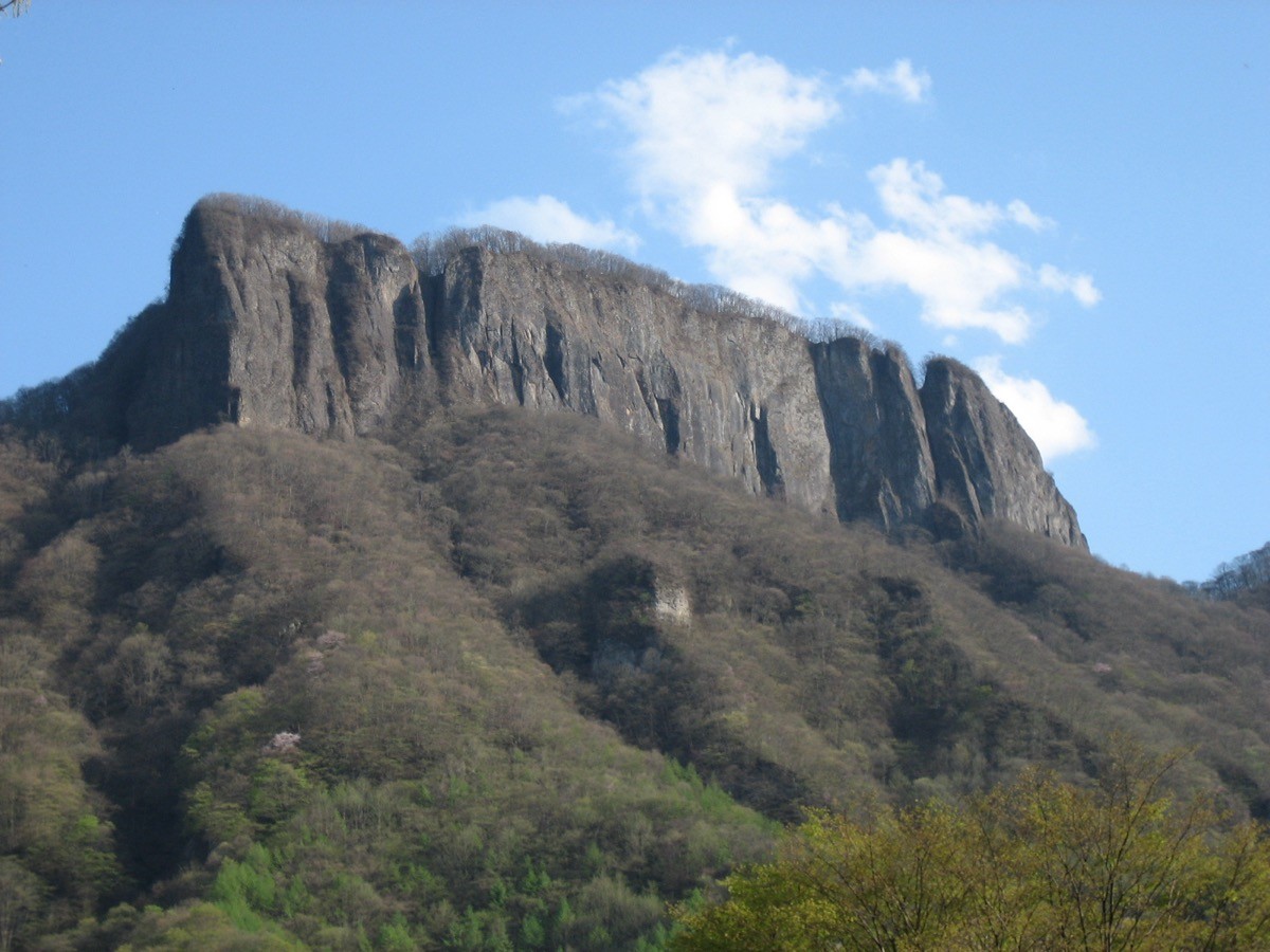
It is known for its distinctive table-shaped profile, like an overturned ship, with a roughly 200 m vertical cliff called Tomoiwa rising at its northern end. The highest point is Kyōzukayama (Yukizukayama) at the southern end. The standard route from Uchiyama Pass over Tomoiwa to the summit and back takes about 4 hours round trip, with little elevation gain and easy walking.
The nearest station is Nakagome on the JR Koumi Line. From there you reach the Uchiyama Pass trailhead by taxi.
The trailhead is Uchiyama Pass (about 1,060 m elevation), with a parking area along National Route 254. The route runs Uchiyama Pass → Hasamiiwa → Ippaimizu → Tomoiwa (viewpoint) → Hoshio Pass junction → Kyōzukayama summit (highest point, 1,423 m) and back, about 1 hour 30 minutes to Tomoiwa and about 2 hours to the summit. The elevation gain is only about 360 m, beginner-to-intermediate.
The top of Tomoiwa is a broad lava plateau where Primula japonica blooms in June and the foliage turns in October. However, Tomoiwa sits atop a roughly 200 m cliff, and going near the edge risks a fatal fall — deaths have occurred here. Do not approach the edge when taking in the view. The area is also home to Asian black bears, so take precautions such as a bear bell.
How to access the trailheads
1. [Outbound & Return] Nakagome Station → Uchiyama Pass trailhead (taxi)
Get off at Nakagome Station on the JR Koumi Line (connecting with the Hokuriku Shinkansen at Sakudaira), and reach the Uchiyama Pass trailhead in about 30 minutes by taxi (about 20 km).
There is no regular bus directly to Uchiyama Pass, so a taxi from Nakagome Station (or Shimonita Station on the Joshin Railway) is the realistic option. Booking a return pick-up to match your descent time is recommended. The approximate one-way fare from Nakagome Station is about ¥6,500–7,500.
– Chikuma Hire 0267-67-1010
On weekdays only, the Chikuma Bus Uchiyama Line reaches Hatsutani, but from there it is about a 4 km road walk (about 1 hour) to Uchiyama Pass, which is impractical for hikers.
Source: [Shimonita Town, Mt. Arafune] / [Chikuma Bus]
Route and safety notes
Route: Uchiyama Pass → Hasamiiwa → Ippaimizu → Tomoiwa (viewpoint) → Hoshio Pass junction → Kyōzukayama summit (highest point). About 4 hours of walking round trip with about 360 m of elevation gain, beginner-to-intermediate, on a well-maintained trail.
The Tomoiwa cliff: Tomoiwa sits atop a roughly 200 m precipice, and going near the edge risks a fatal fall. Deaths have occurred here, so do not approach the edge even when taking in the view.
Bears: the area is home to Asian black bears. Take precautions such as a bear bell and avoid going alone.
Gear and season: the season is late April to November (Primula japonica in June and foliage in October are the highlights). There are no shops on the mountain, so carry water, food and rain gear, and submit a climbing plan.
In an emergency: call 110 (police) or 119 (fire/rescue).
・Chikuma Hire (pick-up / descent contact) 0267-67-1010
Photo by 韋駄天狗 / Wikimedia Commons, Public domain
Comments