
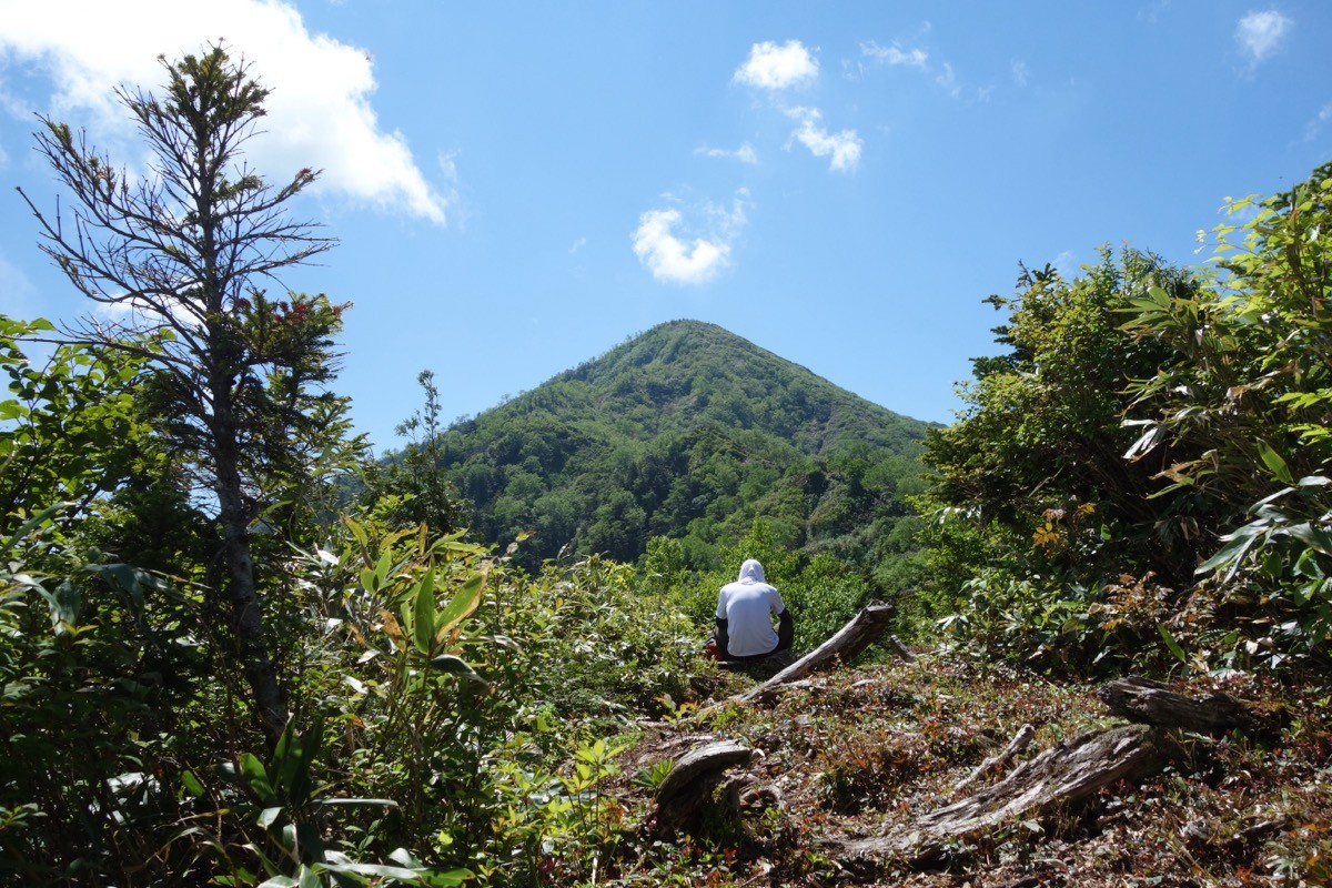
Mount Kuwasaki (Kuwasakiyama, 2,090 m) is a mountain in Toyama City, Toyama, and is one of Japan’s 300 Famous Mountains.
An outlying peak of the Tateyama range, its appeal lies in the wide views from the summit of Mount Tsurugi, Tateyama, Mount Yakushi and the Tateyama Caldera, and its presence as an independent peak famed for a buried-treasure legend. From the Tateyama Sanroku Ski Area it climbs via Setogurayama and Ōshinayama to the summit, an advanced route with about 1,700 m of cumulative ascent.
To reach the trailhead, take a taxi from Tateyama Station on the Toyama Chihō Railway to the Tateyama Sanroku Ski Area.
The trailhead is the Tateyama Sanroku Ski Area (Raichō Valley), passing Setogurayama and Ōshinayama. The main route is the ski area → Setogurayama → Ōshinayama → Mount Kuwasaki (2,090 m) and back, about 13 km with around 1,700 m of cumulative ascent, an advanced route. Beyond Ōshinayama the climb is steeply sustained, and the summit gives a panorama of Mount Tsurugi, Tateyama and Mount Yakushi.
The best season is early summer to autumn (June–October); as it is a long day, an early start is essential, and as the ski-area lift’s summer operation varies by year, check in advance. Also confirm the latest trail conditions and arrange a taxi.
*Last checked: June 7, 2026
How to access the trailheads
1. [There & Back] Tateyama Station ⇄ Tateyama Sanroku Ski Area (Toyama Chitetsu + taxi)
Tateyama Station on the Toyama Chihō Railway Tateyama Line is your base. Reach the Kuwasaki trailhead at the Tateyama Sanroku Ski Area by taxi from the station.
① Toyama Station → Tateyama Station (Toyama Chihō Railway)
From Toyama Station, take the Toyama Chitetsu Tateyama Line to Tateyama Station (about 60–70 minutes), the gateway to the Tateyama Kurobe Alpine Route.
② Tateyama Station → Tateyama Sanroku Ski Area (taxi)
From Tateyama Station, take a taxi to the Tateyama Sanroku Ski Area (Raichō Valley). The Gokurakuzaka shuttle bus runs only on winter ski-operation days and not in summer, so a taxi is reliable.
— Kyowa Taxi (Tateyama) 076-463-3939 / Tateyama Kotsu 076-463-1188.
③ Note (lift and timing): the former climbing gondola was retired in 2017. As the ski-area lift’s summer operation varies by year, if it is not running you must walk the whole way, making for a long, advanced-level day.
By car: there is parking at the Tateyama Sanroku Ski Area, about 40 minutes from the Tateyama IC on the Hokuriku Expressway.
References: [Tateyama Sanroku Ski Area (green season)] / [Toyama Chihō Railway]
Trail Guide and Safety Notes
Route: the main route is an out-and-back from the Tateyama Sanroku Ski Area via Setogurayama and Ōshinayama to Mount Kuwasaki (2,090 m), about 13 km with around 1,700 m of cumulative ascent, an advanced route. Beyond Ōshinayama there are narrow ridges and sustained steep climbs, so allow ample fitness and time.
Itinerary and weather: the standard time is long, so an early-morning start is essential for a day hike. The ridge is windy and prone to mist and sudden changes; snow lingers late, so prepare your footwear. It is Asian black bear country.
Views and legend: from the summit there is a panorama of Mount Tsurugi, Tateyama and Mount Yakushi, with the Tateyama Caldera below. It is also known for a buried-treasure legend that the warlord Sassa Narimasa hid his war funds here, and it stands out as an independent peak above the Toyama plain.
Equipment and emergencies: carry rain gear, warm clothing, a headlamp, a map/GPS, plenty of food, water and a bear bell. In an accident or emergency call 110 (police) or 119 (fire/ambulance).
・Kamiichi Police Station 076-472-0110
Photo by Koda6029 / Wikimedia Commons, CC BY-SA 4.0
Comments