
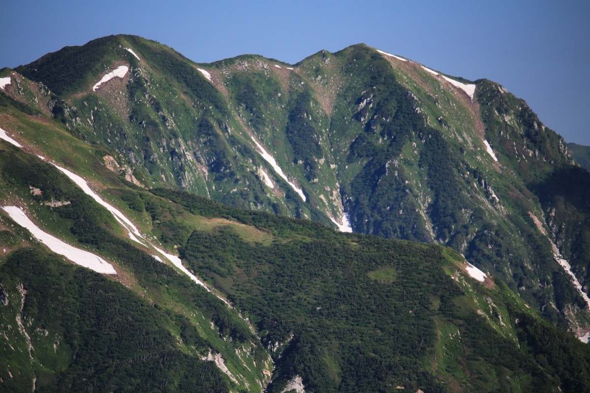
Mt. Kekachi (毛勝山, 2,415 m), straddling Uozu and Kurobe in Toyama, is one of the 200 Famous Japanese Mountains.
The main peak of the Kekachi Three Peaks, it is a massive mountain of the northern North Alps, prized for the perennial snow at its foot, said to be the only such snow in Japan only 20 km from the sea. The Seihoku (northwest) ridge route is an advanced round trip of over 10 hours from Katakai Lodge with about 1,700 m of elevation gain, while in the residual-snow season people climb from Abekidani using crampons and an ice axe.
The trailhead is Katakai Lodge (Abekidani). There is no route bus to the trailhead, so a taxi or rental car from Uozu Station is assumed.
The trailhead is Katakai Lodge / Abekidani trailhead (headwaters of the Katakai River, with parking). In the snow-free season the recently developed Seihoku ridge route is usual, and in the residual-snow season the Abekidani route, both advanced with a long round trip. The Seihoku ridge takes over 10 hours round trip from Katakai Lodge. In the residual-snow season crampons and an ice axe are essential, and care is needed with snow-patch conditions and route-finding.
There is no mobile signal near the trailhead, so arrange your return taxi in advance, and do not enter as beginners only. In the residual-snow season, depending on snow clearance, you may only be able to drive as far as the Katakai No.4 power station. The seasons are the residual-snow season (May–June) and the snow-free season (July–October).
How to access the trailheads
1. [Round trip] Uozu Station → Katakai Lodge (Mt. Kekachi trailhead)
The nearest base is Uozu Station (Ainokaze Toyama Railway / Toyama Chiho Railway). From Uozu Station to the trailhead there is no route bus, so a taxi or rental car is the norm; following the Katakai River, it is about 30 minutes by car to the Katakai Lodge trailhead.
There is no mobile signal near the trailhead, so when you board the taxi, firmly arrange the time and place for your return. In the residual-snow season, depending on snow clearance, you may only be able to drive as far as the Katakai No.4 power station, in which case it is a 40–50 minute walk from there to the trailhead.
– Uozu Tourism Association (taxi, road info) 0765-22-1200
Source: [Uozu Tourism Association, Mt. Kekachi]
Route and safety notes
Route: Katakai Lodge → Seihoku ridge → Mt. Kekachi (snow-free season), or Katakai Lodge → Abekidani → Mt. Kekachi (residual-snow season). The standard course on the Seihoku ridge is over 10 hours round trip with about 1,700 m of ascent, advanced. A traverse of the Kekachi Three Peaks (Mt. Kekachi, Mt. Kamadani, Mt. Nekomata) is longer still.
Residual-snow season: as you ascend the snow patches of Abekidani, crampons and an ice axe are essential, and great care is needed with avalanches, slips and route-finding. Outside that season, use the Seihoku ridge.
Signal and gear: there is no signal near the trailhead. Carry a map and compass (GPS), and submit a climbing plan. Do not enter as beginners only.
Season: the seasons are the residual-snow season (May–June) and the snow-free season (July–October). As snow patches including the perennial snow linger late, carry warm and rain gear.
In an emergency: call 110 (police) or 119 (fire/rescue).
・Uozu City Office 0765-23-1000
Photo by Alpsdake / Wikimedia Commons, CC BY-SA 4.0
Comments