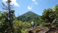
Mt. Arakai (荒海山, 1,581 m), straddling Minamiaizu in Fukushima and Nikko in Tochigi, is a peak of the Taishaku Mountains and one of the 300 Famous Japanese Mountains.
Called “Mt. Taro” on the Tochigi side, it rises on the Central Watershed as the source of the Agano River, and a second-order triangulation point named “Taro-dake” sits on a peak about 90 m east-northeast of the summit. The usual route from the Yatsuso mine site is a round trip of about 8.8 km with about 909 m of gain, around 6 hours, an intermediate route. It repeatedly fords the Arakai River and climbs a steep slope of tree roots and rope sections, and as it is also bear country, full precautions are essential.
The trailhead is the Yatsuso mine site. There is no direct public transport to the trailhead, so the premise is to come by rental car or taxi from Aizu-Kogen-Ozeguchi Station.
The trailhead is the Yatsuso mine site (about 820 m elevation; roadside parking for about 6 cars, no toilet). From the Yatsuso mine site you follow a forest road along the Arakai River, ford the stream several times, then climb a steep slope of tree roots and rope sections to the ridge, and reach Mt. Arakai over undulating ground (the regular trail is only on the Fukushima side). It was closed for a long time after the September 2015 flood disaster and reopened in May 2021, but the forest road has a collapsed section and you may only be able to drive as far as a designated lot, so always check the road status with Minamiaizu Town’s latest information.
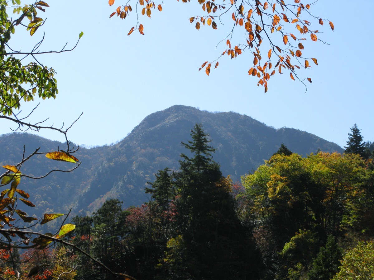
Water sources are unclear, so carry plenty, and carry a bear bell and bear spray against bears. The season is late May (after the opening) to early November, with the autumn colours especially fine. Fording is dangerous when the water is high, so do not push on after rain.
How to access the trailhead
1. [Round trip] Aizu-Kogen-Ozeguchi Station → Yatsuso mine site (Mt. Arakai trailhead)
The base is Aizu-Kogen-Ozeguchi Station (Aizu Railway Aizu Line / Yagan Railway Aizu-Kinugawa Line), reached from the Asakusa direction via the Tobu Railway plus the Yagan Railway, or from the Aizu-Wakamatsu direction on the Aizu Railway. The Yatsuso mine site trailhead is about 5.5 km from the station, and as there is no direct bus, the basic plan is to take a taxi from the station’s taxi stand or to rent a car near Aizu-Tajima Station. By car, turn from Route 121 onto Route 352 (toward Uonuma and Oze), turn at the Mt. Arakai signboard, and note that the road becomes unpaved about 3 km before the trailhead and has a collapsed section, so check whether you can drive in beforehand.
– Minamiaizu Town Office 0241-62-6100 / Aizu-Kogen-Ozeguchi Station 0241-78-2017
Source: [Minamiaizu Town official site]
Route and safety notes
Route: Yatsuso mine site → Arakai River (fords) → steep climb (tree roots / ropes) → ridge → Mt. Arakai. An intermediate round trip of about 8.8 km with about 909 m of gain, around 6 hours, with the “Taro-dake” second-order triangulation point on a peak about 90 m east-northeast of the summit.
Forest road and access: the forest road to the Yatsuso mine site becomes unpaved about 3 km before the trailhead, and a collapse may limit you to a designated lot. Check the latest road status with Minamiaizu Town and Fukushima Prefecture.
Bears: this is bear country, and encounters are especially likely along the stream. Carry a bear bell and bear spray, and avoid going alone.
Season and gear: the season is late May to early November, with the autumn colours at their best. As the route fords streams and has rope sections and steep climbs, carry a map and compass (GPS) and plenty of water, and submit a climbing plan. Fording is dangerous in high water, so reconsider your plan after rain.
In an emergency: in a mishap or accident, call 110 (police) or 119 (fire/rescue).
・Minamiaizu Town Office 0241-62-6100 / Minamiaizu Police Station 0241-62-0110
Photo by Qwert1234 / Wikimedia Commons, Public domain
Comments