
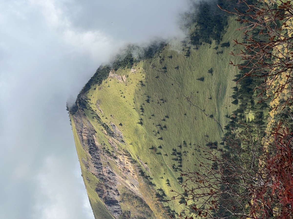
Mount Neko (Nekodake, 2,207 m) sits on the border of Ueda City and Suzaka City in Nagano Prefecture, and is one of Japan’s 300 Famous Mountains.
A gentle peak rising north of Sugadaira Highland, its appeal lies in the alpine flower meadows that earned it a place among the Flower 100 Mountains, and the sweeping ridge that runs on to neighbouring Mount Azumaya. The usual day hike, beginner-to-intermediate, goes up to the summit and back from Sugadaira Pasture, and a circuit with Mount Azumaya is also popular.
For public-transport access, take a bus from Ueda Station (JR / Shinano Railway) to Sugadaira-Kogen Dabos.
The trailhead is Sugadaira Pasture (about 1,500 m), with parking, a shop and toilets. The main route is Sugadaira Pasture → birch forest → Mount Neko (2,207 m) and back, an intermediate route with a standard time of about 4 hours. It is gentle and easy to walk all the way to the summit, with alpine flowers in summer and wide views of the Northern Alps and Mount Azumaya from the top.
The best season is early summer to autumn (June–October); in winter it becomes a ski area with snow. Always check the latest bus times and trail conditions before you go.
*Last checked: June 6, 2026
How to access the trailheads
1. [There & Back] Ueda Station ⇄ Sugadaira-Kogen Dabos / Sugadaira Pasture (Ueda Bus)
Ueda Station on the JR Hokuriku Shinkansen and Shinano Railway is your base. Take an Ueda Bus from the station to Sugadaira Highland, then walk or take a taxi to the Sugadaira Pasture trailhead.
① Ueda Station → Sugadaira-Kogen Dabos (Ueda Bus)
The bus bound for Sugadaira-Kogen Dabos takes about 58 minutes. Services include Ueda Station dep. 7:05 → Sugadaira-Kogen Dabos arr. 8:03, 8:15 dep. → 9:13 arr. and 10:30 dep. → 11:28 arr.
② Sugadaira-Kogen Dabos → Sugadaira Pasture (trailhead, on foot or by taxi)
From Sugadaira-Kogen Dabos it is about 40 minutes on foot to the Sugadaira Pasture trailhead. To save the walk, combining a taxi is reliable.
③ Sugadaira-Kogen Dabos → Ueda Station (return)
Buses back to Ueda Station include Sugadaira-Kogen Dabos dep. 14:50 → Ueda Station arr. 15:50, 17:00 dep. → 18:00 arr. and 18:15 dep. → 19:15 arr.
④ Taxi
A direct taxi from Ueda Station to Sugadaira Pasture is also available.
— Ueda Taxi 0268-22-0055
By car: there is a paid car park at Sugadaira Pasture (separate entry fee). It is about 40 minutes from the Ueda-Sugadaira IC on the Joshin-etsu Expressway.
References: [Ueda Bus] / [Sugadaira Highland Tourism]
Trail Guide and Safety Notes
Route: Sugadaira Pasture → Azumaya rest hut → birch forest → Mount Neko (2,207 m) and back. The standard time is about 4 hours, an intermediate route. For strong walkers, the circuit Mount Neko → Ōsukima → Mount Azumaya → Naka-Azumaya → Sugadaira Pasture (about 6–7 hours) is also popular. It is gentle and easy even for beginners.
Ridge and weather notes: the summit area is above the tree line, with bamboo grass and gravel — watch for strong wind and lightning. The Neko–Azumaya circuit has some narrow ridge sections, so switch to an out-and-back in bad weather rather than pushing on.
Flowers and seasons: as a Flower 100 Mountain, summer brings meadows of alpine flowers such as grass-of-Parnassus. The summit gives views of the Northern Alps, Mount Asama and Mount Azumaya. In winter it becomes a ski area and the trail is under snow.
Equipment and emergencies: carry rain gear, warm clothing, a headlamp, a map/GPS and plenty of food. In an accident or emergency call 110 (police) or 119 (fire/ambulance).
・Ueda Police Station 0268-22-0110
Photo by Naganojmmmm / Wikimedia Commons, CC BY-SA 4.0
Comments