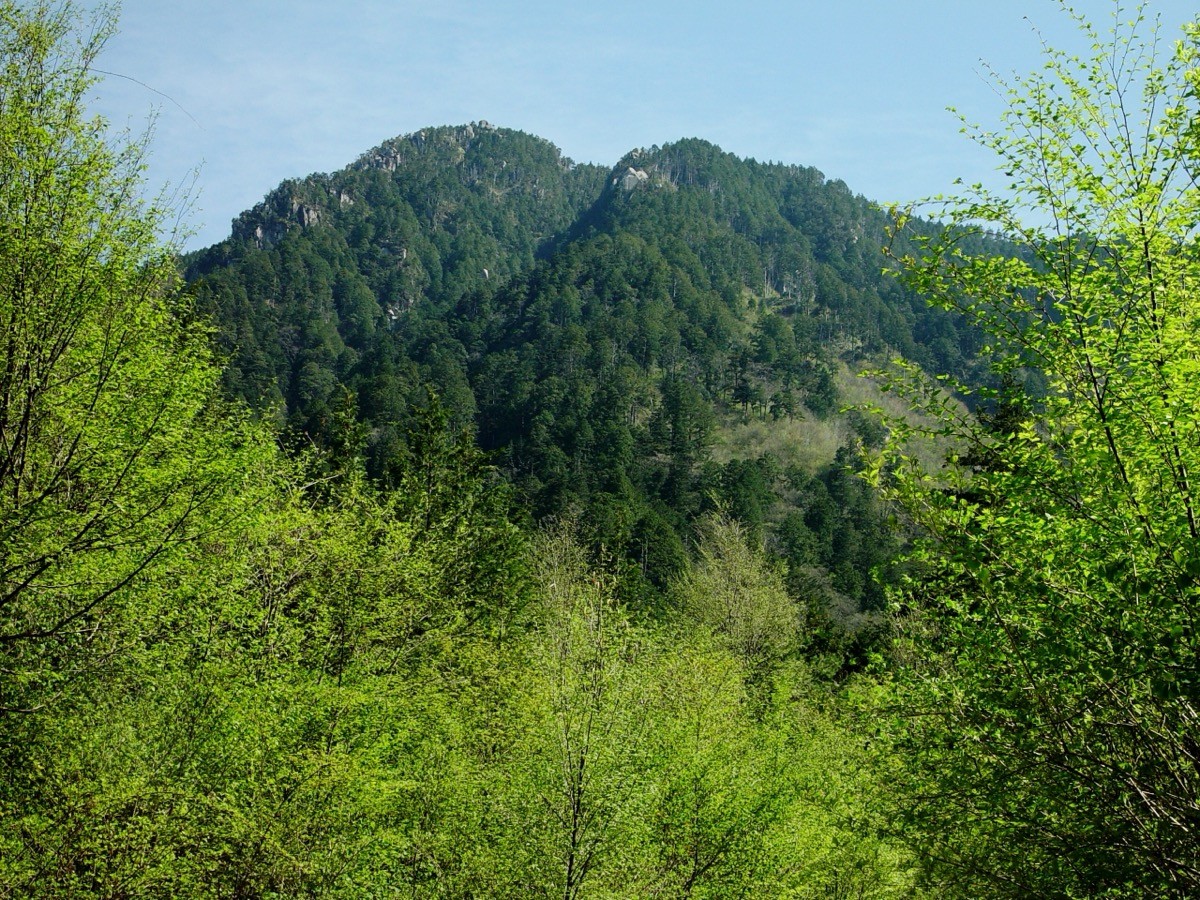
Mount Nagiso (Nagisodake, 1,679 m) is in Nagiso Town, Nagano Prefecture, and is one of Japan’s 300 Famous Mountains.
In the southwestern part of the Kiso range (Central Alps), its appeal lies in the steep trail of wooden steps and ladders, the old-growth cypress forest, and the views of the Central Alps and Mount Ontake from Marishiten. The usual day hike starts from JR Nagiso Station and makes a circuit over the summit from the Araragi trailhead.
For public-transport access, take a taxi from JR Nagiso Station to the Araragi trailhead.
The trailhead is the Araragi trailhead (Nagiso Sanroku Araragi Campground, about 1,000 m), with parking and toilets. The main route is a one-way circuit: Araragi trailhead → Mount Nagiso (1,679 m) → Marishiten → emergency hut, an intermediate route with a standard time of about 4–5 hours. Steep wooden steps, ladders and chained sections run one after another, and the summit and Marishiten give views of the Central Alps and Mount Ontake.
The best season is spring to late autumn (May–November) outside the snow season; there is snow in winter. Always check the latest trail conditions and arrange a taxi before you go.
*Last checked: June 6, 2026
How to access the trailheads
1. [There & Back] Nagiso Station ⇄ the Araragi trailhead (taxi)
Nagiso Station on the JR Chuo Main Line (Chuo-West Line) is your base. As there is no scheduled bus to the Araragi trailhead, take a taxi from the station.
① Nagiso Station → Araragi trailhead (taxi)
It is about 30 minutes by taxi from Nagiso Station to the Araragi trailhead (Nagiso Sanroku Araragi Campground). Reach Nagiso on the frequent Chuo-West Line from the Nagoya direction, then change to a taxi at the station.
② Taxi company
As there is no scheduled bus to the trailhead, booking a taxi in advance is reliable.
— Nagiso Kanko Taxi 0264-57-3133
③ Alternative route (Kamihaira course): you can also climb from the Kamihaira trailhead about 3.3 km east of Nagiso Station. It is a route for strong walkers that can be approached on foot from the station.
④ Return: it is reassuring to book a taxi for your expected descent time. Afterwards you can stop at Nagiso Onsen and return to Nagiso Station.
By car: there is parking at the Araragi trailhead (Nagiso Sanroku Araragi Campground). It is about 19 km / 40 minutes from the Nakatsugawa IC on the Chuo Expressway.
References: [Nagiso Tourism Association: Mount Nagiso] / [Nagiso Town]
Trail Guide and Safety Notes
Route: Araragi trailhead → Mount Nagiso (1,679 m) → Marishiten → emergency hut as a circuit. The standard time is about 4–5 hours, an intermediate route. The trail is split into one-way climb and descent paths (clockwise as standard); follow the signs around the loop. The view from Marishiten is superb.
Steep climbs and ladders: the trail has continuous wooden steps, ladders, chained sections and steep tree-root climbs. After rain the boardwalks and wooden steps are slippery, so take care. The descent is also steep — watch for falls.
Old-growth forest and seasons: the mountain is cloaked in old-growth cypress (hinoki and sawara) forest, lovely in fresh green and autumn colour. The summit area opens into bamboo grass with views. There is snow in winter, and snow gear is needed in the late-snow season.
Equipment and emergencies: carry rain gear, warm clothing, a headlamp, a map/GPS and plenty of food and water. In an accident or emergency call 110 (police) or 119 (fire/ambulance).
・Kiso Police Station 0264-23-0110
Photo by Alpsdake / Wikimedia Commons, CC BY-SA 3.0
Comments