
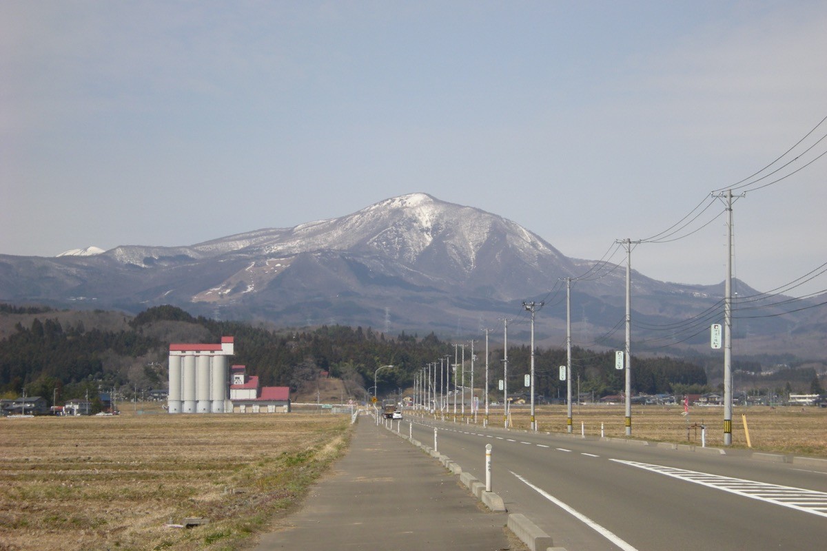
Mount Izumigatake (Izumigatake, 1,175 m) is in Izumi Ward, Sendai City, Miyagi Prefecture, and is one of Japan’s 300 Famous Mountains.
A much-loved local mountain rising northwest of central Sendai, its appeal lies in the gentle, easy-to-walk trails and the views of the Sendai Plain and the Funagata range from the summit. A municipal bus runs directly from Izumi-Chuo subway station to the trailhead, so a day hike is possible by public transport alone.
For access, take the subway and a Sendai City bus from Sendai Station to Sangaku Shizen Fureai-kan (Izumigatake nature centre).
The trailhead is the Sangaku Shizen Fureai-kan / youth centre (about 450 m), with a reception desk, toilets, a shop and a hiking post-box. The main route is Fureai-kan → Suijin course → Mount Izumigatake (1,175 m) and back (descending the Kakkō course), a beginner-to-intermediate route with a standard time of about 4 hours. The terrain is gentle and easy even for families, and the summit gives views of the Sendai Plain, the Pacific and the Funagata range.
The best season is spring to late autumn (April–November); in winter it becomes a ski area with snow. Always check the latest bus times and trail conditions before you go.
*Last checked: June 6, 2026
How to access the trailheads
1. [There & Back] Sendai Station ⇄ Sangaku Shizen Fureai-kan (subway & Sendai City bus)
JR Sendai Station is your base. Take the subway Namboku Line to Izumi-Chuo Station, then a Sendai City bus to the Sangaku Shizen Fureai-kan trailhead.
① Sendai Station → Izumi-Chuo Station (Sendai Subway Namboku Line)
From the subway Namboku Line directly under JR Sendai Station, go to Izumi-Chuo Station (the terminus). It takes about 15 minutes.
② Izumi-Chuo Station → Sangaku Shizen Fureai-kan (Sendai City Bus route 10)
From Izumi-Chuo Station take Sendai City Bus route 10 bound for “Fureai-kan / Spring Valley,” getting off at Sangaku Shizen Fureai-kan; it takes about 40 minutes and costs 800 yen. On weekends and holidays it departs Izumi-Chuo at 7:15, 8:20, 10:30 and 13:30; on weekdays there are about two morning and two afternoon services.
③ Sangaku Shizen Fureai-kan → Izumi-Chuo Station (return)
Return buses also run, mainly in the afternoon. As services are limited, always check the time of the last bus for your descent.
④ Taxi
To avoid waiting for the bus, a taxi from Izumi-Chuo Station is also available.
— Sendai Chuo Taxi 022-222-2454
By car: there is parking around the Fureai-kan and the ski area.
References: [Sendai City Transportation Bureau] / [Mount Izumigatake]
Trail Guide and Safety Notes
Route: Fureai-kan → Suijin course → Mount Izumigatake (1,175 m), descending the Kakkō course as a circuit. The standard time is about 4 hours, a beginner-to-intermediate route. The Suijin course runs from a stream up to the ridge, and the Kakkō course is a ridge path with good views. There are several trailheads and courses.
Stream and route-finding: the Suijin course follows a stream and is slippery after rain. Follow the signs and take care not to mistake your descent route at the junctions of the several courses.
Views and seasons: the summit gives views of the Sendai Plain, the Pacific and the Funagata range. Fresh greenery and autumn colours are lovely, and it is a favourite local mountain. In winter it becomes a ski area with snow and ice, so snow gear is needed.
Equipment and emergencies: carry rain gear, warm clothing, a headlamp, a map/GPS and plenty of food. In an accident or emergency call 110 (police) or 119 (fire/ambulance).
・Izumi Police Station 022-372-0110
Photo by Wkatsuhiro / Wikimedia Commons, Public domain
Comments