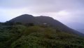
Mount Gomadan (Gomadanzan, 1,372 m) sits on the border of Tanabe City in Wakayama and Totsukawa Village in Nara, and is one of Japan’s 300 Famous Mountains.
On the ridgeline of the Kōya-Ryūjin Skyline, its appeal is the beech old-growth forest and the easy walk that also takes in the adjacent Mount Ryūjin (1,382 m), the highest peak in Wakayama. From the “Gomasan Sky Tower” roadside station it is an easy hike of about 30 minutes one way to the summit.
For public-transport access, take the seasonal pilgrimage bus (Nankai Rinkan Bus / Ryujin Bus) from Koyasan or Kii-Tanabe Station to Gomadanzan.
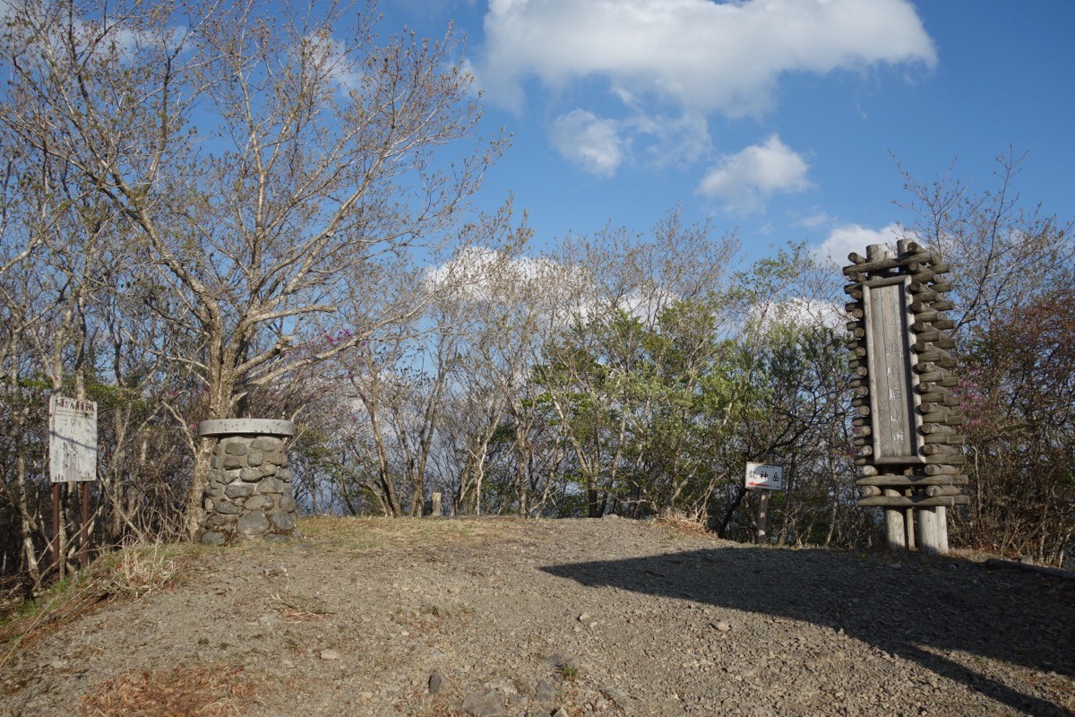
The trailhead is the “Tanabe Ryūjin Gomasan Sky Tower” roadside station (about 1,300 m), with an observation tower, shop and toilets. The main route is the roadside station → promenade → Mount Gomadan (1,372 m) → Mount Ryūjin (1,382 m) and back, a beginner route with a standard time of about 1 hour. The promenades of the beech-clad Gomadan Forest Park are well maintained.
The best season is April–November, when the bus and the Skyline are open. In winter the Skyline is closed, and neither public transport nor cars can reach the trailhead. Always check the latest bus operating days before you go.
*Last checked: June 6, 2026
How to access the trailheads
1. [There & Back] Kii-Tanabe / Koyasan Station ⇄ Gomadanzan (pilgrimage bus)
Kii-Tanabe Station on the JR Kinokuni Line, or Koyasan Station on the Nankai Koya Line (via the Gokurakubashi cable car), is your base. Take the seasonal pilgrimage bus that links Koyasan and Kumano to Gomadanzan.
① Kii-Tanabe Station → Gomadanzan (Ryujin Bus pilgrimage bus)
On the pilgrimage bus via Ryujin Onsen, it is Kii-Tanabe Station dep. 8:00 → Gomadanzan arr. 10:50 (with a transfer at Nakahechi). The operating period is April 2 to November 30, 2026 (no service Tuesdays and Wednesdays).
② Koyasan Station → Gomadanzan (Nankai Rinkan Bus)
From the Koyasan side, take the Nankai Rinkan Bus to Gomadanzan. There is one round trip on weekdays and two on weekends and holidays, connecting with the Ryujin Bus at Gomadanzan.
③ Gomadanzan → Koyasan Station (return)
For the return it is Gomadanzan dep. 11:05 → Koyasan Station arr. 12:14. You can also transfer toward Ryujin Onsen and Kii-Tanabe.
④ Note (winter): the Kōya-Ryūjin Skyline is closed in winter, so from about December to March neither public transport nor cars can reach Gomadanzan.
By car: there is parking at the Gomasan Sky Tower roadside station (only while the Skyline is open).
References: [Ryujin Bus pilgrimage bus] / [Nankai Rinkan Bus]
Trail Guide and Safety Notes
Route: Gomasan Sky Tower roadside station → promenade → Mount Gomadan (1,372 m) → Mount Ryūjin (1,382 m) and back. The standard time is about 1 hour, a beginner route. The forest-park promenades are well maintained and suitable for families. Going further, a traverse route continues toward Mount Obako.
Season and access notes: the Kōya-Ryūjin Skyline is closed in winter (roughly December–March), when the trailhead cannot be reached. In spring and autumn mornings and evenings are cold and mist forms easily, so take care.
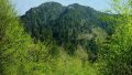
Views and seasons: from the Sky Tower and summit there are views of the deep Kōya area and the Hatenashi and Ōmine ranges. The fresh beech greenery and autumn colours are the highlights. Mobile reception is weak in places.
Equipment and emergencies: wear comfortable shoes and carry warm clothing, rain gear, water and a map. In an accident or emergency call 110 (police) or 119 (fire/ambulance).
・Tanabe Police Station 0739-22-0110
Photo by Koda6029 / Wikimedia Commons, CC BY-SA 4.0
Comments