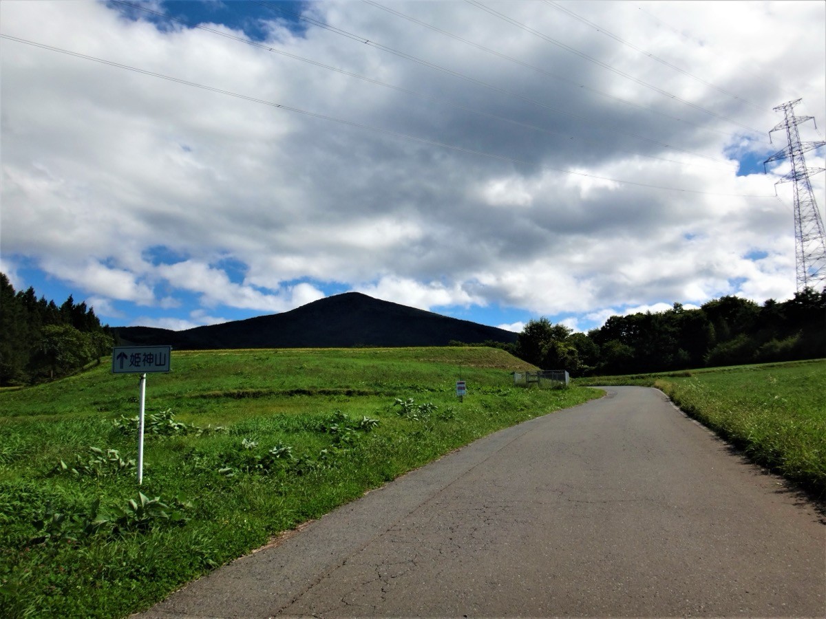
Mt. Himekami (姫神山, 1,124 m) in Morioka, Iwate Prefecture, is one of the 200 Famous Japanese Mountains.
One of the Three Sacred Mountains of the Northern Ōu range together with Mt. Iwate and Mt. Hayachine, it is known for its beautifully symmetrical cone, the granite boulders of its summit, and the sweeping view from there over Mt. Iwate and the city of Morioka. The usual route, out and back from the summit via the Ipponsugi course, is about 1.5 hours up and around 3 hours round trip — a beginner-to-intermediate mountain.
The nearest station is Kōma on the Iwate Ginga Railway. From there you reach the Ipponsugi trailhead by taxi.
The trailhead is the Ipponsugi trailhead (Ipponsugi Park), with free parking (lots 1 and 2) and toilets and water (both usable April–November). The most-walked Ipponsugi course runs trailhead → 5th station → summit (1,124 m), about 1.5 hours up. Descending by the Kowasaka course makes a loop, about 3 hours round trip, beginner-to-intermediate. The area just below the summit is granite outcrop, and the summit commands a view of Mt. Iwate, Mt. Hayachine and the city of Morioka.
There are four trailheads — Ipponsugi, Kowasaka, Tashiro and Jōnai, of which Ipponsugi is the best maintained. The season is late April to November. The toilets and water are unavailable in winter (December–March), so prepare accordingly along with your other gear.
How to access the trailhead
1. [Outbound & Return] Kōma Station → Ipponsugi trailhead
Get off at Kōma Station on the Iwate Ginga Railway (with through service from the JR Hanawa Line); the Ipponsugi trailhead is about 20 min by taxi (around ¥2,400).
There is no regular bus directly to the Ipponsugi trailhead (Morioka’s Tamayama-district buses only reach the Kōma Station area, and from there it is about a 2-hour walk to the trailhead — not realistic). A taxi from Kōma Station is therefore the realistic option; it is also about 15 min from the neighboring Shibumin Station. Booking a return pick-up to match your descent time is recommended.
– Kōma Taxi 019-682-0135
Source: [Morioka City, Himekami Ipponsugi Park] / [Morioka Tourism, Mt. Himekami]
Route and safety notes
Route: Ipponsugi trailhead → 5th station → summit → (descent) Kowasaka course → Ipponsugi trailhead. About 1.5 hours up, around 3 hours round trip as a loop, beginner-to-intermediate. The area just below the summit is granite outcrop with some slippery spots, so watch your footing.
Views: from the summit you can see Mt. Iwate, Mt. Hayachine, the city of Morioka and as far as Lake Gandō. The symmetrical cone is itself a sight from the foothills.
Toilets and water: the toilets and water at Ipponsugi Park are usable only April–November. There are no shops on the mountain, so prepare water and food in advance.
Bears: Asian black bears live in the area, so carry a bear bell and submit a climbing plan.
In an emergency: call 110 (police) or 119 (fire/rescue).
・Kōma Taxi (pick-up / descent contact) 019-682-0135
Photo by Koda6029 / Wikimedia Commons, CC BY-SA 4.0
Comments