Mt. Aizu-Asahi (会津朝日岳, 1,624 m) in Tadami, Fukushima Prefecture, is one of the 200 Famous Japanese Mountains.
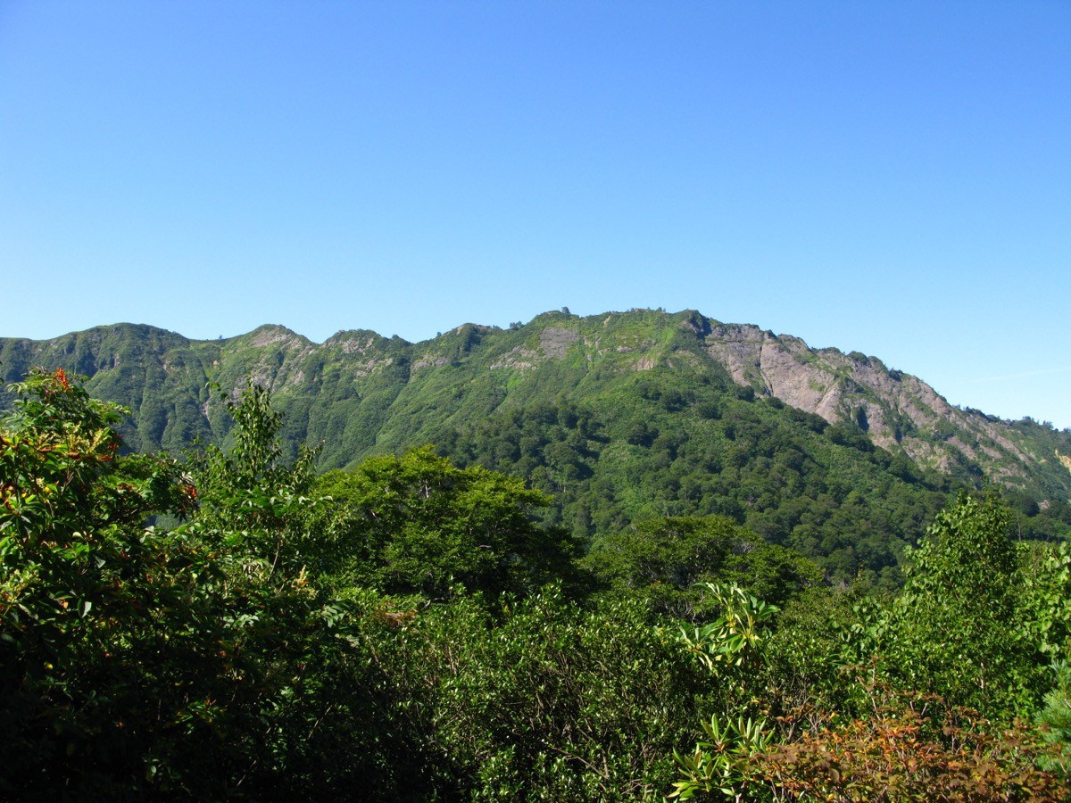
Cradled in the deep forests of Oku-Aizu, it is a quiet, little-visited peak whose appeal lies in its great beech forest and the view of Mt. Aizu-Koma, Mt. Hiuchi and the Echigo Sanzan from the summit. The Iwana-no-Sato route is an intermediate (fit-hiker) round trip of about 8 hours with continuous steep climbing.
The nearest station is Tadami on the JR Tadami Line. From Tadami you reach the Iwana-no-Sato trailhead by taxi.
The trailhead is the Iwana-no-Sato trailhead (Akakura-sawa). The route runs Iwana-no-Sato → Miyoshi-michigi → Hitomi-no-Matsu → Kano-no-Takate → emergency hut → Mt. Aizu-Asahi and back; the standard round trip is about 8 hours with about 1,335 m of ascent, intermediate (fit-hiker) level. From the stream, past Miyoshi-michigi, steep climbing continues, and the view opens up at Hitomi-no-Matsu.
Just below the summit is a free, unstaffed Aizu-Asahi emergency hut. Water is at Miyoshi-michigi early on. Parts of the trail are not well maintained, and there are many sections with no mobile-phone signal, so allow plenty of time. The area is home to Asian black bears. The season is mid-June to late October.
How to access the trailheads
1. [Round trip] Tadami Station → Iwana-no-Sato trailhead (Mt. Aizu-Asahi trailhead)
Tadami Station on the JR Tadami Line (fully reopened in 2022) is the gateway. The Iwana-no-Sato trailhead is about 30 minutes by taxi from Tadami Station.
There is no route bus to the trailhead, so a taxi is the norm. Tadami Kanko Taxi is right by Tadami Station. Since the route is long and many stretches have no phone signal, an early start is reassuring, and staying overnight near Tadami Station or at Tadami Onsen is also recommended. The trailhead’s “Iwana-no-Sato” (fishing park) is open May to early November; check the latest status.
– Tadami Kanko Taxi 0241-82-2202 / Iwana-no-Sato 090-2603-6162
Source: [Tadami Tourism and Community Association] / [Iwana-no-Sato]
Route and safety notes
Route: Iwana-no-Sato trailhead → Miyoshi-michigi → Hitomi-no-Matsu → Kano-no-Takate → emergency hut → Mt. Aizu-Asahi. The standard round trip is about 8 hours, around 11 km, with about 1,335 m of ascent, intermediate (fit-hiker) level. Around Kano-no-Takate is a great beech forest, and in July you can see Himesayuri lilies.
Steep climbing and trail condition: beyond Miyoshi-michigi the climbing is steep and continuous. Parts of the trail are not well maintained and some sections are unclear, so proceed carefully. Note that many stretches have no mobile-phone signal.
Bears: the area is home to Asian black bears. Take precautions such as a bear bell and avoid going alone.
Gear and season: the season is mid-June to late October. There is an unstaffed emergency hut just below the summit, but it is a day trip. Carry water, food and rain gear, and submit a climbing plan.
In an emergency: call 110 (police) or 119 (fire/rescue).
・Minami-Aizu Police Station 0241-62-0110
Photo by Qwert1234 / Wikimedia Commons, CC BY-SA 4.0
Comments