
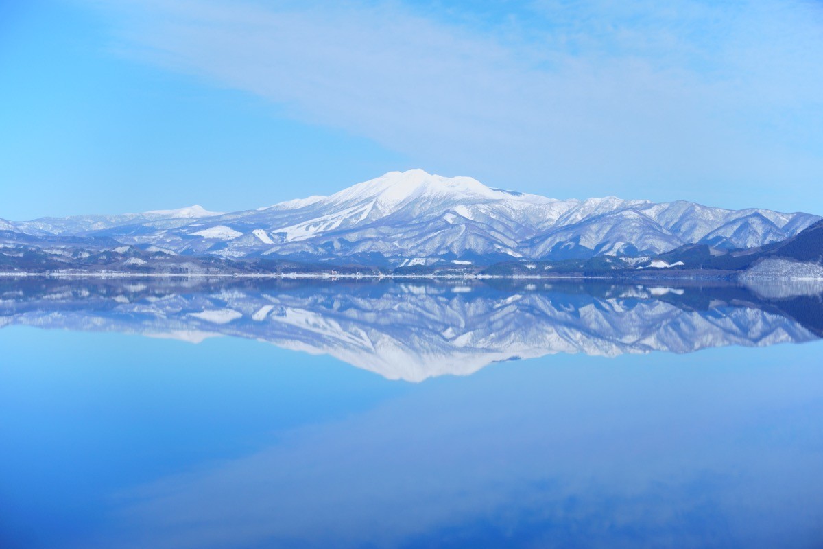
Mt. Akita-Komagatake (秋田駒ヶ岳) is a 1,637m volcano on the border of Semboku City (Akita) and Shizukuishi Town (Iwate), one of the 200 Famous Japanese Mountains and the New 100 Famous Flower Mountains.
Its highest peak, Onamedake (1,637m), is the highest point in Akita Prefecture and, together with Odake and Medake, forms a caldera surrounding Amida-ike pond. Known as one of Tohoku’s finest treasure houses of alpine flora such as Komakusa and Chinguruma, it is popular even with beginners because you start from the 8th Station.
From JR Tazawako Station, access the 8th Station by Ugo Kotsu Bus “Komagatake Line.”
The climb starts at the 8th Station (Komagatake 8th Station bus stop).
From the 8th Station, via Katakuradake to Amida-ike pond takes about 1 hour, and the round trip from Amida-ike to the highest peak Onamedake about 30 minutes. Even including the Odake summit and the crater-rim circuit, it takes around 3 hours 30 minutes; with little elevation gain, you can enjoy alpine flowers easily.
*Note: Medake is an active volcano (eruption alert level 1 as of June 2026). Check the latest volcanic information and consider using a helmet (provided at Alpa Komakusa, the 8th Station rest house, and the Amida-ike emergency hut). Oyakezuna is a loose scree slope, so take care.
How to access the trailheads
- [Outbound] Tazawako Station → Komagatake 8th Station
- [Return] Komagatake 8th Station → Tazawako Station
1.[Outbound] Tazawako Station → Komagatake 8th Station
From JR Tazawako Station, take the Ugo Kotsu Bus “Komagatake Line” and get off at Komagatake 8th Station.
Travel time: about 56–59 minutes
Fare: ¥1,250
This bus runs only on private-car restriction days: Saturdays, Sundays, and holidays from June 1 to October 20, and weekdays from June 21 to August 15. On other weekdays there is no service, so use a taxi. The prefectural Komagatake road is closed in winter (November 1 – May 31).
The ◎ mark means no service on October Sat/Sun/holidays; the ★ mark means service only on October Sat/Sun/holidays.
Bus TimetableTazawako Station to Komagatake 8th Station
| Tazawako Station Dep. | Komagatake 8th Sta. Arr. |
|---|---|
| ◎5:30 | ◎6:26 |
| 6:00 | 6:56 |
| 6:33 | 7:32 |
| 8:15 | 9:14 |
| 10:05 | 11:04 |
| 12:20 | 13:19 |
| 13:30 | 14:29 |
Reference: [Semboku City (Akita-Komagatake car restriction)]
2.[Return] Komagatake 8th Station → Tazawako Station
From Komagatake 8th Station, take the Ugo Kotsu Bus “Komagatake Line” and get off at JR Tazawako Station.
Travel time: about 59 minutes
Fare: ¥1,250
Service days are the same as the outbound: Saturdays/Sundays/holidays from June 1 to October 20, and weekdays from June 21 to August 15.
The ◎ mark means no service on October Sat/Sun/holidays; the ★ mark means service only on October Sat/Sun/holidays.
Bus TimetableKomagatake 8th Station to Tazawako Station
| Komagatake 8th Sta. Dep. | Tazawako Station Arr. |
|---|---|
| 8:50 | 9:49 |
| 10:00 | 10:59 |
| 11:50 | 12:49 |
| 14:05 | 15:04 |
| ★15:50 | ★16:49 |
| 16:25 | 17:24 |
| ◎17:00 | ◎17:59 |
Reference: [Semboku City (Akita-Komagatake car restriction)]
Photo by 掬茶 / Wikimedia Commons, CC BY-SA 4.0

Comments