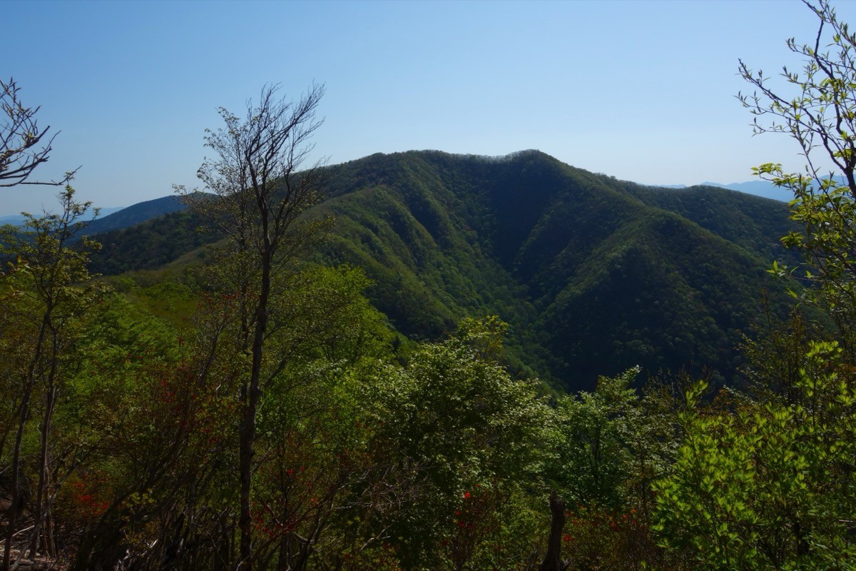
Mt. Obako (伯母子岳, 1,344 m), on the border of Nosegawa and Totsukawa in Nara, is one of the 200 Famous Japanese Mountains.
It stands above the Obako Pass crossed by the Kohechi route of the Kumano Kodo, a World Heritage pilgrimage trail, and is one of the finest viewpoint peaks of the inner Koya area. From the summit the ranges of Mt. Gomadanzan and the Omine Mountains spread out, and it is an intermediate-level mountain offering a quiet, history-rich ridge walk.
Public transport to the trailhead is only a resident-oriented village bus with no times suited to hiking, so a lodge shuttle or a taxi is the norm. The nearest station is Koyasan on the Nankai Koya Line, and you reach the Omata trailhead from the Koyasan area.
The trailhead is the Omata trailhead (Omata, Nosegawa; parking for about 4 cars). The standard route is a loop: Omata → Kaya-goya site → Mt. Obako → Obako Pass → Omata, with a standard time of about 5 hours 20 minutes, intermediate level. You follow the stone paving and old hut sites of the Kohechi, and one last climb from Obako Pass to the summit opens up a wide view.
The Hotel Nosegawa (Nosegawa Onsen) at the foot shuttles overnight guests to the Omata trailhead (by reservation), making it an ideal base for an overnight and an early start. The season runs from fresh green to autumn foliage (roughly April to November). A day trip is possible, but access is inconvenient, so an overnight stay is convenient. Always check the latest trail and forest-road conditions in advance.
How to access the trailheads
1. [Round trip] Koyasan Station → Omata trailhead (Hotel Nosegawa shuttle / taxi)
From the Osaka direction, take the Nankai Koya Line and cable car to Koyasan Station. The Nosegawa village bus to the Omata trailhead runs on weekdays only on a resident-oriented schedule, and the buses passing Omata-hashizume only run toward the village office in the morning and from it in the evening (reaching Omata only in the afternoon), so it is effectively unusable for hiking. A lodge shuttle or a taxi is therefore the norm.
The most reliable option is to stay the night before at Hotel Nosegawa (Nosegawa Onsen, 0747-38-0011) and be shuttled to the Omata trailhead (by reservation; on the way down, call for a pickup from near the trailhead). A shuttle from Koyasan is also available on request, and day-use bathing is possible.
For a day trip or without the shuttle, take a taxi from around Koyasan Station (the distance is long and the fare high, so confirm it in advance). For weekday village-bus times and fares, check with the Nosegawa Village Office, Industry Division (0747-37-2104). If you drive, there is parking for about 4 cars at the Omata trailhead.
Source: [Nosegawa Village, access & village bus] / [Nosegawa Village, Hotel Nosegawa]
Route and safety notes
Route: Omata → Kaya-goya site → Hinoki Pass → Mt. Obako (1,344 m) → Obako Pass → Omata. The standard loop is about 5 hours 20 minutes, intermediate level. You follow part of the Kohechi of the World Heritage Kumano Kodo, and from Obako Pass to the summit it is a grassy ridge with good views. The summit looks out over Mt. Gomadanzan and the Omine Mountains.
Access notes: The forest and prefectural roads to Omata run deep into the mountains and can be closed after heavy rain or typhoons. The Kii Peninsula is prone to disasters, so check the weather and road conditions not only for the day but for the preceding several days.
On the mountain: The Kohechi is quiet with few people, and mobile reception is poor in places. Some old-trail signs are hard to read, so carry a map and GPS. There is an emergency hut and a toilet near Obako Pass.
Gear and season: The season runs April to November. Carry water, food, rain gear, warm clothing, and a map/GPS. In winter, snow and ice make it a route for the experienced.
Emergencies: In case of accident or distress, call 110 (police) or 119 (fire/rescue).
・Nosegawa Village Office 0747-37-2101
Photo by Koda6029 / Wikimedia Commons, CC0
Comments