
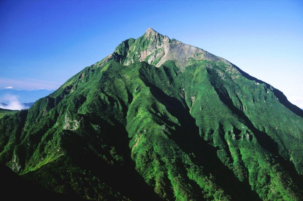
Mt. Nipesotsu (ニペソツ山, 2,013 m), straddling Kamishihoro and Shintoku in Hokkaido, is one of the 200 Famous Japanese Mountains.
For its sharply pointed shape it is the symbol of the eastern Daisetsu, also called the “Matterhorn of Hokkaido,” and the view of it from Mae-Tengu is praised as one of the most beautiful in Japan. The Horoka Onsen route is a long, advanced round trip of about 11 hours with about 1,550 m of ascent.
The nearest base is Nukabira Onsenkyo (Nukabira Onsen). There is no public transport to the trailhead, so a rental car and an overnight stay are assumed.
The trailhead is the Horoka Onsen route trailhead (Sugisawa junction, no toilet). The route runs Sugisawa junction → Mae-Tengu → Tengu Col → Mt. Nipesotsu and back; the standard round trip is about 11 hours, around 16 km, advanced. The climb to Mae-Tengu is a long forest stretch, and on the ridge the sharp peak of Nipesotsu appears straight ahead. From Tengu Col to the summit is a steep rocky climb with hands-on sections, and the summit is narrow with both sides dropping away.
The other route, via Juroku-no-sawa, is closed due to a washed-out forest road. It is brown-bear country with no mobile-phone signal, and as the route is long, solo climbing is not recommended. Water is the stream early on (boil before use), and as there is no toilet, carry a portable toilet. The season is early July to late September.
How to access the trailheads
1. [Round trip] Nukabira Onsenkyo → Horoka Onsen route trailhead (Mt. Nipesotsu trailhead)
The public-transport base is Nukabira Onsenkyo (Nukabira Onsen). From Obihiro Station on the JR Nemuro Main Line, take the Tokachi Bus / Hokkaido Takushoku Bus Kamishihoro–Nukabira line to Nukabira Onsenkyo (services are few, so check the latest times with Kamishihoro Town and the bus companies).
From Nukabira Onsenkyo to the trailhead there is no route bus, so a rental car (or a chartered taxi) is the norm. From Nukabira Onsen, head toward Horoka Onsen and continue about 1 hour on the forest road to the Horoka Onsen route trailhead (Sugisawa junction). The forest road may be washed out or closed, so check conditions with the Kamishihoro Town office in advance. As the route is long, staying the night before at Nukabira Onsenkyo or Horoka Onsen is reassuring.
– Kamishihoro Town Office (forest-road conditions) 01564-2-2111
Source: [Kamishihoro, Kamishihoro–Nukabira line timetable] / [Hokkaido Takushoku Bus]
Route and safety notes
Route: Horoka Onsen route trailhead (Sugisawa junction) → Mae-Tengu → Tengu Col → Mt. Nipesotsu. The standard round trip is about 11 hours, around 16 km, with about 1,550 m of ascent, advanced. The view opens at Mae-Tengu, where the sharp peak of Nipesotsu appears straight ahead.
Rock and falls: from Tengu Col to the summit is a steep rocky climb with hands-on sections. The summit is narrow with both sides dropping away, so beware of falls and turn back if the weather changes suddenly.
Bears and signal: it is brown-bear country with no mobile-phone signal. As the route is long, carry a bear bell and avoid going alone. There is no toilet, so carry a portable toilet.
Gear and season: the season is early July to late September. Carry water, food, rain gear, warm clothing, a map and compass (GPS), and submit a climbing plan. Water is the stream early on; boil before use.
In an emergency: call 110 (police) or 119 (fire/rescue).
・Kamishihoro Town Office 01564-2-2111
Photo by alpsdake / Wikimedia Commons, Public domain

Comments