Mt. Shaka (釈迦ヶ岳, 1,800 m), on the border of Totsukawa and Shimokitayama in Nara, is one of the 200 Famous Japanese Mountains.
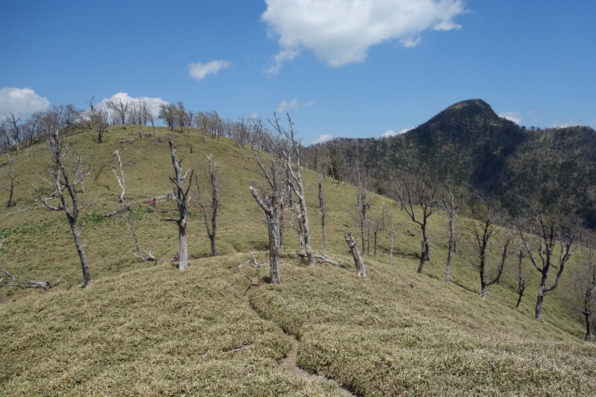
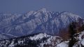
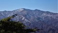
A noted peak of mountain-asceticism in the southern Omine range, its appeal is the bronze statue of Shakyamuni Buddha standing on the summit and the grand view over the main Omine ridge and the Daiko range. From the Futao trailhead on the west side the climb is a relatively gentle 500 m of ascent, and the classic plan is a day-trip out and back to Mt. Shaka from the Futao trailhead.
There is no public transport to the trailhead, so the standard way is an overnight trip combining a bus and a taxi from the nearest station. The nearest station is Gojo on the JR Wakayama Line. You take a Nara Kotsu bus from Gojo Station to Asahibashi, then a taxi from Asahibashi to the Futao trailhead.
The trailhead is the Futao trailhead (about 1,300 m). The standard route is Futao trailhead → Koda-no-mori → Senjodaira → Mt. Shaka, out and back, with a standard time of about 5 hours and about 500 m of ascent, intermediate level. It is an open ridge path with fine views, and the Shiroyashio (five-leaf azalea) season in late May is especially popular.
At the Futao trailhead there is parking for about 10 cars and a toilet, serving as the trailhead base. At Senjodaira there is a water source called “Kakushi-mizu.” The best season is May to October; note the rocky area just below the summit and the steep drops along the ridge toward Shinsen. The forest road (Momiji-kaido) to the Futao trailhead is narrow, so always check the latest conditions in advance.
*Last checked: June 6, 2026
How to access the trailheads
1. [Round trip] Gojo Station → Asahibashi → Futao trailhead
The base is Gojo Station on the JR Wakayama Line. There is no local bus to the Futao trailhead, so from the nearest stop, Asahibashi, a taxi or a car is the standard option.
① Gojo Station → Asahibashi (Nara Kotsu, Yagi–Shingu line)
Take the Nara Kotsu “Yagi–Shingu Express” — known as Japan’s longest local bus route (running between Gojo and Totsukawa Onsen) — and get off at Asahibashi. It takes about 1 hour 30 minutes.
― Gojo Stn dep. 10:31 → Asahibashi arr. 11:59
― Gojo Stn dep. 13:06 → Asahibashi arr. 14:34
― Gojo Stn dep. 15:06 → Asahibashi arr. 16:34
Return buses from Asahibashi (toward Gojo) leave around 8:17, 9:30, 11:30 and 13:43 (as revised October 2024).
② Asahibashi → Futao trailhead (taxi)
From Asahibashi to the Futao trailhead is about 40 minutes by taxi via the “Momiji-kaido.” As the forest road is narrow and long, booking both the outbound and return rides in advance is essential.
― Sengoku Taxi 0747-52-2555 (toll-free 0120-84-1986)
As the bus times make a same-day round trip difficult, an overnight stay in Gojo or Totsukawa is realistic. Stay overnight and take a taxi to the Futao trailhead early in the morning, or take a taxi directly from Gojo Station. If you drive, there is parking at the Futao trailhead (about 10 cars).
Source: [Nara Kotsu, Yagi–Shingu Express bus] / [Sengoku Taxi]
Route and safety notes
Route: Futao trailhead → Koda-no-mori → Senjodaira → Mt. Shaka (1,800 m), out and back. The standard time is about 5 hours with about 500 m of ascent. On the summit stands the bronze statue of Shakyamuni Buddha, placed in 1924, and the grand view over the main Omine ridge and the Daiko range opens up.
Rocky and narrow ridges: Just below the summit, and along the ridge if you traverse toward Shinsen and Mt. Dainichi, there are rocky sections and narrow ridges with steep drops. In rain or fog the risk of a fall or losing the way rises, so be willing to turn back.
Forest road and access: The forest road (Momiji-kaido) to the Futao trailhead is narrow with some rockfall and can be closed after heavy rain or in winter. Check the weather and forest-road conditions not only for the day but for the preceding several days.
Water, gear and season: Apart from the “Kakushi-mizu” at Senjodaira there are few reliable water sources, so carry plenty of water. The best season is May to October. Do not forget rain gear, warm clothing, a headlamp and a map/GPS.
Emergencies: In an accident or emergency, call 110 (police) or 119 (fire/rescue).
・Totsukawa Village Hall 0746-62-0001
Photo by Koda6029 / Wikimedia Commons, CC BY-SA 4.0
Comments