Mt. Mishotai
More figures and data sources
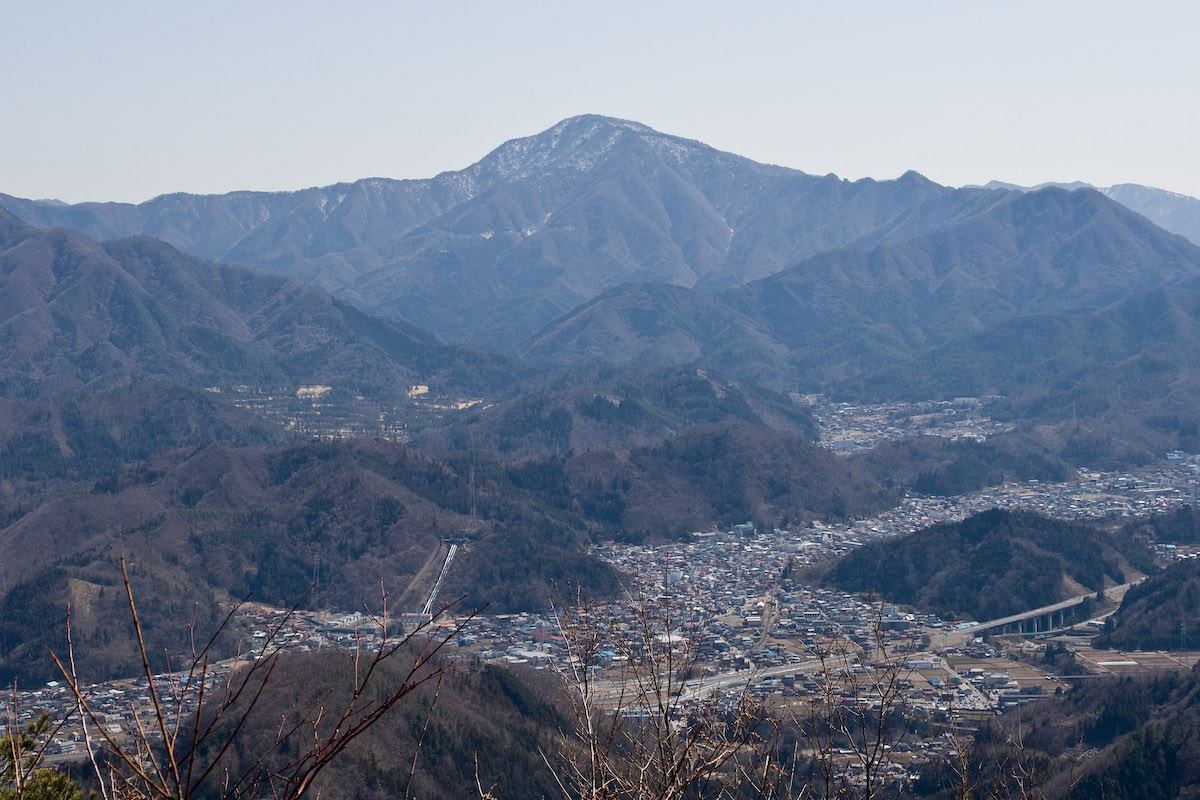
Mt. Mishotai (御正体山) is a 1,681m peak on the border of Tsuru City and Doshi Village in Yamanashi Prefecture — the highest peak of the Doshi Mountains. Selected as one of the 200 Famous Japanese Mountains and the 100 Famous Mountains of Yamanashi, the quiet hike through beech virgin forest is enjoyable. A view of Mt. Fuji can be gained from near the summit.
Mt. Mishotai is reached by taking the Fujikyu Bus (Doshi-Tsuru Line) from Tsurushi Station on the Fujikyuko Line to the Dosaka-Suido bus stop, but the service runs only on weekends and holidays and is infrequent. Against a course time of about 6.5 hours, a same-day round trip by bus alone is not possible, so plan on combining a taxi from Tsurushi Station or staying overnight.
⚠ Important (April 2026) — Partial termination of Fujikyu Bus Tsuru-area routes
Fujikyu Bus implemented “termination of local bus service within Tsuru City” on March 31, 2026; closed-loop Tsuru City services have been converted to demand taxi. However, routes toward Doshi Village (Tsurushi Station ~ Doshi Village ~ Tsukiyono) continue to operate, so the Dosakasuido and Mishotai-Iriguchi bus stops for Mt. Mishotai access are expected to remain usable.
Verify the latest times on Fujikyu Bus Official or NAVITIME Mishotai-Iriguchi.
*Timetable last checked: unverified
1. [Outbound] Fujikyu Tsurushi Station → Dosakasuido bus stop
From Tsurushi Station, take the Fujikyu Bus “Doshi-Tsuru Line” and get off at the Dosakasuido bus stop.
Operating period: Sat/Sun/holidays only from April – December 5 (excluding August)
Travel time: 30 minutes
Fare: ¥650
*This bus runs only on weekends and holidays. The last outbound departs Tsurushi Station at 9:15 (arriving Dosaka-Suido 9:45), and the last return leaves Mishotai-iriguchi at 15:22. With a course time of about 6.5 hours you cannot get back down in time for this last bus, so a same-day round trip by bus alone is not possible. For a day hike, use a taxi from Tsurushi Station (please confirm the time and fare in advance), or plan on a hut/tent stay or a night nearby beforehand.
Bus TimetableTsurushi Station → Dosakasuido Bus Timetable
| Tsurushi Station | Dosakasuido |
|---|---|
| 8:15 | 8:45 |
| 9:15 | 9:45 |
Reference: [Fujikyu Yamanashi Bus]
2. [Return] Mishotai-Iriguchi bus stop → Tsurushi Station
From the Mishotai-Iriguchi bus stop, take the Fujikyu Bus “Doshi-Tsuru Line (bound for Tsurushi Station)” and get off at Tsurushi Station.
Operating period: Sat/Sun/holidays only
Travel time: 28 minutes
Fare: ¥380
Bus TimetableMishotai-Iriguchi bus stop → Tsurushi Station Bus Timetable
| Mishotai-Iriguchi Dep. | Tsurushi Station Arr. |
|---|---|
| 15:22 | 15:40 |
Reference: [Fujikyu Yamanashi Bus]
Mt. Mishotai Hiking Routes, Difficulty & Best Season
Mt. Mishotai is the highest peak of the Dōshi mountains, a quiet mountain whose upper slopes are covered in beautiful old-growth beech and Mongolian oak forest. The main trailheads are all poorly served by public transport, and a round trip takes around six hours, so a day hike calls for an early start and solid fitness.
Main routes
- Dosaka Pass (Dosaka Tunnel) route (from the Dosaka-suido bus stop): about 10.6 km / elevation gain about 1,041 m / time about 6 hours 20 minutes / difficulty: intermediate. This is the standard out-and-back route matching the bus access between Tsurushi Station and Dosaka-suido described in this article.
- Yamabushi Pass route (from the Yamabushi-toge bus stop): about 10 km / elevation gain about 966 m / time about 6 hours / difficulty: moderate. A ridge walk over Okunodake, Nakanodake and Maenodake, a little shorter than the Dosaka Pass route, though you should check public transport to this trailhead separately.
- There is also a long ridge traverse for strong hikers from the direction of Mt. Ishiwari to Mt. Mishotai, but check the map carefully in advance as it takes considerably longer.
Difficulty & fitness
With a large elevation gain and around six hours of walking, this is an intermediate-level mountain. As noted above, buses to the trailhead are infrequent and a day trip cannot be completed by bus alone, so plan on combining it with a taxi or an overnight stay.
Best season
The fresh greenery of early summer (May–June) through the autumn foliage (October–November) offers the best walking conditions. In winter (December–March), snow and ice make light crampons and similar gear necessary.
Highlights
A quiet walk through beautiful old-growth beech and oak forest is the main appeal. There are viewpoints along the route where Mt. Fuji can be seen up close, though the forest near the summit itself limits the view. The summit enshrines Goshotai Gongen, adding a touch of quiet solemnity fitting for the highest peak of the Dōshi mountains.
Photo by Wikipedia
Your next mountain
The highest point of the Amago range, the best westward viewpoint for an unobstructed face-on view of Mt. Fuji.
A Yamanashi viewpoint overlooking Yatsugatake and the southern Alps, known also as the place where mountaineer Fukada Kyuya died.
An ancient sacred mountain of the Oku-Chichibu ridge, its iconic Gojōiwa pillar towering above, with views to the southern Alps and Yatsugatake.
A quiet peak in front of the southern Alps, beautiful for its iris meadows on the Ayame plateau and ancient moss-draped primeval forest.
Climbed it? Stamp your logbook