
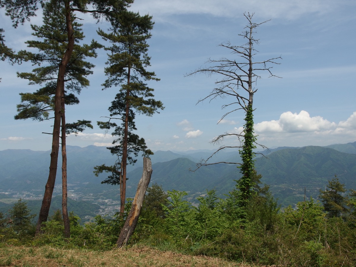
Mt. Kuratakeyama (くらたけやま, 990m) on the Otsuki / Uenohara City border, Yamanashi, is the 9th-rank peak of the Shurei Fugaku Twelve Views (paired with Mt. Takahatayama). The principal of the 9th-rank pair, the summit’s Mt. Fuji panorama is among the very finest of the Shurei Fugaku Twelve, overlooking Mt. Mitsutoge, the Southern Alps, and the Doshi range.
The standard route is the Yanagawa Stn → Mt. Kuratakeyama → Anaji Pass → Mt. Tenjin → Mt. Takahatayama → Torisawa Stn dual-peak traverse. Beginner-Intermediate ★★★・distance ~10 km・elevation gain 710 m・action time ~5 hr 30 min (day hike). Walking access from JR Chuo Line stations; the Mt. Takahatayama dual-peak conquest is the classic plan.
Access to the trailhead
- [Outbound / Return] Otsuki Stn ⇔ Yanagawa Stn / Torisawa Stn (JR Chuo Line local)
- Traverse course, Takahata link, suggested plans
Course time (Yanagawa Stn → Mt. Kuratake → Mt. Takahata → Torisawa Stn traverse, day hike, Beginner-Intermediate, ~5 hr 30 min)
Yanagawa Stn (280 m) → (0:20) → Mt. Kuratakeyama trailhead → (1:30) → Tateno Pass → (1:00) → Mt. Kuratakeyama summit (990 m) → (0:30) → Anaji Pass → (0:30) → Mt. Tenjin → (1:00) → Mt. Takahatayama (982 m) → (1:00) → Torisawa Stn (330 m)
1. [Outbound / Return] Otsuki Stn ⇔ Yanagawa Stn / Torisawa Stn (JR Chuo Line local)
Yanagawa Station (280 m, Mt. Kuratakeyama trailhead start, JR Chuo Line local-only) and Torisawa Station (330 m, Mt. Takahatayama descent point, JR Chuo Line local-only) are both walking-accessible. From Yanagawa toward Yanagawa-Ohashi, 20 min walk to distinctive black-stone trailhead marker. Otsuki → Yanagawa ~7 min・¥230, Otsuki → Torisawa ~4 min・¥210; service approx. every 30-60 min. Limited Express Kaiji / Azusa bypass Yanagawa / Torisawa; transfer to local at Otsuki required.
Operating period : Year-round, JR Chuo Line local
Travel time : Otsuki Stn → Yanagawa ~7 min・Torisawa ~4 min
Fare : Yanagawa ¥230, Torisawa ¥210
Frequency : approx. every 30-60 min
Otsuki Stn → Yanagawa / Torisawa Stn (JR Chuo Line local, morning hiker excerpt)
| Otsuki Stn dep | Yanagawa Stn arr | Torisawa Stn arr |
|---|---|---|
| 6:35 (morning) | 6:42 | 6:39 |
| 7:25 | 7:32 | 7:29 |
| 8:18 | 8:25 | 8:22 |
Yanagawa / Torisawa Stn → Otsuki Stn (JR Chuo Line local, return, descent excerpt)
| Yanagawa Stn dep | Torisawa Stn dep | Otsuki Stn arr |
|---|---|---|
| 14:53 | 14:56 | 15:00 |
| 15:53 | 15:56 | 16:00 |
| 16:53 | 16:56 | 17:00 |
Note : JR Chuo Line local timetables should always be pre-confirmed at the JR East official site. Limited Express Kaiji / Azusa bypass Yanagawa / Torisawa (transfer to local at Otsuki required). After descent, “Tenku-no-Yu” near Otsuki Station or Uenohara City bath facilities (when descending at Yanagawa) are recommended.
Reference : JR East Chuo Line timetable | Mt. Takahata / Kuratake traverse guide
Contact : JR Otsuki Station ☎0554-22-0029 / Otsuki Tourism Association ☎0554-22-2942
2. Traverse course, Takahata link, suggested plans
About Mt. Kuratakeyama
At 990 m on the Otsuki / Uenohara City border, Yamanashi. Selected as the 9th-rank peak of Otsuki City’s Shurei Fugaku Twelve Views (paired with Mt. Takahatayama), and one of the 100 Famous Yamanashi Mountains. The adjacent Mt. Takahatayama (982 m) forms the dual-peak traverse — the classic plan. As the principal of the 9th-rank pair, the Mt. Fuji panorama is especially stunning, a favorite of photographers. Summit views: Mt. Fuji, Mt. Mitsutoge, the Doshi range, the Southern Alps.
Trail overview (2 main courses)
- Yanagawa → Mt. Kuratake → Mt. Takahata → Torisawa traverse (standard, Beginner-Intermediate, ~5 hr 30 min): Yanagawa Stn → Tateno Pass → Mt. Kuratake → Anaji Pass → Mt. Tenjin → Mt. Takahata → Torisawa Stn; dual-peak set conquest
- Torisawa → Mt. Takahata → Mt. Kuratake → Yanagawa reverse traverse (Beginner-Intermediate, ~5 hr 30 min): Reverse direction same course time
Mountain huts / hot springs (2026 information)
– No huts on the trail: Day-hike basis
– Roadside parking near Yanagawa / Torisawa Stations: Limited
– Water source (around Anaji Pass): Possibly seasonally dry, supplemental
– “Tenku-no-Yu” near Otsuki Station: Drop-in bath
Climbing season / flora: Year-round possible (winter with light crampons). May-June: mitsuba-tsutsuji, fresh greens; October-November: autumn colors. Winter (Dec-Feb) has snow / ice; light crampons recommended.
Cautions
– Local transfer required at Otsuki: Limited Express bypasses Yanagawa / Torisawa
– Dual-peak traverse is standard: Mt. Takahatayama link is the classic route
– Limited water sources: Anaji Pass area only, carry at least 1 L
– Mt. Fuji photography spot: Open summit area for stunning views
– Winter ice caution: Light crampons recommended
Emergency contacts / inquiries
- Otsuki City Office (Tourism Association): ☎0554-22-2942 / Uenohara City Office: ☎0554-62-3111
- Otsuki Police (climbing notification / mountain rescue): ☎0554-22-0110
- JR Otsuki Station: ☎0554-22-0029
Suggested plans (Yanagawa → Mt. Kuratake → Mt. Takahata → Torisawa traverse, day hike, recommended, standard)
- Day-hike dual-peak traverse (recommended, Beginner-Intermediate, 9th-rank complete conquest): Shinjuku 7:00 → Otsuki Stn 8:30 → Yanagawa Stn 8:37 → Mt. Kuratakeyama trailhead 8:57 → Tateno Pass 10:30 → Mt. Kuratake 11:30 (Mt. Fuji panorama) → Mt. Takahata 13:00 → Torisawa Stn 14:00 → Otsuki Stn 14:30 → return
- Mt. Kuratake out-and-back (Beginner, simple): Yanagawa Stn → Mt. Kuratake round trip → Yanagawa Stn (~4 hr)
Reference : Otsuki Tourism — Mt. Kuratakeyama | Mt. Takahata / Kuratake traverse guide
Photo by Guilhem Vellut
Comments