Mt. Hachimori (鉢盛山, 2,447 m), rising on the border between the Matsumoto and Kiso areas of Nagano, is one of the 300 Famous Japanese Mountains.
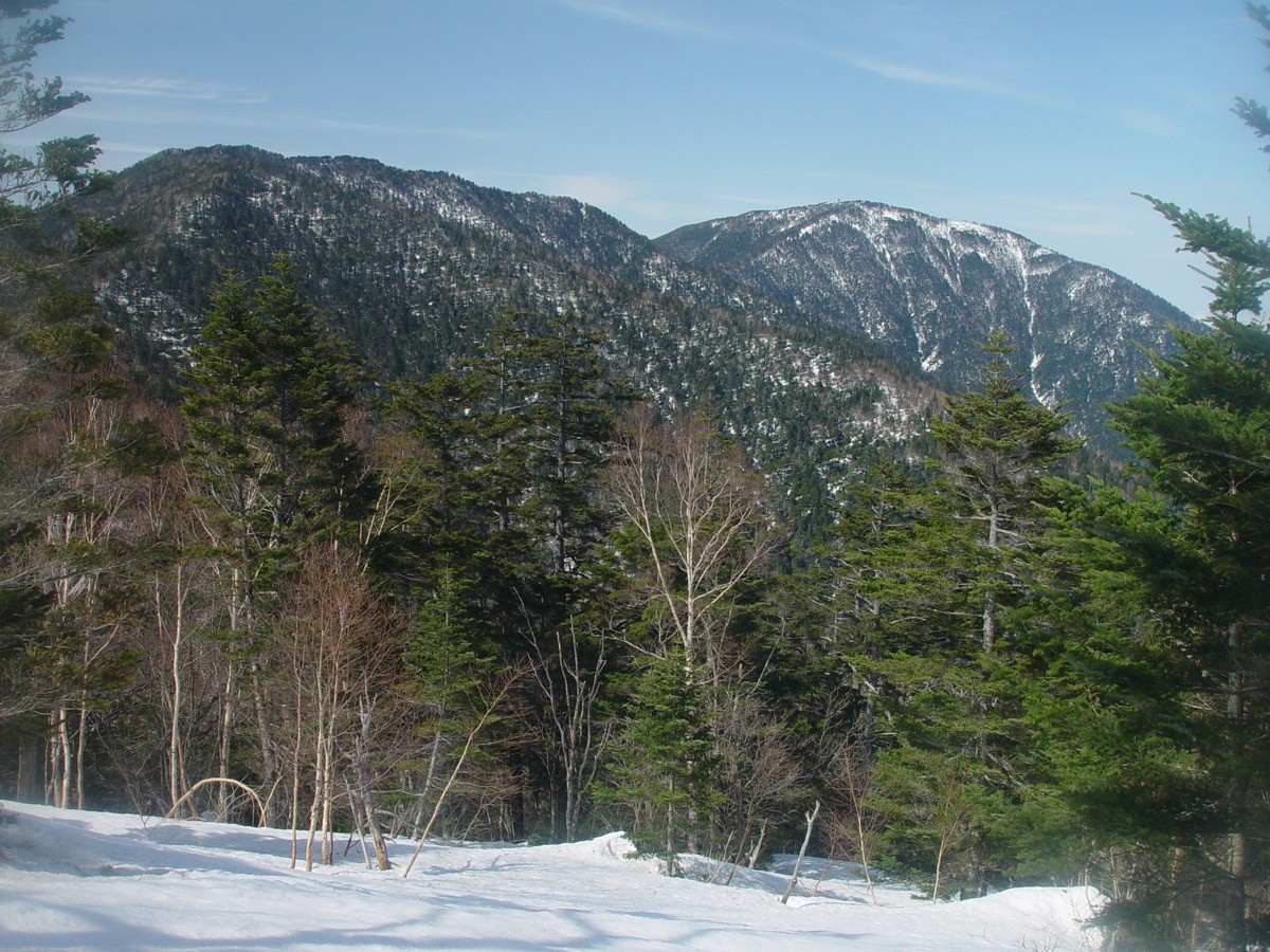
An outlier peak in the foothills of the Northern Alps, it is the highest of the mountain group linking Kiso and Chikuma, and from the summit you take in a grand view of the Northern Alps centred on Mt. Hotaka and Mt. Yari, as well as Mt. Ontake, with an emergency hut near the top. From the Nomatazawa forest road trailhead it is about 2 hours to the hut just below the summit, then about 20 minutes to the top, a round trip of about 5 hours 15 minutes, an intermediate course. Entry requires an advance application to the Asahi Village Tourist Association and the loan of a gate key, and the season is usually mid-June to October 31.
The trailhead is deep on the Nomatazawa forest road. There is no public transport to the trailhead, and you drive up the forest road with the borrowed key, so a rental car or private car is the premise.
The trailhead is deep on the Nomatazawa forest road (about 100 m beyond the entrance to Asahi Prime Ski Resort there is a “Mt. Hachimori trailhead” signboard, and from there you follow the forest road). This road runs through private forest and has a locked gate at its entrance because of landslide and fallen-tree hazards, so during the open season you apply to the Asahi Village Tourist Association for permission and borrow the key (in principle by one week before your planned climb, by email / fax / post / in person; the keys and parking spaces are limited, and general entry is not allowed on the day of the early-August climbing marathon). In 2025 the season ran from June 14 to October 31. Always confirm the 2026 opening date and application method with the Asahi Village Tourist Association (0263-87-1935).
Bears and monkeys are repeatedly sighted on the forest road and trail, so you are asked to carry a bear bell or other noise-maker. The prefab emergency hut at the summit can be used as a refuge in an emergency.
How to access the trailhead
1. [Round trip] Matsumoto Station → Asahi Village Tourist Association → Nomatazawa forest road (Mt. Hachimori trailhead)
The base is Matsumoto Station, and as there is no route bus to the Mt. Hachimori trailhead, the basic plan is to rent a car near Matsumoto Station or come by private car. First collect the gate key at the Asahi Village Tourist Association in Komi, Asahi Village, then pass the hamlet of Onmagoshi and drive up the forest road along the Nomatazawa (about 12 km, around 1 hour by car from the association to the trailhead). The road runs through private forest with a locked gate and has landslide and fallen-tree hazards, so check the open season and road conditions with the Asahi Village Tourist Association in advance.
– Asahi Village Tourist Association 0263-87-1935
Source: [Mt. Hachimori climbing and entry application guide (Asahi Village)]
Route and safety notes
Route: Nomatazawa forest road trailhead → emergency hut (about 2 hours) → Mt. Hachimori (about 20 minutes) → return the way you came. A round trip of about 5 hours 15 minutes, an intermediate course, with a grand view of the Northern Alps including Mt. Hotaka and Mt. Yari from the summit.
Entry application and forest road: entry requires an advance application to the Asahi Village Tourist Association and the loan of a gate key (in principle by one week before your climb). Keys and parking are limited, and applications may be declined. General entry is not allowed on the day of the early-August climbing marathon.
Bears and monkeys: bears and monkeys are repeatedly sighted on the forest road and trail. Carry a bear bell or other noise-maker, and avoid going alone.
Season and gear: the season is usually mid-June to October 31. Confirm the 2026 opening date with the Asahi Village Tourist Association. Carry a map and compass (GPS) and plenty of water, and submit a climbing plan.
In an emergency: in a mishap or accident, call 110 (police) or 119 (fire/rescue).
・Asahi Village Office 0263-99-2001 / Matsumoto Police Station 0263-25-0110
Photo by Alpsdake / Wikimedia Commons, CC0
Comments