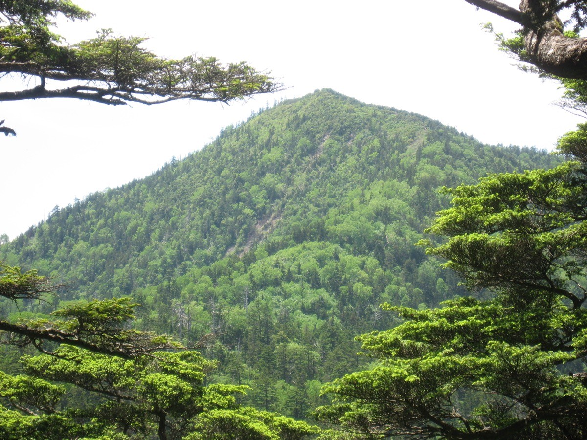
Mt. Taishaku (帝釈山, 2,060 m), on the border of Minamiaizu and Hinoemata in Fukushima and Nikko in Tochigi, is one of the 200 Famous Japanese Mountains.
It lies north of Oze, and its appeal is the marsh spreading across the summit of neighbouring Mt. Tashiro along the connecting ridge, and the easy access and wide views from Masaka Pass. It is also known as a habitat of the rare fern Osabagusa, and the classic plan is a day-trip loop over Mt. Taishaku and Mt. Tashiro from Masaka Pass.
There is no public transport to the Masaka Pass trailhead, so a taxi from the nearest station or a car is the norm. The nearest station is Aizu-Kogen-Ozeguchi on the Aizu and Yagan railways. You reach the Masaka Pass trailhead by taxi from Aizu-Kogen-Ozeguchi Station.
The trailhead is Masaka Pass (Masaka-toge, about 1,790 m). The standard route is Masaka Pass → Mt. Taishaku → Mt. Tashiro (marsh) → Masaka Pass, a loop with a standard time of about 5–6 hours. Masaka Pass to Mt. Taishaku is short at about 50 minutes, beginner to intermediate level. The stretch from Mt. Taishaku toward Mt. Tashiro is a muddy forest path, and the summit area of Mt. Tashiro is a vast marsh laid with boardwalk.
At Masaka Pass there is a simple toilet and parking for about 20 cars, serving as the trailhead base (toilet available only during the mountain-opening season). The best season is early June to early October, after the snow melts; the flowering periods such as Osabagusa in June and day lilies in July are popular. The Masaka forest road to the pass is an unpaved gravel road, so always check the latest conditions in advance.
*Last checked: June 6, 2026
How to access the trailheads
1. [Round trip] Aizu-Kogen-Ozeguchi Station → Masaka Pass (trailhead)
The base is Aizu-Kogen-Ozeguchi Station on the Aizu and Yagan railways. There is no local bus to the Masaka Pass trailhead, so a taxi or a car is the standard option.
To Masaka Pass it is about 2 hours and about ¥25,000 by taxi from Aizu-Kogen-Ozeguchi Station (via Hinoemata; the Masaka forest road is unpaved gravel). As the distance is long, the fare is high. There is no mobile reception around Masaka Pass, so booking both the outbound and return rides in advance is essential. As the loop takes about 5–6 hours, allow margin in the descent time you give for the pickup.
– Aizu Kotsu, Tajima office (taxi) 0241-62-1243
To keep the cost down, an overnight stay is realistic. Take an Aizu Bus toward Hinoemata from Aizu-Kogen-Ozeguchi Station (operating roughly early May to end of October; departures from the station around 9:40, 10:40, 12:35 and 14:10, about 68 minutes) to Hinoemata Onsen, stay overnight, and head to Masaka Pass by taxi the next morning (about 15 km of forest road). Some Hinoemata inns can arrange a pickup or a taxi for you.
Forest road / inquiries: For closures of the Masaka forest road or the trail, check in advance with the Hinoemata Village Tourism Association (0241-75-2432). If you drive, there is parking at Masaka Pass (about 20 cars).
Source: [Aizu Bus route timetables] / [Fukushima Oze, Tashiro–Taishaku course]
Route and safety notes
Route: Masaka Pass → Mt. Taishaku (2,060 m) → Masaka Pass → Mt. Tashiro (1,926 m, marsh) → Masaka Pass, an out-and-back loop. The standard time is about 5–6 hours. Masaka Pass to Mt. Taishaku is short at about 0.9 km and 50 minutes, and from the summit you can see Mt. Hiuchi in Oze and the mountains of Aizu. The summit area of Mt. Tashiro is a vast marsh with a one-way boardwalk, a treasury of alpine plants.
Mud and boardwalk: The Mt. Taishaku–Mt. Tashiro stretch is a muddy forest belt with many slippery tree roots. The boardwalk on the Tashiro marsh is slippery after rain; to protect the marsh, do not step off it.
Forest road and access: The Masaka forest road to the pass is an unpaved gravel road and can be closed after heavy rain or while snow lingers. Check the weather and forest-road conditions not only for the day but for the preceding several days. There is no mobile reception around Masaka Pass.
Gear and season: The best season is early June to early October. Carry water, food, rain gear, warm clothing, a headlamp, and a map/GPS.
Emergencies: In an accident or emergency, call 110 (police) or 119 (fire/rescue).
・Hinoemata Village Hall 0241-75-2311
Photo by Qwert1234 / Wikimedia Commons, CC BY-SA 4.0


Comments