
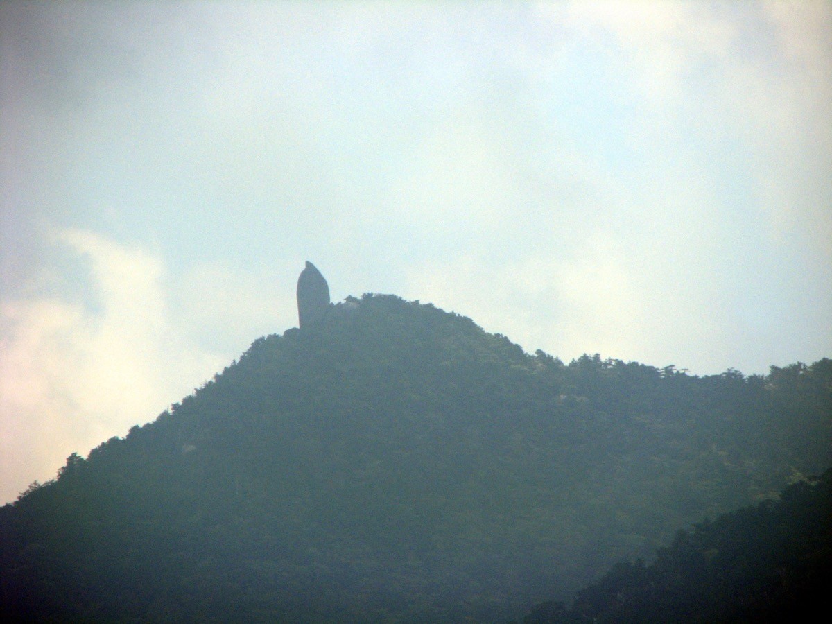
Mount Tachu (Tachudake, 1,497 m) is a mountain on Yakushima in Kagoshima, and is one of Japan’s 300 Famous Mountains.
Its symbol is Tenchūseki, a 40-metre monolith that rises from the summit, and its appeal lies in the mystical trail through moss-covered Yakusugi cedar forest to the great rock. Starting from Yakusugi Land, the out-and-back to Tenchūseki takes about 6 to 7 hours and suits strong walkers.
To reach the trailhead, use Anbō on Yakushima as a base and take a bus bound for Yakusugi Land, a guide shuttle or a taxi.
The hike starts at Yakusugi Land (about 1,000 m), right by the “Yakusugi Land” bus stop. The main route is Yakusugi Land → the Tenmon-no-mori forest → Mount Tachu and Tenchūseki (1,497 m) and back, about 7 km and 6 to 7 hours, a route for strong walkers. The latter half is a steep climb, emerging at the base of Tenchūseki just below the top.
You can climb year-round, but fresh green to autumn (April–November) is easiest, while in winter watch for snow and ice. Always check the latest trail conditions and arrange a bus or shuttle before you go.
*Last checked: June 7, 2026
How to access the trailheads
1. [There & Back] Anbō / Miyanoura ⇄ Yakusugi Land (local bus + taxi)
Cross from Kagoshima to Miyanoura Port or Anbō Port on Yakushima by high-speed boat or ferry. Reach Yakusugi Land by local bus, taxi or a guide shuttle.
① Miyanoura / Anbō → Yakusugi Land (local bus)
From Miyanoura or Anbō, take the local bus toward Kigen-sugi and get off at the “Yakusugi Land” stop. Take a morning bus up, but as Mount Tachu is a 6-to-7-hour round trip, mind the time of the return bus.
② Anbō → Yakusugi Land (taxi or shuttle)
It is about 40 minutes by car from Anbō to Yakusugi Land. For a reliable day hike, a taxi or a guided-tour shuttle is convenient.
— Anbō Taxi 0997-46-2333 / Yakushima Kotsu Taxi, Anbō office 0997-46-2321.
③ Note (entry and season): entering Yakusugi Land requires a cooperation fee, handled at the management hut during opening hours. Buses are infrequent, so always check the latest timetable.
By car / rental car: there is free parking at Yakusugi Land, about 40 minutes by rental car from central Anbō.
References: [Yakushima Tourism Association: Mount Tachu] / [Yakushima Tourism Association (access)]
Trail Guide and Safety Notes
Route: branching off the Yakusugi Land boardwalk, the route passes Jamon-sugi and the Tenmon-no-mori forest to Mount Tachu and Tenchūseki (1,497 m) and back, about 7 km, 497 m of climb and 6 to 7 hours, a route for strong walkers. The latter half is a steep climb over roots and rock.
Weather and footing: Yakushima has a lot of rain, and the trail is slippery with moss and roots, so waterproof gear and grippy shoes are essential. The base of Tenchūseki is a viewpoint, but take care on the rocks.
Forest and highlights: the trail is lined with ancient Yakusugi cedars and moss-covered old-growth forest, a mystical walk typical of Yakushima. The summit’s Tenchūseki is a 40-metre granite monolith, striking in the way it juts toward the sky.
Equipment and emergencies: carry rain gear, warm clothing, a headlamp, a map/GPS, plenty of food and water. In an accident or emergency call 110 (police) or 119 (fire/ambulance).
・Yakushima Police Station 0997-46-2110
Photo by Chris 73 / Wikimedia Commons, CC BY-SA 3.0
Comments