
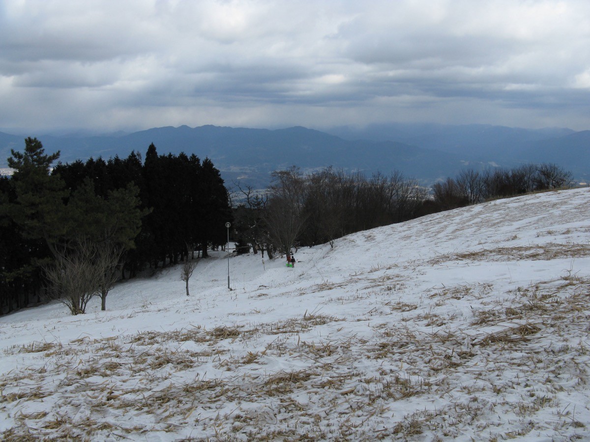
Mount Yamato-Katsuragi (Yamato-Katsuragisan, 959 m) sits on the border of Gose City in Nara and Osaka Prefecture, and is one of Japan’s 300 Famous Mountains.
The main peak of the Kongō range facing Mount Kongō, it is famous for the great azalea fields that turn the summit deep red in May — “a million blooms at a glance” — and for views over the Osaka Plain and Mount Kongō. The Katsuragi Ropeway carries you almost to the top, leaving an easy walk of about 15 minutes to the summit.
For public-transport access, take a Nara Kotsu bus from Kintetsu Gose Station to Katsuragi-Ropeway-mae.
The trailhead is Katsuragi-tozanguchi Station (the ropeway base station), with toilets and parking nearby. Ride the ropeway up to Katsuragi summit station, then summit station → promenade → summit of Mount Yamato-Katsuragi (959 m) and back, a beginner route of about 40 minutes when using the ropeway. The summit area is known for azaleas in May and pampas grass in autumn, with wide views of the Osaka Plain, Mount Kongō and the Nara Basin.
The best season is all year (azaleas peak in May). To climb on foot there are the Kujira Falls route and the north-ridge route (about 2 hours from the trailhead). Always check the latest ropeway operation and bus times before you go.
*Last checked: June 6, 2026
How to access the trailheads
1. [There & Back] Kintetsu Gose Station ⇄ Katsuragi-Ropeway-mae (Nara Kotsu bus & ropeway)
Gose Station on the Kintetsu Gose Line (the JR Wakayama Line’s Gose Station is adjacent) is your base. From the station, take a Nara Kotsu bus to Katsuragi-Ropeway-mae, then ride the ropeway up.
① Kintetsu Gose Station → Katsuragi-Ropeway-mae (Nara Kotsu bus routes 80 & 88)
The bus bound for Katsuragi-Ropeway-mae takes about 15–19 minutes and costs 340 yen. Departures include Kintetsu Gose Station 8:40, 10:40, 12:40 and 14:33, and it is about a 2-minute walk to the ropeway station after you get off.
② Katsuragi Ropeway (Katsuragi-tozanguchi Station → Katsuragi summit station)
The ropeway is 1,500 yen round trip (950 yen one way), open 9:10–17:00. It takes about 6 minutes from the base to the summit station (occasional closures for maintenance).
③ Katsuragi-Ropeway-mae → Kintetsu Gose Station (return)
Buses back to Kintetsu Gose Station also run during the day. Always check the time of the last bus.
④ To climb on foot: from Katsuragi-tozanguchi it is about 2 hours to the summit via the Kujira Falls route or the north-ridge route. There is also a round-trip plan on foot for strong walkers without using the ropeway.
⑤ Taxi: a taxi from Gose Station is also available.
— Gose Taxi 0745-62-3105
By car: there is a paid car park at Katsuragi-tozanguchi.
References: [Katsuragi Ropeway] / [Nara Kotsu]
Trail Guide and Safety Notes
Route: Ropeway summit station → promenade → summit of Mount Yamato-Katsuragi (959 m) and back. The standard time is about 40 minutes, a beginner route. On foot it is Katsuragi-tozanguchi → Kujira Falls route → summit (about 2 hours). From the summit the Diamond Trail continues toward Mount Kongō.
Crowds in azalea season: at the May azalea peak the ropeway becomes very crowded, with long waits to board. Consider an early start or the walking route.
Views and seasons: the summit gives wide views of the Osaka Plain, Mount Kongō and the Nara Basin. Highlights are azaleas in May, pampas grass in autumn and rime ice in winter. There can be snow and ice in winter.
Equipment and emergencies: wear comfortable shoes and carry warm clothing, rain gear, water and a map. In an accident or emergency call 110 (police) or 119 (fire/ambulance).
・Gose Police Station 0745-62-0110
Photo by KENPEI / Wikimedia Commons, CC BY-SA 3.0
Comments