
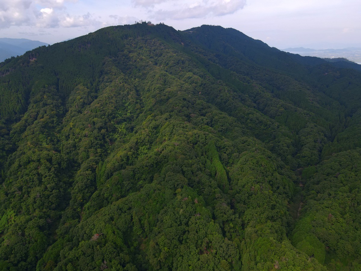
Mount Hiei (Hieizan, 848 m at its highest peak, Ōhiei) sits on the border of Ōtsu City in Shiga and Kyoto City, and is one of Japan’s 300 Famous Mountains.
A mountain of ancient faith, it is dotted with the halls and pagodas of the World Heritage temple Enryaku-ji, and from the heights you can look out over Lake Biwa and the city of Kyoto. The Sakamoto Cable, the longest funicular in Japan, carries you straight up, and from Enryaku-ji it is an easy walk of about 40 minutes to Ōhiei.
For public-transport access, from JR Hieizan-Sakamoto Station go via Cable Sakamoto Station and take the Sakamoto Cable to Enryaku-ji.
The trailhead is Cable Enryakuji Station (about 650 m), the base for the Enryaku-ji Tōdō area. Ride the Sakamoto Cable up, then Cable Enryakuji Station → Enryaku-ji Tōdō → Ōhiei (848 m) and back, a beginner route of about 1 hour 30 minutes to 2 hours. From the heights there is a wide view of Lake Biwa and Kyoto, and you can also tour the halls of Enryaku-ji.
The best season is all year (with snow in winter). From the Kyoto side there are the Eizan Cable and Ropeway, and for strong walkers the Kirarazaka trail from Shūgakuin. Always check the latest cable operation and temple-visit information before you go.
*Last checked: June 6, 2026
How to access the trailheads
1. [There & Back] Hieizan-Sakamoto Station ⇄ Enryaku-ji (Sakamoto Cable)
Hieizan-Sakamoto Station on the JR Kosei Line (or Sakamoto-Hieizanguchi Station on the Keihan Ishiyama-Sakamoto Line) is your base. Walk from the station to Cable Sakamoto Station and take the Sakamoto Cable up.
① Hieizan-Sakamoto Station → Cable Sakamoto Station (on foot)
It is about a 10–15 minute walk from JR Hieizan-Sakamoto Station to Cable Sakamoto Station (about 10 minutes from Keihan Sakamoto-Hieizanguchi Station). Kojak (Kojaku) local buses are also available.
② Sakamoto Cable (Cable Sakamoto → Cable Enryakuji)
At 2,025 m it is the longest funicular in Japan: 1,660 yen round trip (870 yen one way), about 11 minutes, departing at :00 and :30 each hour. Hours are March–November 8:00–17:30, December–February 8:30–17:00.
③ Cable Enryakuji Station → Ōhiei (on foot)
From Cable Enryakuji Station via the Enryaku-ji Tōdō it is about 40 minutes on foot to the highest peak, Ōhiei (848 m). Return by the same route to the cable (mind the last descent time).
④ Alternative route (Kyoto side): from the Kyoto side, take the Eizan Railway to Yase-Hieizanguchi Station, then the Eizan Cable (1,200 yen round trip) and Eizan Ropeway (800 yen round trip) to the Hiei summit. Strong walkers can also use the Kirarazaka trail from Shūgakuin.
⑤ Taxi: a taxi from Sakamoto Station is also available.
— Kojak Taxi 077-578-0500
By car: use the Hieizan and Oku-Hiei Driveways to the summit car parks (toll roads).
References: [Sakamoto Cable] / [Mount Hiei & Lake Biwa tourism]
Trail Guide and Safety Notes
Route: Cable Enryakuji Station → Enryaku-ji Tōdō → Ōhiei (848 m) and back. The standard time is about 1 hour 30 minutes to 2 hours, a beginner route. Combined with a tour of the Enryaku-ji halls (Tōdō, Saitō and Yokawa) it becomes a half- to full-day outing. The summit of Ōhiei has a first-order triangulation point.
Temple visits and paths: Enryaku-ji is a World Cultural Heritage site with reception desks and visiting hours. The grounds are busy with worshippers, so walk quietly and mind your manners. The hall circuit mixes paved roads and mountain paths.
Views and seasons: from the heights there is a wide view of Lake Biwa and Kyoto. Fresh greenery and autumn colours are the highlights, and in winter there is snow and ice. The cable and ropeway run in winter too, but note shortened hours and possible suspensions.
Equipment and emergencies: wear comfortable shoes and carry warm clothing, rain gear, water and a map. In an accident or emergency call 110 (police) or 119 (fire/ambulance).
・Ōtsu-Kita Police Station 077-524-0110
Photo by Benlisquare / Wikimedia Commons, CC BY-SA 4.0
Comments