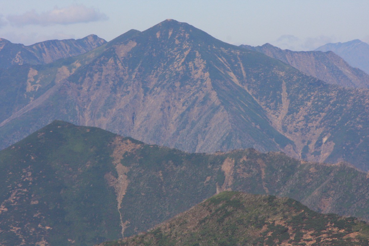
Mt. Petegari (ペテガリ岳, 1,736 m), on the border of Shinhidaka in Hidaka and Taiki in Hiroo, Hokkaido, is one of the 200 Famous Japanese Mountains.
Rising in the deepest part of the Hidaka Mountains, it is one of the hardest of the 200 Famous Mountains, called “the far-off mountain,” and its appeal is the deep ridge and grand view reached over stream walking and narrow ridges. The current route climbs the West Ridge via Petegari Hut from Kamui Hut on the Urakawa side, and it is an advanced-only route of two nights and three days with river fords and bushwhacking.
There is no public transport to the trailhead, so a bus as far as Urakawa and then a private car or a taxi (hire car) is the norm. From the town of Urakawa you reach Kamui Hut via the Motoura-gawa forest road.
The trailhead is Kamui Hut (Urakawa, an unstaffed emergency shelter). The standard route is Kamui Hut → fording and stream walking along the Nishuomanai River → over a ridge → Petegari Hut (overnight) → the West Ridge → Mt. Petegari, out and back, over two nights and three days. With river fords, faint cut paths and bushwhacking, there is little clear trail, so a map and GPS are essential on this hardest-grade route.
On the Shizunai side, Prefectural Route 111 (Shizunai-Nakasatsunai) is permanently closed by rockfall (even on foot), so at present you can only enter from the Urakawa side. The Motoura-gawa forest road to Kamui Hut is unpaved and open only from June to September (and can close after heavy rain). The area is brown-bear habitat. The best season is June to September, so always check the latest forest-road and trail conditions in advance.
*Last checked: June 6, 2026
How to access the trailheads
1. [Round trip] Urakawa → Motoura-gawa forest road → Kamui Hut (trailhead)
The nearest town is Urakawa. There is no public transport to the trailhead, so access is by car only.
① Public transport to Urakawa
The JR Hidaka Line (Mukawa–Samani) closed to rail service in 2021, and you now reach the Urakawa and Samani area by the Donan Bus Hidaka regional public bus. From Sapporo you can also use the Pegasus express bus.
② Urakawa → Kamui Hut (private car / taxi)
From Urakawa, go by private car or a taxi (hire car), from Ogifushi on National Route 235 via Prefectural Routes 384 and 348, then about 37 km up the Motoura-gawa forest road (unpaved, open June–September) to Kamui Hut. On the Shizunai side, Prefectural Route 111 is permanently closed by rockfall. Mobile reception on the forest road is poor and it can close after heavy rain, so booking and checking conditions in advance are essential.
― Lotus Kabutani Shokai (Urakawa) 0146-28-1016
― Toei Sawatani Auto Service (Urakawa) 0146-25-2221
Inquiries: For the latest forest-road and trail information, check with the Hidaka Nanbu Forest Office (0146-42-1615).
Source: [Shinhidaka Town, Mt. Petegari climbing info] / [Hokkaido Forest Office, climbing info]
Route and safety notes
Route: Kamui Hut → Nishuomanai River (fording, stream walking) → over a ridge → Petegari Hut → the West Ridge → Mt. Petegari (1,736 m). The trip is two nights and three days, a hardest-grade advanced route representative of the Hidaka Mountains. After climbing the long West Ridge, the grand view of the main Hidaka ridge opens up.
Fords, bush and route-finding: The fords of the Nishuomanai River are dangerous in high water, and with cut paths and bush there is little clear trail and it is easy to lose the way, so a map and GPS are essential. Take particular care after rain.
Brown bears and unstaffed huts: The area is brown-bear habitat. Carry a bear bell and manage your food. Kamui Hut and Petegari Hut are unstaffed emergency shelters, so bring your own bedding, water and food.
Season and gear: The best season is June to September, while the forest road is open. Carry stream-crossing gear, rain gear, warm clothing, a headlamp, a map/GPS and spare food.
Emergencies: In an accident or emergency, call 110 (police) or 119 (fire/rescue).
・Urakawa Police Station 0146-22-0110
Photo by Highten31 / Wikimedia Commons, CC BY-SA 3.0
Comments