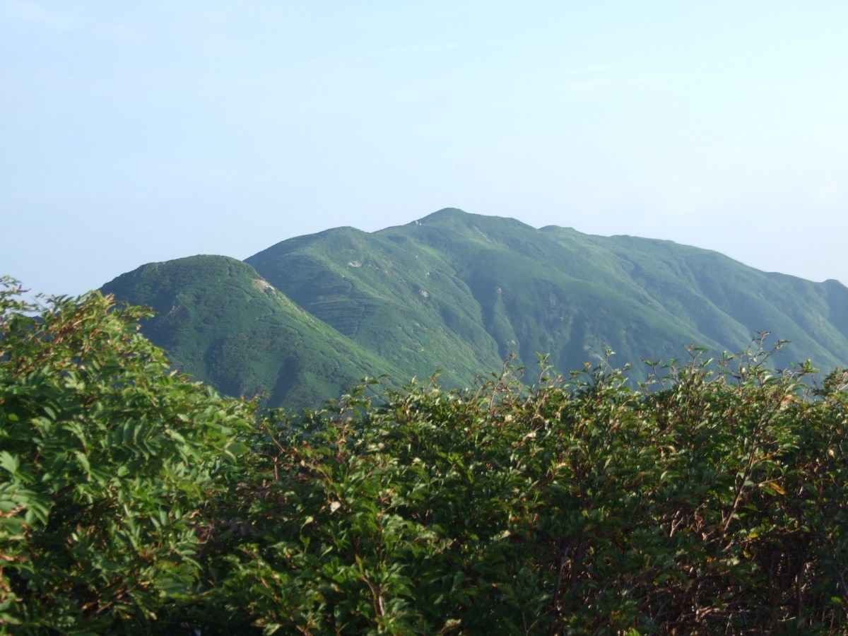
Mt. Eburisashi (朳差岳, 1,636 m) in Sekikawa, Niigata, is one of the 200 Famous Japanese Mountains.
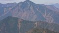
At the northern end of the Iide Mountains, it is a quiet peak prized for the “sky-high flower fields” spread along its gentle ridge and the wide view from the Eburisashi emergency hut just below the summit. The shortest Ashinomatsu Ridge route is closed from June 1 to November 30, 2026 (the trail from the Ashinomatsu trailhead to the Oishiyama junction) following a bear incident in November 2025. For the 2026 season, the Gonnai Ridge (Higashimata route) from the Oishi Dam is therefore the alternative, an advanced long route of about 22 km round trip with a standard time of over 15 hours.
The trailhead is the Oishi Dam (Higashimata Sculpture Park). Public access is basically by taxi from Echigo-Shimoseki Station, on the premise of a two-day trip with a night at the hut.
The trailhead is the gate of the Oishi Dam Higashimata Sculpture Park (about 15 parking spaces; about 2.3 km from the gate to the trailhead). Because the shortest Ashinomatsu Ridge is closed from June 1 to November 30, 2026, the 2026 season uses the Gonnai Ridge (Higashimata route) from the Oishi Dam. From the sculpture-park gate you walk a forest road, cross the Higashimata No. 2 Bridge to begin the real climb, join the main ridge from the Oishi Dam at Kamosu-no-Atama, and pass Gonnai Peak and Mae-Eburisashi to the summit. It is an advanced long route of about 22.2 km round trip with a standard time of 15 hours 15 minutes, normally done over two days.
The unstaffed Eburisashi hut just below the summit is the base, with water from a snowfield on its east side, but there is no water beyond the end of the forest road, so resupply with care. This is bear country, so carry a bear bell and submit a climbing plan. The season is late June to October, once the lingering snow clears.
How to access the trailhead
1. [Round trip] Echigo-Shimoseki Station → Oishi Dam (Mt. Eburisashi Higashimata trailhead)
The nearest base is Echigo-Shimoseki Station (JR Yonesaka Line). Because the Yonesaka Line has been suspended between Sakamachi and Imaizumi since the August 2022 floods and replaced by a substitute bus, transfer to the Yonesaka substitute bus at Sakamachi Station (Uetsu Main Line) to reach Echigo-Shimoseki (the substitute-bus times were revised on March 14, 2026; check the latest with JR East). From Echigo-Shimoseki Station, take a taxi to the Oishi Dam (Higashimata Sculpture Park) trailhead, as there is no route bus. By car, head for the Oishi Dam from the Arakawa-Tainai IC on the Nihonkai-Tohoku Expressway.
– Arakawa Taxi 0120-641042 / Sekikawa Village Office 0254-64-1331
Source: [Oishi Dam trailhead info (Yamakei Online)]
Route and safety notes
Route: Oishi Dam Higashimata Sculpture Park → Higashimata No. 2 Bridge → Kamosu-no-Atama → Gonnai Peak → Mae-Eburisashi → Mt. Eburisashi. It is an advanced long route of about 22.2 km round trip with a standard time of 15 hours 15 minutes, normally done over two days. The Nishimata route (Oguma Ridge) is closed due to many dangerous sections.
Ashinomatsu Ridge closure: the shortest Ashinomatsu Ridge (from the Okutainai Hütte) is closed from June 1 to November 30, 2026, between the Ashinomatsu trailhead and the Oishiyama junction, after a bear incident in November 2025. The 2026 season uses the Gonnai Ridge from the Oishi Dam.
Hut and water: the unstaffed Eburisashi hut just below the summit is the base, with water from a snowfield on its east side. There is no water beyond the end of the forest road, so carry enough up.
Season: the season is late June to October, once the lingering snow clears. This is bear country, so carry a bear bell and do not go with beginners only. Submit a climbing plan and carry warm and rain gear and a map and compass (GPS).
In an emergency: in a mishap or accident, call 110 (police) or 119 (fire/rescue).
・Sekikawa Village Office 0254-64-1331
Photo by Amadeus0220 / Wikimedia Commons, CC BY-SA 3.0
Comments