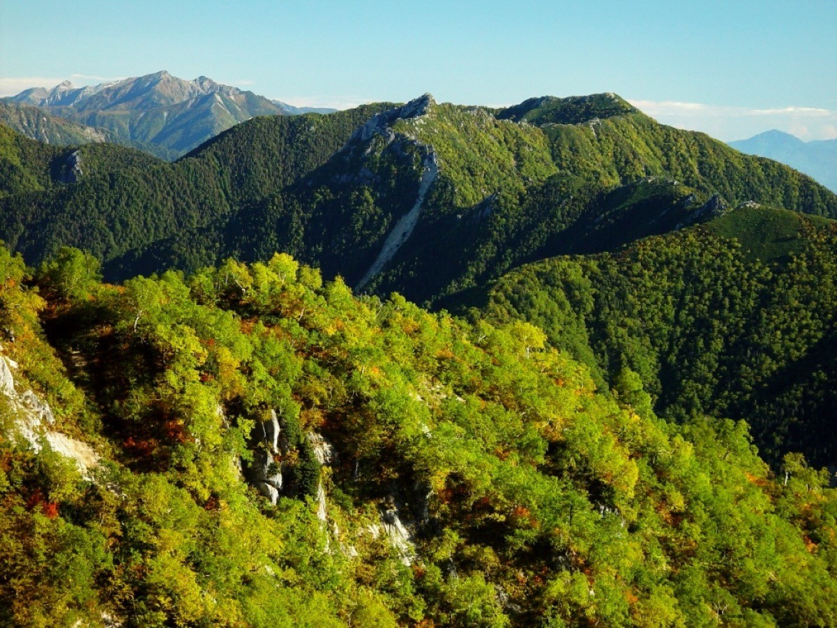
Mt. Gaki (餓鬼岳, 2,647 m) in Omachi, Nagano Prefecture, is one of the 200 Famous Japanese Mountains.
Standing near the northern end of the Northern Alps, it is a quiet, little-known fine peak with few climbers, and from the summit you see Mt. Yari, Mt. Hotaka and Mt. Tsubakuro close at hand. The Shirasawa route is a long climb of about 1,730 m of ascent over roughly 12 km round trip, and a two-day trip staying at the Gakidake hut is standard, for fit hikers.
The nearest station is Shinano-Omachi on the JR Oito Line. From Shinano-Omachi you reach the Shirasawa trailhead by taxi.
The trailhead is the Shirasawa trailhead. The route runs Shirasawa trailhead → last water point → Mt. Onagi → Hyaku-magari → Gakidake hut → Mt. Gaki and back; the standard round trip is about 10 hours, with about 1,730 m of ascent, a demanding intermediate climb. The climb along Shirasawa has chains and rocky spots one after another, and is especially dangerous when the river is high. Past Mt. Onagi, Hyaku-magari is a series of steep switchbacks.
Because the route is long, a two-day trip staying at the Gakidake hut (reservation required) is the rule. In 2026 the hut is open July 1 to mid-October, with capacity about 70 and 5 tent spaces (2,000 yen per person, reservation required). Water is at the last water point along Shirasawa, and there are toilets at the Shirasawa trailhead and the Gakidake hut. The season is early July to early October.
How to access the trailheads
1. [Round trip] Shinano-Omachi Station → Shirasawa trailhead (Mt. Gaki trailhead)
From the Matsumoto side, take the JR Oito Line to Shinano-Omachi Station. The Shirasawa trailhead is about 20 minutes by taxi from Shinano-Omachi Station (around 4,000 yen).
There is no route bus to the Shirasawa trailhead, so a taxi is the norm. As the number of cabs is limited, reserve both ways in advance; telling the company your expected descent time for a pickup is reassuring. Taxi companies include Alps Daiichi Kotsu in front of the station.
– Alps Daiichi Kotsu (in front of Shinano-Omachi Station) 0261-22-2121
– Gakidake hut (lodging reservations) 0261-22-2220
Source: [Omachi Tourism Association, Shirasawa trailhead] / [Shinano-Omachi access]
Route and safety notes
Route: Shirasawa trailhead → last water point → Mt. Onagi → Hyaku-magari → Gakidake hut → Mt. Gaki. The standard round trip is about 10 hours, around 12 km, with about 1,730 m of ascent, a demanding intermediate climb.
Rocks and the stream: the climb along Shirasawa has chains and rocky spots one after another. It is especially dangerous when the river is high, so avoid going in bad weather or after heavy rain. Hyaku-magari is a series of steep switchbacks.
Two-day trip: a day trip is hard, so a two-day trip staying at the Gakidake hut (reservation required; open July 1 to mid-October in 2026) is the rule. Water is at the last water point along Shirasawa.
Gear and season: the season is early July to early October. Carry water, food, rain gear and warm clothing, and submit a climbing plan.
In an emergency: call 110 (police) or 119 (fire/rescue).
・Omachi Police Station 0261-22-0110
Photo by Alpsdake / Wikimedia Commons, Public domain

Comments