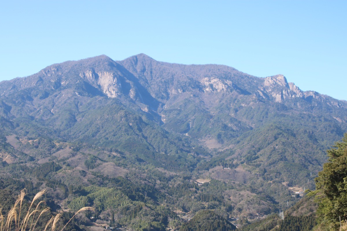
Mt. Okue (大崩山, 1,643 m) in Nobeoka, Miyazaki, is one of the 200 Famous Japanese Mountains.
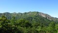
The main peak of the Okue massif in the Kyushu Mountains, it is famous as one of Kyushu’s last wild frontiers, with huge granite spires (the Waku-zuka rocks and Bozu Ridge) rising above the Hori River valley. With slab climbs on fixed ropes, ladders, and river crossings one after another, it is a mountain for experienced hikers.
There is currently no public transport (local bus or shared taxi) to the trailhead. The nearest station is Nobeoka on the JR Nippo Main Line, and you reach the Kami-Hori trailhead by taxi from Nobeoka Station.
The trailhead is Kami-Hori trailhead (the Mt. Okue trailhead, about 612 m). The standard route is a loop: Mt. Okue trailhead → Okue Hut → Sodedaki → Waku-zuka Ridge → Mt. Okue summit → Bozu Ridge → trailhead, with a standard time of about 8–10 hours, advanced level. It is a scenic course linking the rock peaks of Lower, Middle, and Upper Waku-zuka, but you cross the Hori River right after the start, so after rain or in high water the crossing becomes impossible and entry is not allowed. Bozu Ridge has ladders and the “Zo-iwa (Elephant Rock)” traverse, where a fall can be fatal.
The season runs from spring (Akebono azaleas) to autumn (foliage). A day trip is possible but the route is long, so an overnight stay nearby is recommended. Always check the latest trail and weather conditions in advance.
How to access the trailheads
1. [Round trip] Nobeoka Station → Kami-Hori trailhead (Mt. Okue trailhead)
Take the JR Nippo Main Line to Nobeoka Station from the Oita or Miyazaki direction. There is currently no local bus or shared taxi to the Kami-Hori trailhead (Mt. Okue trailhead), so a taxi is the standard option.
From Nobeoka Station to the Kami-Hori trailhead is about 35 km and roughly 1 hour, costing on the order of ¥10,000 one way (the road follows a narrow forest road along the Hori River, so ask each company for an exact fare in advance). No taxis wait at the trailhead and mobile phone reception is poor, so booking both the outbound and return rides in advance is essential. Tell the company your expected descent time and arrange the pickup.
– Miyazaki Daiichi Kotsu, Nobeoka office 0982-33-3345
– Miyako Taxi, Nobeoka office 0982-32-5431
– Green Taxi (Nobeoka) 0982-33-5433
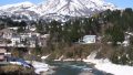
Overnight stay / bath after the hike: Hourigawa Onsen “Bijin-no-Yu” (0982-23-3080), just before the trailhead, is a day-use hot spring with views of Mt. Okue (open 10:00–20:00, closed Thursdays). It has no lodging, so for an overnight stay use one of the guesthouses around Hourigawa Onsen.
If you drive, there is a free car park at the Kami-Hori trailhead.
Source: [Nobeoka City, Mt. Okue] / [Visit Miyazaki, Mt. Okue]
Route and safety notes
Route: Kami-Hori trailhead → Okue Hut (about 40–60 minutes on foot from the trailhead) → Sodedaki → Waku-zuka Ridge (Lower, Middle, Upper Waku-zuka) → Mt. Okue summit (1,643 m) → Bozu Ridge → trailhead. The standard loop time is about 8–10 hours, advanced level.
River crossing: You cross the Hori River soon after the trailhead. After rain or in high water the crossing is impossible and you must turn back, so check the weather not only for the day but for the preceding several days and skip the climb in poor conditions.
Rock sections and hazards: Waku-zuka to Bozu Ridge has slab climbs on fixed ropes, ladders, and the “Elephant Rock” traverse one after another, and a fall can be fatal. As of 2025 the course near Middle Waku-zuka has been rerouted and is partly indistinct, so a map, GPS, and the latest information are essential. Those without sufficient fitness, rock experience, and gear should not attempt it.
Gear and season: The season runs spring to autumn. Always carry water, food, rain gear, a headlamp, and a map/GPS, and prepare for a long day.
Emergencies: In case of accident or distress, call 110 (police) or 119 (fire/rescue). Mobile reception is absent over much of the route, so submitting a climbing plan and avoiding solo hiking are strongly recommended.
・Nobeoka City Hall 0982-22-7000
Photo by Yama0904 / Wikimedia Commons, CC BY-SA 4.0
Comments