
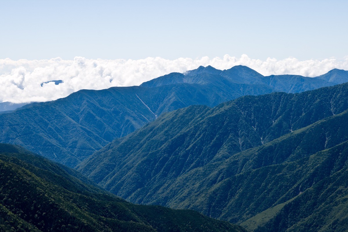
Mt. Zaru (笊ヶ岳, 2,629 m), on the border of Hayakawa in Minamikoma, Yamanashi and Aoi Ward in Shizuoka City, is one of the 200 Famous Japanese Mountains.
On the Shirane-Nanrei ridge of the Southern Alps, it is a twin-peaked mountain of Ozaru and Kozaru, and its appeal is the grand view from the summit over the main Southern Alps ridge, including Mt. Akaishi and Mt. Hijiri. Known as one of the hardest peaks, “far from anywhere,” it is an advanced route of more than 2,000 m of ascent climbed from Oidaira over Mt. Nunobiki.
For public transport to the trailhead, you can reach near Oidaira from JR Minobu Station by combining the Hayakawa community bus and a reservation-only shared taxi.
The trailhead is the road-end gate at Oidaira (about 580 m), where there is a climbing-register post. The standard route is Oidaira → Hirogawara → Yama-no-kami → Mt. Hinoyokote → Mt. Nunobiki → Mt. Zaru, out and back, with a one-way standard time of about 9–10 hours. With its large elevation gain it is an advanced route best done over two days with one night near Mt. Nunobiki (a very long day trip is possible for strong hikers). Along the way are fords and a suspension bridge at Hirogawara and a long steep climb from Mt. Hinoyokote to Mt. Nunobiki.
There are good campsites around Mt. Nunobiki, but few reliable water sources, so carry plenty of water. The best season is June to October after the snow melts; beware of high water at the fords, the steep climb, route-finding and weather changes on the nearly 3,000 m ridge. Always check the latest trail, forest-road and bus conditions in advance.
*Last checked: June 6, 2026
How to access the trailheads
1. [Round trip] Minobu Station → Oshima → Baba → Oidaira (trailhead)
The base is Minobu Station on the JR Minobu Line. To Oidaira you combine the Hayakawa community bus and a reservation-only shared taxi.
① Minobu Station → Oshima (Hayakawa community bus)
Take the “Hayakawa community bus” from Minobu Station and get off at Oshima, about 40 minutes. It is reservation-only (book by 19:00 the day before), and large hiking luggage costs an extra ¥200.
― Minobu Station dep.: 7:54 / 12:14 / 14:34 / 17:34 (toward Narada Onsen)
② Oshima → Baba (reservation-only shared taxi)
From Oshima to Baba is about 20 minutes by Hayakawa’s reservation-only shared taxi (operated by Sumise Taxi). This too must be booked by 19:00 the day before.
― Sumise Taxi 0556-45-2062
③ Baba → Oidaira (about 15 minutes on foot)
From Baba, about 15 minutes on the paved road reaches the Oidaira hamlet, and the road-end gate beyond it is the trailhead. There is parking for about 10 cars before the gate.
Inquiries: For the latest bus and trail information, check with Hayakawa Town Hall (0556-45-2511).
Source: [Hayakawa Town, public transport] / [Yamakei Online, Oidaira]
Route and safety notes
Route: Oidaira → Hirogawara → Yama-no-kami → Mt. Hinoyokote → Mt. Nunobiki (2,584 m) → Mt. Zaru (2,629 m). The one-way standard time is about 9–10 hours, a very long advanced route with over 2,000 m of ascent. From the main peak, Ozaru, the grand view of Mt. Akaishi, Mt. Hijiri and Mt. Fuji opens up.
Fords and steep climb: Around Hirogawara there are fords and a suspension bridge, dangerous in high water. From Mt. Hinoyokote to Mt. Nunobiki, a long, steep climb tests your stamina, and in rain or fog take care not to lose the way.
Water, camping and season: As reliable water sources are few, carry plenty of water. There are good campsites around Mt. Nunobiki. The best season is June to October; outside it, snow and ice make it unsuitable for general hiking.
Gear and emergencies: Carry rain gear, warm clothing, a headlamp, a map/GPS, a bivy sack, and ample food. In an accident or emergency, call 110 (police) or 119 (fire/rescue).
・Nanbu Police Station 0556-64-2611
Photo by Σ64 / Wikimedia Commons, CC BY 3.0
Comments