Mt. Kushigata (櫛形山, 2,052 m), on the border of Minami-Alps and Fujikawa in Yamanashi, is one of the 200 Famous Japanese Mountains.
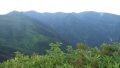
A gently sloping outlier of the Southern Alps, it is known for the iris fields spreading across Ayame-daira and Hadakayama, and its beautiful old-growth and moss-covered forest. As you can reach the summit in a short time from the forest-road end, it is a beginner-to-intermediate mountain that a wide range of people can enjoy.
There is no local bus to the trailhead, so a taxi from the nearest station is the norm. The nearest stations are Ichikawa-Daimon and Kajikazawaguchi on the JR Minobu Line, or Kofu on the JR Chuo Main Line. From these stations you reach the Ikenochaya forest-road-end trailhead by taxi.
The trailhead is the Ikenochaya forest-road-end trailhead (about 1,860 m). The standard route is a loop: Ikenochaya trailhead → Mt. Kushigata (Okusenju) summit → Ayame-daira → Hadakayama → trailhead, with a standard time of about 4 hours, beginner-to-intermediate level (about 1 hour 20 minutes for just an out-and-back to the summit). After passing through moss-covered old-growth forest, the iris fields of Ayame-daira and Hadakayama open up.
There is parking and a toilet at the trailhead, and you can drive or take a taxi up to the forest-road end. The season runs from early summer when the irises bloom to autumn foliage (roughly June to October). The Maruyama forest road is closed in winter (late November to mid-May). Always check the latest trail and forest-road conditions in advance.
How to access the trailheads
1. [Round trip] Ichikawa-Daimon / Kofu Station → Ikenochaya trailhead
The bases are Ichikawa-Daimon and Kajikazawaguchi stations on the JR Minobu Line, or Kofu Station on the Chuo Main Line. There is no local bus to the Ikenochaya trailhead, so a taxi is the standard option.
To the forest-road-end trailhead is reached by taxi from Ichikawa-Daimon or Kofu Station (about 1 hour 30 minutes from Kofu Station). No taxis wait at the trailhead, and the forest road is closed in winter and bars large vehicles, so booking both the outbound and return rides in advance is essential. Tell the company your expected descent time and arrange the pickup.
– Tokiwa Taxi (Kofu / Minami-Alps) 055-282-2112
Public transport option: From Kajikazawaguchi Station you can take the Fujikawa Holiday Bus to the Hirabayashi bus stop (¥200, about 35 minutes), but Hirabayashi is far from the trailhead, so from there it means a taxi or climbing via the Prefectural Forest. If you drive, there is parking for about 20 cars and a toilet at the Ikenochaya trailhead.
Source: [Fujikawa Town, Mt. Kushigata] / [Yamanashi Hiking 100, Mt. Kushigata]
Route and safety notes
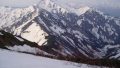
Route: Ikenochaya trailhead → Mt. Kushigata (Okusenju, 2,052 m) → Ayame-daira → Hadakayama → trailhead, a loop. The standard time is about 4 hours, beginner-to-intermediate level (about 1 hour 20 minutes for just an out-and-back to the summit). The moss-covered old-growth forest and the flower fields are the highlights, and on a clear day the view opens out over Mt. Fuji and the Southern Alps.
Forest road / winter note: The Maruyama forest road to the trailhead is closed in winter (roughly late November to mid-May) and bars vehicles with 11 or more seats. The opening date varies by year, so always check in advance.
Season and weather: At around 2,000 m the weather changes easily and the ridge can be windy. The old-growth forest has places where the trail is hard to follow, so carry a map and GPS.
Gear and season: The season runs June to October. Carry water, food, rain gear, warm clothing, and a map/GPS.
Emergencies: In case of accident or distress, call 110 (police) or 119 (fire/rescue).
・Minami-Alps City Hall 055-282-1111
Photo by Sakaori / Wikimedia Commons, CC BY-SA 3.0
Comments